Continued Uncertainty With This Weekend’s Forecast
Update (Tuesday morning): I will be providing another update later this afternoon. I am aware of the latest models by the GFS and Euro. Before the next update, the 12Z GFS and 12Z Euro will have run. I urge caution when interpreting the model solutions. While they can’t be overlooked at this stage, strength and location still need to be fine-tuned. I will cover more later.
The rain will continue to move northeastward this afternoon. As previously forecast, the rain will begin to ease up some as the bulk of the precipitation moves offshore. Rain increases in coverage Tuesday morning as the cold front approaches the area from the west. Once the front has passed Tuesday night, the rain will come to an end. Another cold front will pass through the area Wednesday afternoon. This front won’t have any moisture associated with it so I do not expect and precipitation with the front’s passage.
Low pressure will develop along the front offshore in response to southern stream energy south of the region. The exact timing and location is still uncertain but right now it appears that high pressure will be strong enough to keep this system far enough south and east for minimum to no impact on the area. That said, I will keep my forecast dry for Thursday and Friday if nothing changes in the next day or two.
The forecast becomes a problem after that as model consistency remains a major problem. The forecast discussed below is one of many possible forecasts and does not represent an official forecast.
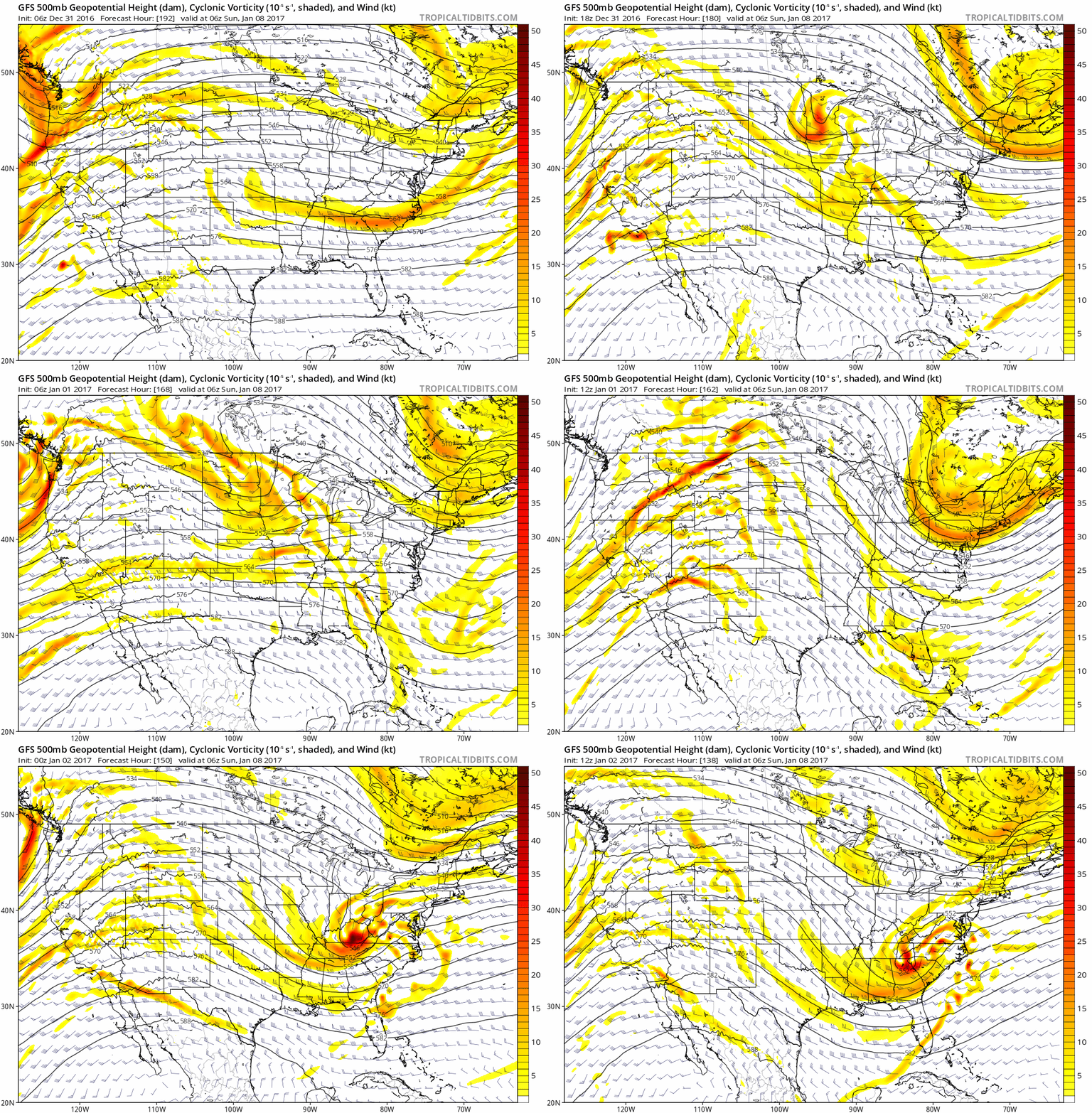
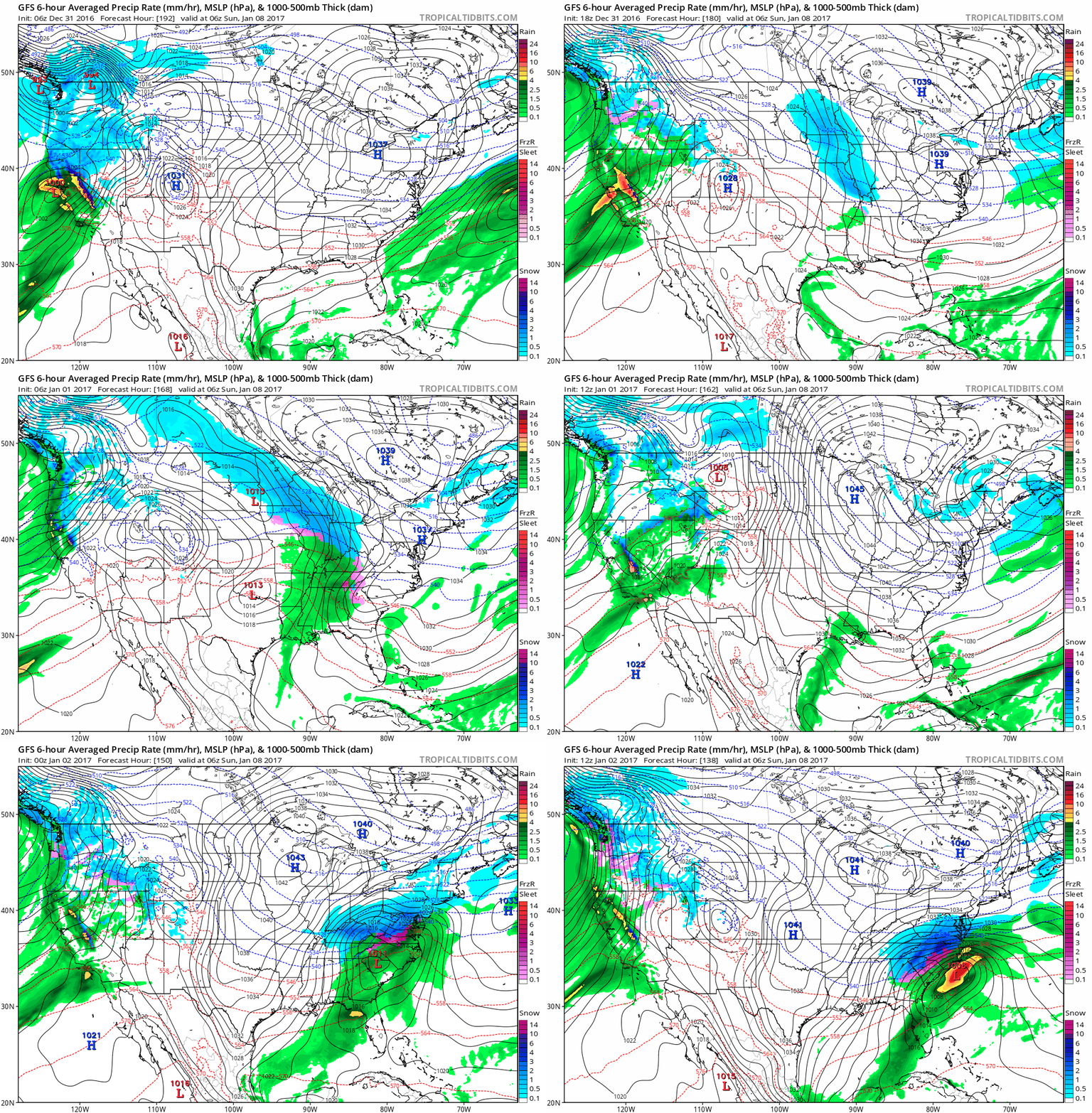
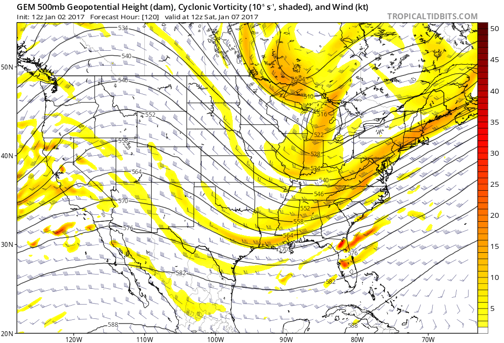
Models indicate that a trough will dive south over the central US Friday and Saturday. The GFS is a little slower than the Euro right now but both show this trough. Low pressure is forecast to form and travel over the Gulf Coast States. The image above shows the run to run change in the 500mb vorticity over the past 10 runs. As you can see there has been significant shift between models all with different possible outcomes. The image below shows the outcome different outcome over the past 10 runs. While it may not look like much, the last for runs of the GFS have been a little more consistent though the difference in outcomes still remains significant.
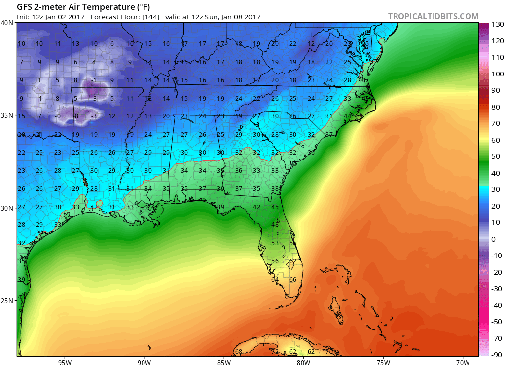
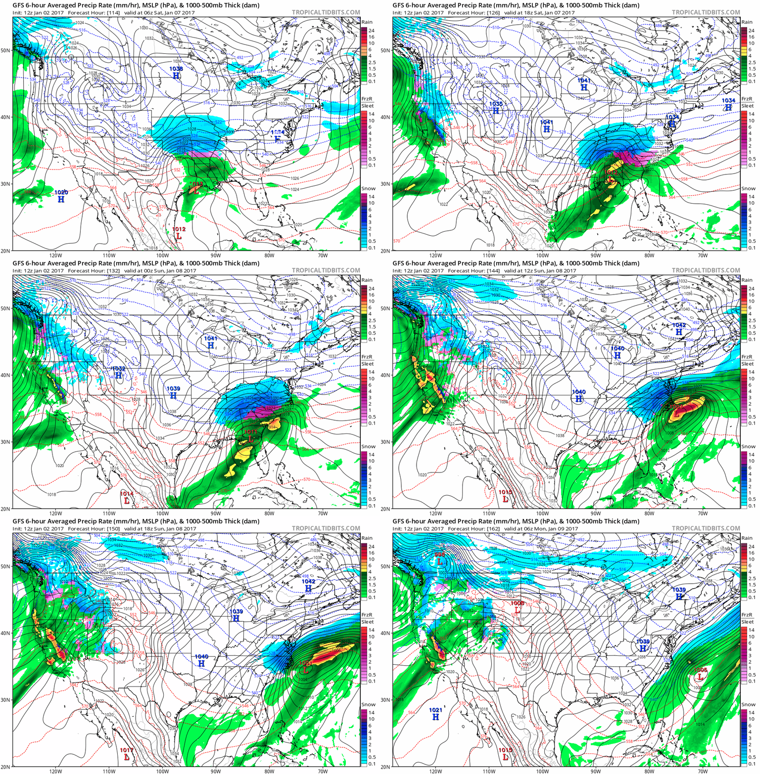
The 12Z GFS run has a surface low associated with this trough moving east off the Florida coast and over the Atlantic. The low would reform northeast of the previous low and strengthen. High pressure will reside over the northeastern US potentially providing sufficient CAD for potential precipitation type issues far enough east for frozen precipitation over western ENC. As you can see in the animation above, slightest movements in this track would result in changes in the forecast.
12Z GFS forecast animation below shows the potential track and precipitation.
The 12Z CMC has the trough digging further south which would bring the surface low over the Gulf. It would then bring the surface low off the Florida coast further south of the GFS. The low and wrap around moisture then be further offshore resulting in less precipitation over the area.
The 12Z Euro does not have any major changes from the 00Z Euro earlier. The trough that is forecast to dive south is weaker in the Euro than it was in the GFS (I am unable to post the Euro model on this site). As it stands right now, the trough GFS solution above seems to be a little too strong compared to the other solutions including ensemble members.
The main thing to keep in mind with this forecast is that it has changed dramatically over the past couple of days and it is important to not focus on one individual model or model run. The features that will be at play are still offshore and won’t be accurately imputed into the models until they are onshore and sampled.
I will not be issuing any forecast amounts at this time or in the next two or three days. I will most likely not be the first person to create such a map. When it comes to snow forecast for ENC (where the impacts are huge) I play it conservative because I want to issue the most accurate information possible. As a result in the past I have rarely had to change my forecast and I plan to keep up that record going forward.
I will continue to monitor the situation and update as we get new information.
Have a great week!
