
Skew-T / Log-P
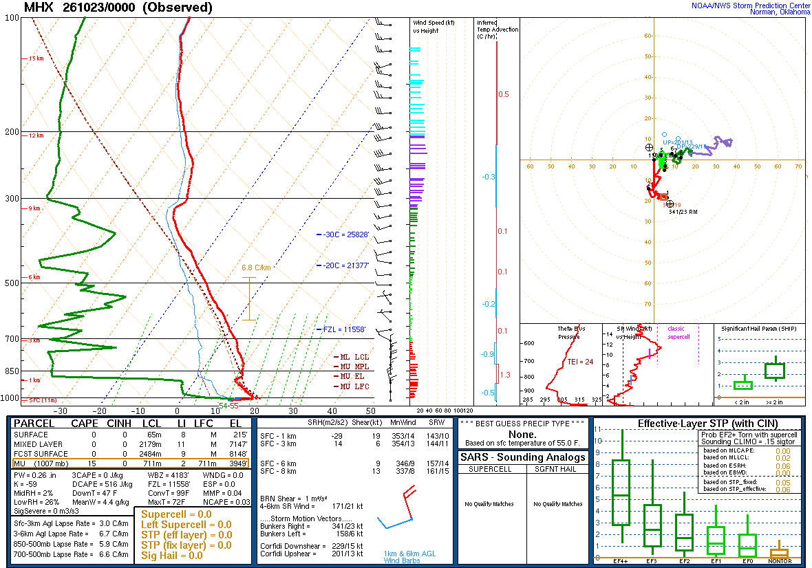
Latest observed radiosonde soundings for Eastern North Carolina and nearby upper-air sites.
Morehead City / Newport KMHX
What to look for
A Skew-T shows how temperature, moisture and wind change through the depth of the atmosphere.
The closer the temperature and dew-point traces are, the more saturated that layer of the atmosphere is.
CAPE represents buoyant energy available to rising parcels; larger values can support stronger convection.
CIN represents negative buoyancy that can suppress parcel ascent until sufficient forcing or heating develops.
The lifting condensation level is an estimate of where a lifted parcel first becomes saturated.
Steeper temperature decreases with height can favor greater instability when sufficient moisture is present.
Wind barbs and the hodograph show changing speed and direction with height, important for vertical wind shear.
Why Morehead City matters for ENC
Morehead City/Newport is one of North Carolina's two operational NWS radiosonde locations and provides a direct sample of the atmosphere over the coastal plain. Greensboro supplies the other routine North Carolina upper-air profile.