
Madden-Julian Oscillation
Track the eastward-moving tropical convective signal, its atmospheric circulation response, and the model forecast of where the MJO may propagate next.
Where is the signal going?
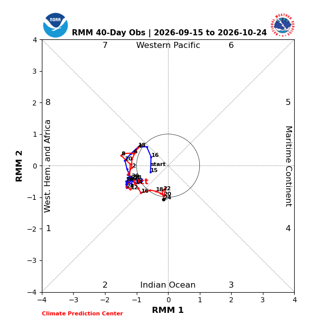
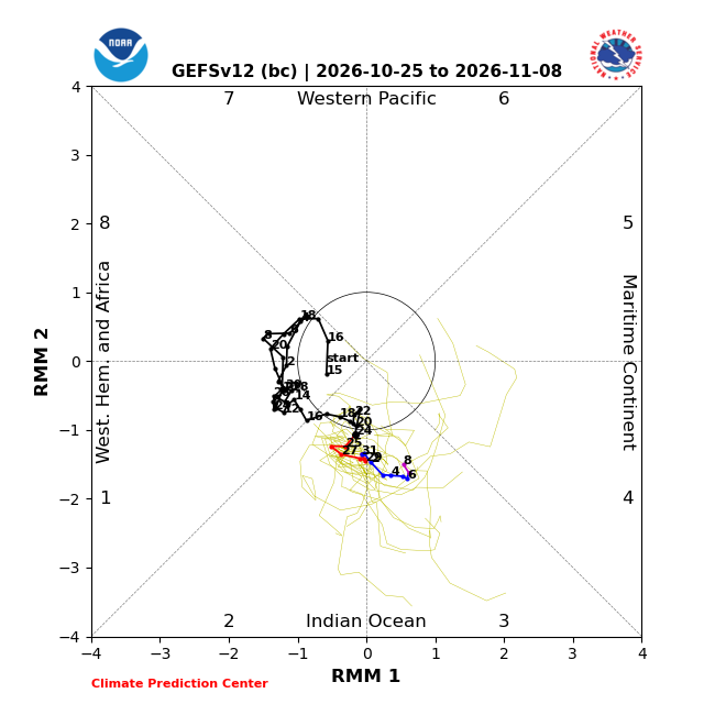
Outside the center circle indicates a stronger RMM signal. Counter-clockwise motion represents eastward propagation.
Current Tropical Signal
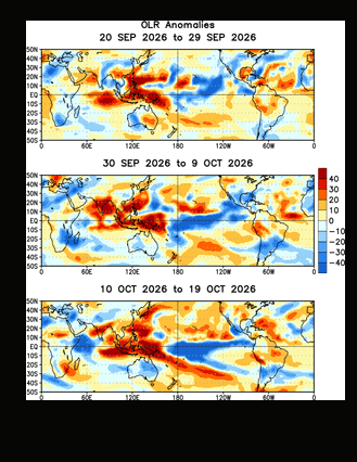
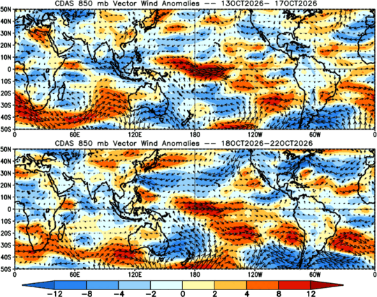
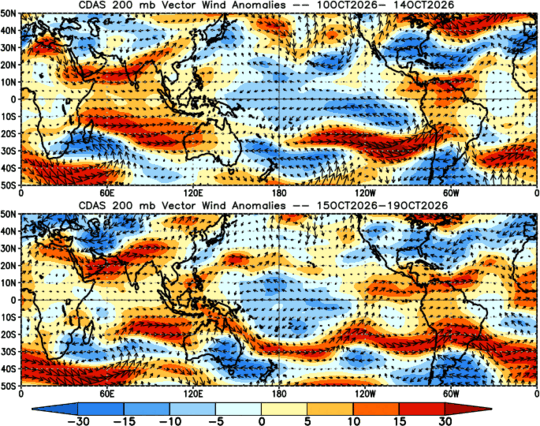
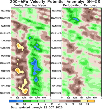
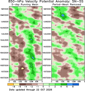
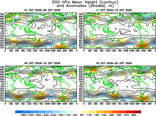
These fields help determine whether the RMM signal is supported by coherent tropical convection and circulation.
MJO Forecast Evolution
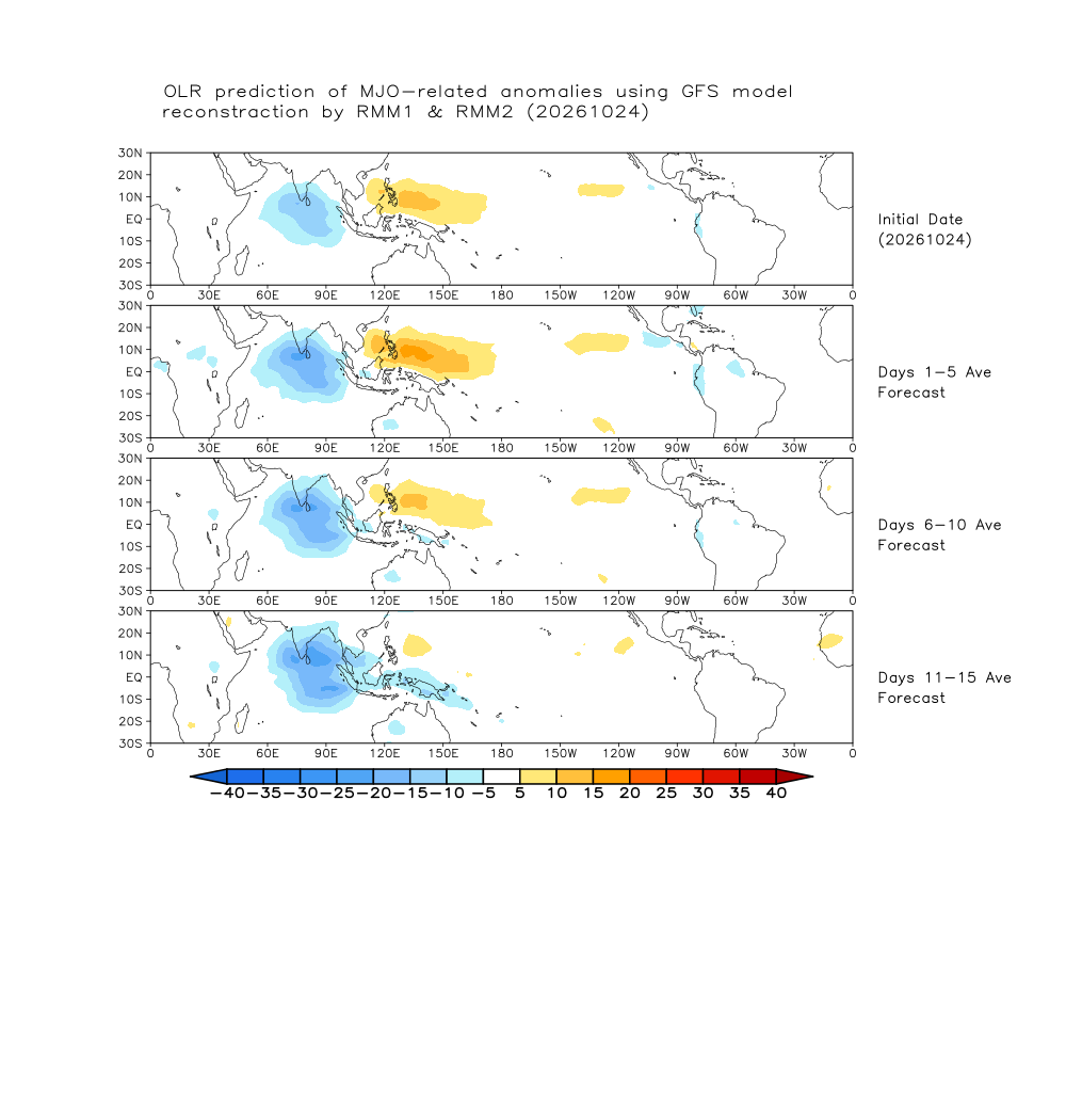
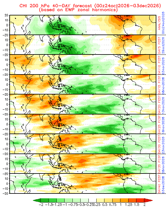
Forecast products isolate MJO-related anomalies and should be considered alongside ENSO and other background climate signals.
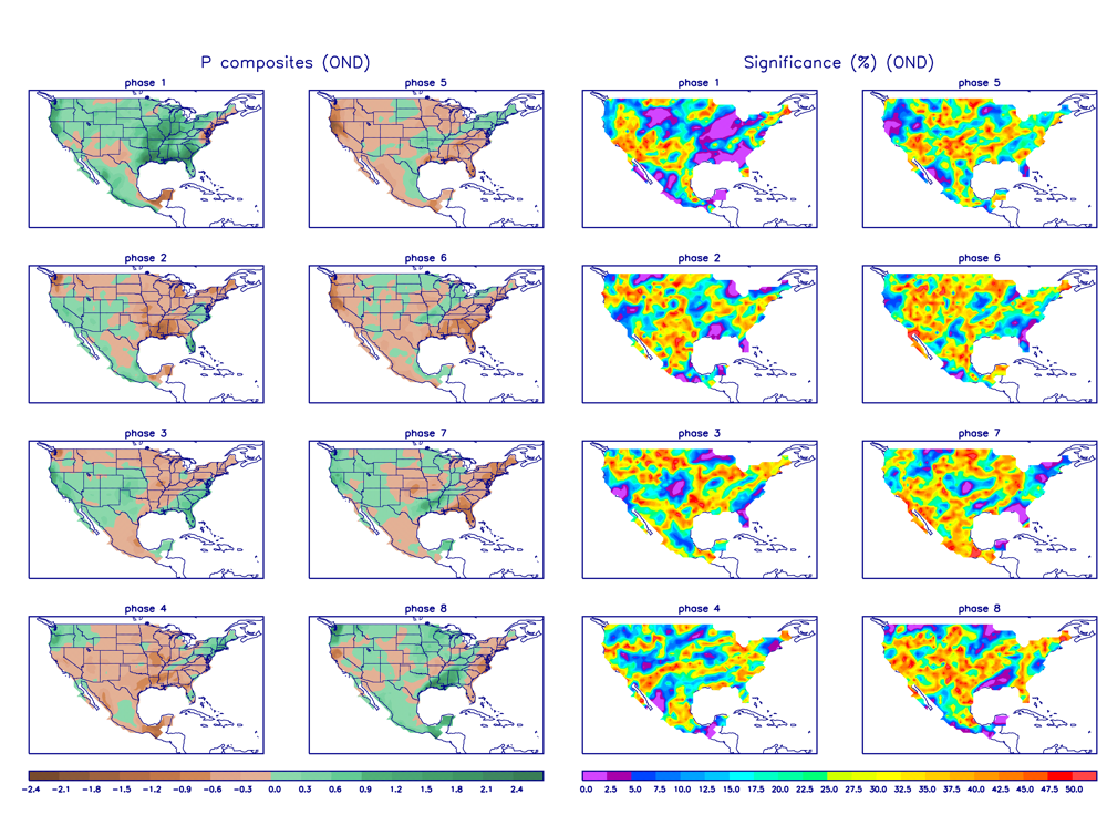
Temperature & Precipitation
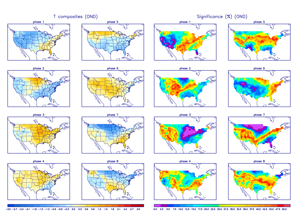
Historical composites for October–December. They show tendencies, not a deterministic local forecast.
A bridge between weather and climate
The MJO is an intraseasonal tropical disturbance that can influence convection, jet-stream patterns, U.S. temperature and precipitation tendencies, and tropical-cyclone activity. Its impacts depend on season, phase, amplitude and the background climate state.
The phase diagram tracks the location and strength of the large-scale tropical signal.
OLR anomalies help identify enhanced and suppressed tropical thunderstorm activity.
Low-level wind anomalies show changes in the tropical easterlies and westerlies.
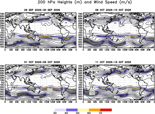
Upper-level winds and velocity potential highlight divergence and the broader atmospheric response.