Northward Trend For This Week’s Winter Storm
Due to the power outage this morning, this update is a little later than I had expected.
Last night’s temperatures dropped down into the upper teens after the passing of the Arctic front. Some areas saw some light showers and a few flurries with the frontal passage but no accumulations had been reported. The front did bring strong wind gust with some in excess of 50 mph. Windy conditions can be expected throughout the day but will become calm after sunset.
Today an upper-level trough over the western CONUS will begin to amplify and dive southeastward. A surface low will develop over the Gulf Coast states and travel eastward late Monday. Clouds will begin to move in ahead of the low on Monday but very limited moisture will keep things dry through Monday afternoon.
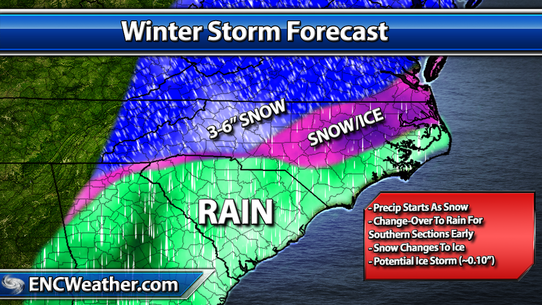
Moisture begins to enter the region Monday night from west to east starting as light snow for areas north of a line from Fayetteville to Jacksonville and starting as a mix south of the line and along the immediate coast.
The low will track through central Georgia and South Carolina before exiting off the North Carolina coast Tuesday morning. As the low approaches the area, the mid-levels will warm starting a change in precipitation type from all snow to mix over the northwestern sections of ENC and mostly rain for areas south. Snowfall totals will be low due to a quick change-over with only a trace to an inch for the northern half if this forecast verifies.
I am a little concerned about the potential for a bad ice storm once the warm layer builds into the area. Current forecast puts parts of ENC at a 50-60% chance of ice accumulations of >0.10.

As the low pushes off the coast, precipitation will begin to end from west to east quickly as mid-level dry out. This quick exit will limit the chance for areas to see a change-over to snow before ending.
I have included a forecast map for Monday night/Tuesday morning precipitation scenario. Further updates to this map will probably be needed as storm evolution begins to take place and the pieces begin to fall into place. Bottom line is be prepared for potential wintry weather across the east Monday night/Tuesday morning.

More details to come as new data becomes available.
