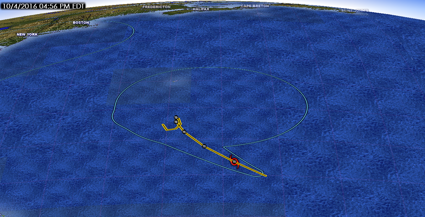
Hurricane Matthew Passes Through Haiti and Cuba
Hurricane Matthew
5:00 PM EDT on October 04, 2016
Location 19.8 N -74.3 W
Winds: 140 mph Gust: 165 mph
Pressure: 949 mb
Category: 4
Moving: N at 9 mph
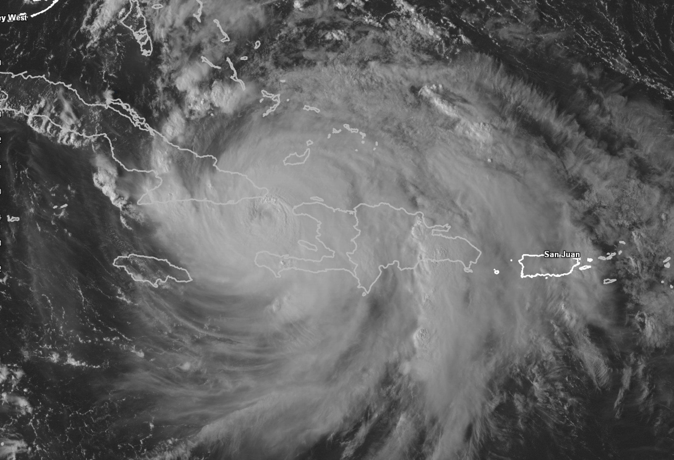
Hurricane Matthew made landfall over Haiti earlier today and it is about to make landfall over Cuba. It is amazing that the storm has not weakened like we thought it would. It may end up weakening as it travels close to Cuba but this is still impressive. Matthew is still a category 4 hurricane with winds up to 140 mph and gusts up to 165 mph.
The total damage in Haiti will be significant which I will report once the storm has passed.
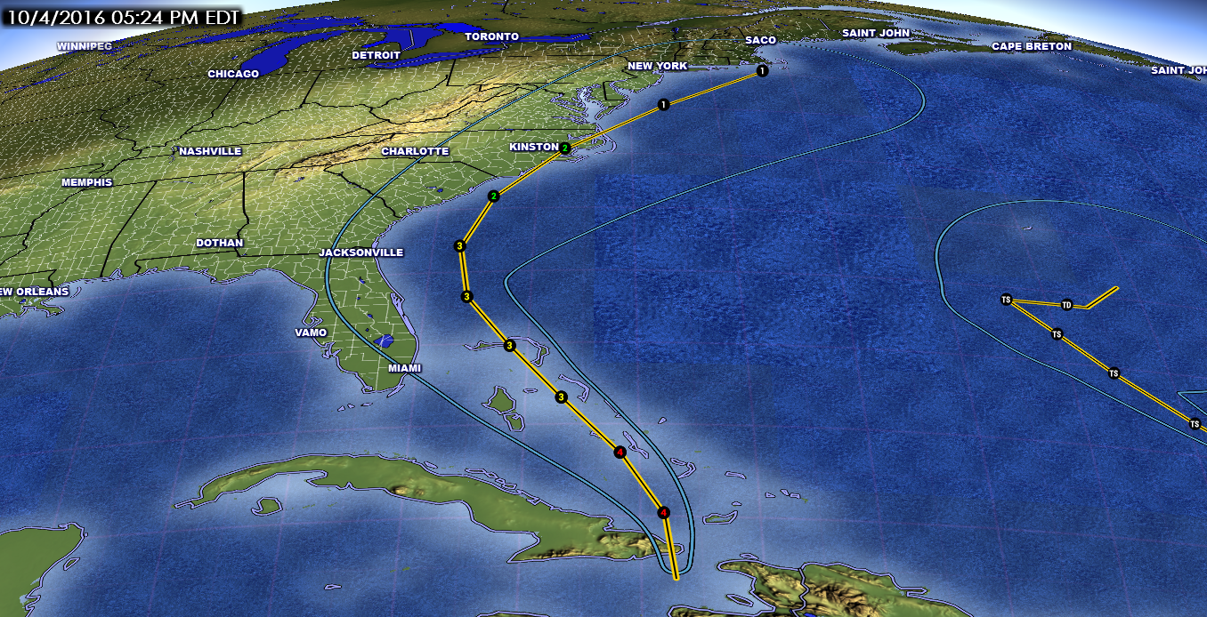
As for the near future for this storm, the storm will then track through the Bahamas as a major hurricane. Matthew has maintained category 4 strength through the Islands which should have been very disruptive but Matthew withstood the challenge. Since it will be entering an area that is very conducive for intensification I would expect the storm could maintain the category 4 status as it moves through the Bahamas. This storm doesn’t plan to be in much of a hurry either. It will take around 48 hours to pass through the islands all while maintaining major hurricane status. Since the islands do not have a mountainous terrain (in fact it is very flat and very spread out) to disrupt the storm and weaken it.
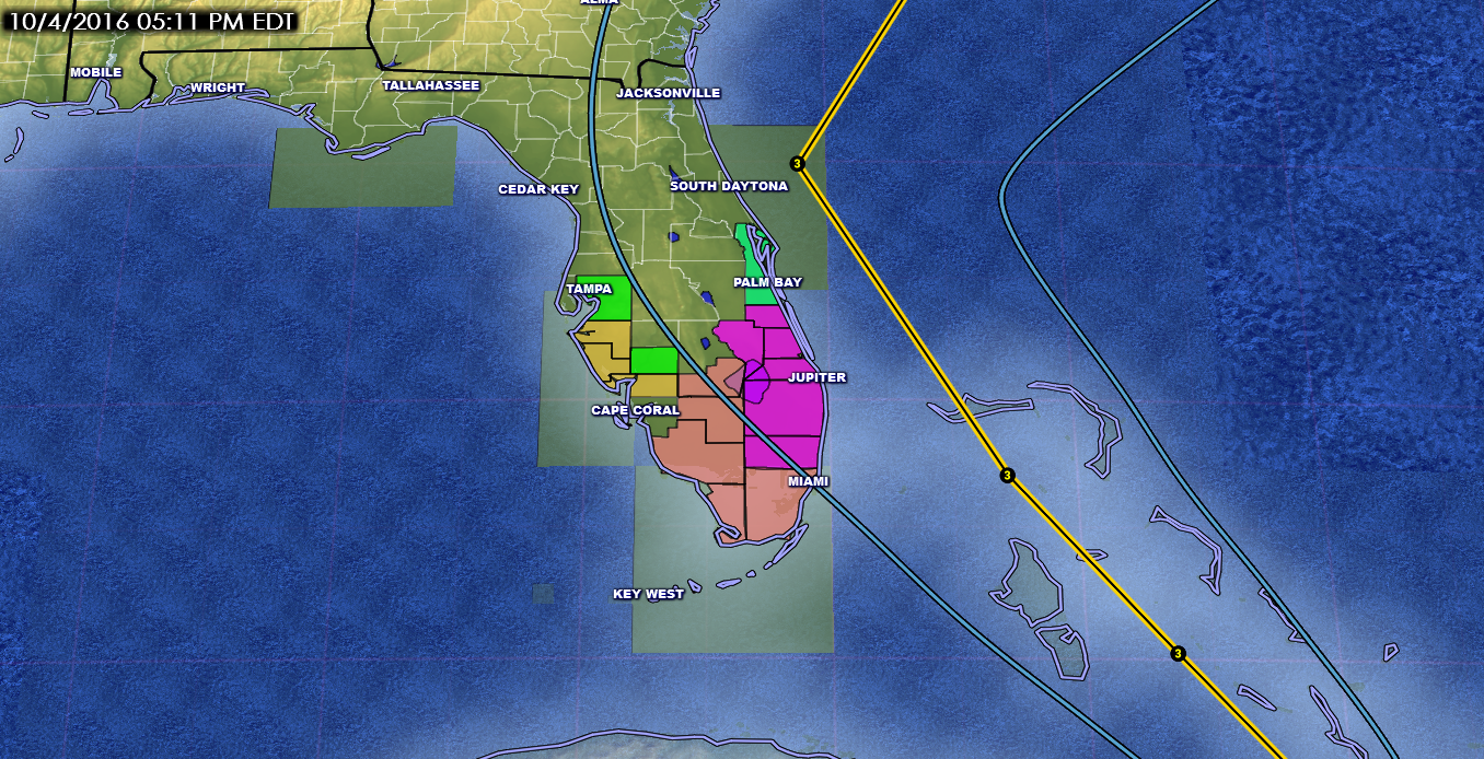
Going forward, the models continue to show a stronger ridge over the Atlantic ahead of the larger trough over the central US. The trough off the northeast coast will be moving out of the area allowing the ridge to maintain its strength. As a result, over the past several model runs we have seen a westward shift in the forecast track bringing the storm very close to the east coast of Florida. It is hard to say at this time where the center will make landfall over Florida but the hurricane force winds, as well as tropical storm force winds, will spread out far from the center of the storm.
The storm will begin to travel along the southwest and western side of the ridge up the coast of Florida. The storm then begins to turn more northward in response to the approaching trough taking it just off of and along the east coast of Georgia and South Carolina. Hurricane conditions will be occurring along this track even if the storm does not make landfall in these areas.
The 12Z GFS had a westward shift from the runs overnight and the 18Z GFS run has shifted even further west bringing it even closer to the east coast.
The one feature that is playing a key role in the future forecast track is this trough to the west. This trough is forecast to continue moving eastward towards the eastern US. This eastward movement will begin to push the ridge over the Atlantic eastward as well as lift the storm northward then northeastward along the eastern side of the trough. The strength and angle of the trough will also determine the trajectory of the storm when it begins its northeastward track away from the eastern US.
The models are having a difficult time forecasting this trough and therefore creating a lot of the uncertainty that we are experiencing. The last several runs of the GFS alone had the trough strong with a negative tilt (resulting in inland North Carolina track), weaker and neutral (closer to the FL, GA, SC coast then away from the coast along the southern NC Outer Banks), now weaker and some positive tilt (resulting in an even closer track along the east coast and out to sea before reaching the NC coast).
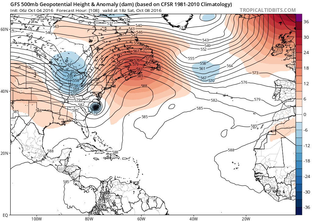
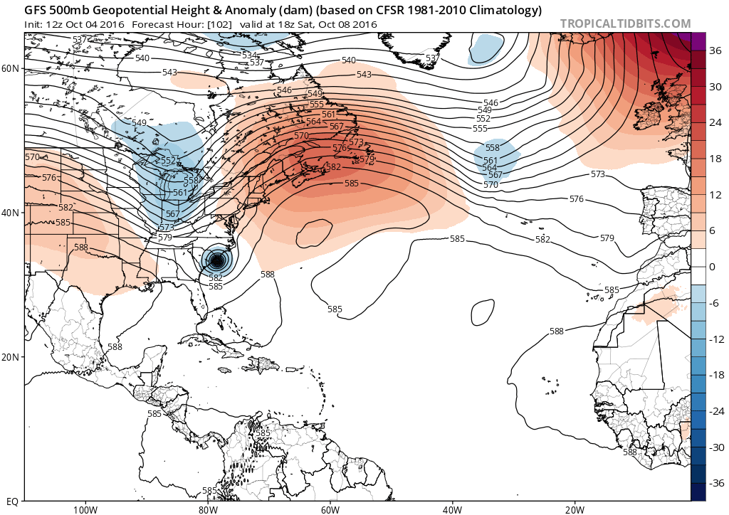
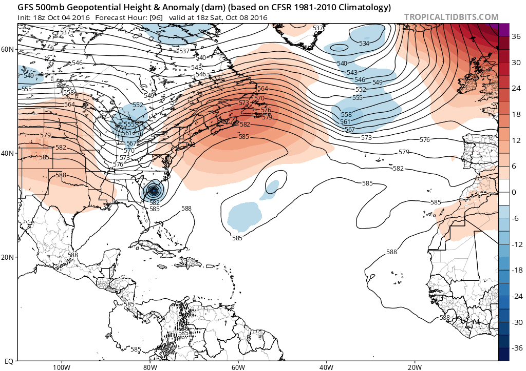
The interesting fact about these three different model runs is they are the past three runs in a row at the same time in the forecast. So you can see why coming up with a definitive forecast track of this storm along the coast is very difficult. This trend could continue or change a few more times before the storm begins to arrive to the east coast.
The strength of the storm as it travels up the coast depends on a couple of things. The trough over the US is going to create shear ahead of the trough as it approaches the east. This will begin to help weaken the storm as it makes its approach. The storm will also be close enough to land that dry air over land will begin to be ingested into the storm weakening it as it travels. Even though it may make it through the Bahamas and close to the Florida coast as a major hurricane, this weakening will begin to occur once the storm is close enough to land and will weaken slowly as it moves northward so areas to the south will see a stronger storm than the areas to the north. Its difficult to say at this time how strong it will be once it approaches North Carolina but the current thinking is a storm that is a category 1 or 2 hurricane.
There are now hurricane and tropical storm watches in places along the east coast already and more are planed over the next few days. So my advice for everyone who lives along the east coast is to pay attention to this storm because you could could experience hurricane conditions late this week and into the weekend.
Listen to the NHC, NWS, or other local authorities for detailed information regarding this storm and actions that need to be taken. Do not use information provided on this site to make life or death decisions. This forecast is not an official forecast but solely my own opinion.
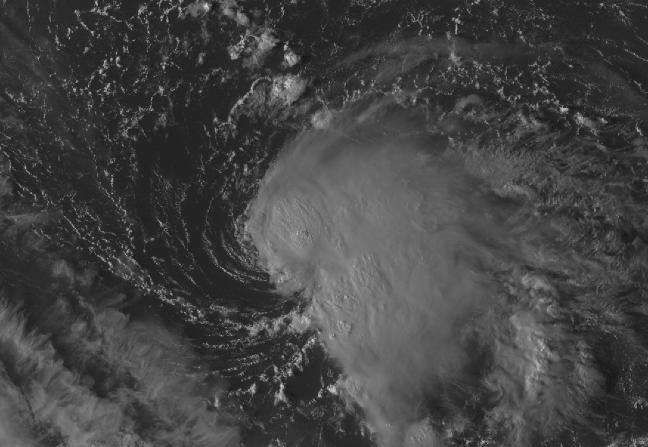
On a side note and something that is easy to overlook: we have a new tropical storm.
Tropical Storm Nicole
5:00 PM EDT on October 04, 2016
Location 24.1 N -61.1 W
Winds: 50 mph Gust: 65 mph
Pressure: 1005 mb
Category: 0
Moving: NW at 9 mph
Tropical Storm Nicole has developed in the Atlantic which could be easy to forget anything else other that Hurricane Matthew. Nicole is expected to remain a tropical storm over the next day or two as she drifts over the central Atlantic. Conditions are not favorable for further development and will weaken to a tropical depression. Nicole is not expected to impact land at this time.
As always, I will update if anything changes.
