Lingering Showers As A Nor’easter Begins To Develop
Good Wednesday morning ENC! Much needed rainfall across some areas of the east yesterday as some areas saw an excess of an inch of rain. Not enough to put a dent in the deficit for the year but very much welcome anyway.
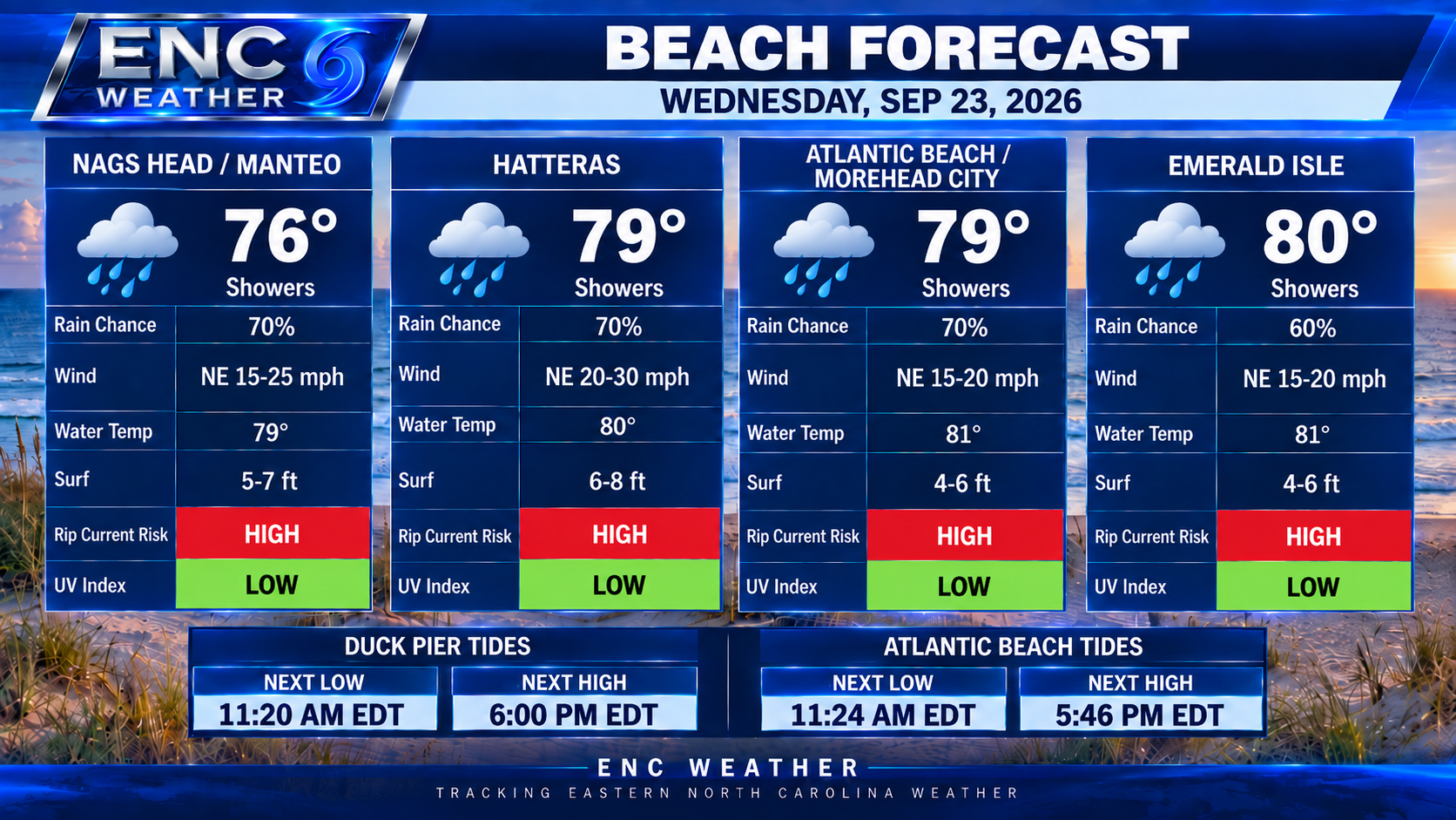
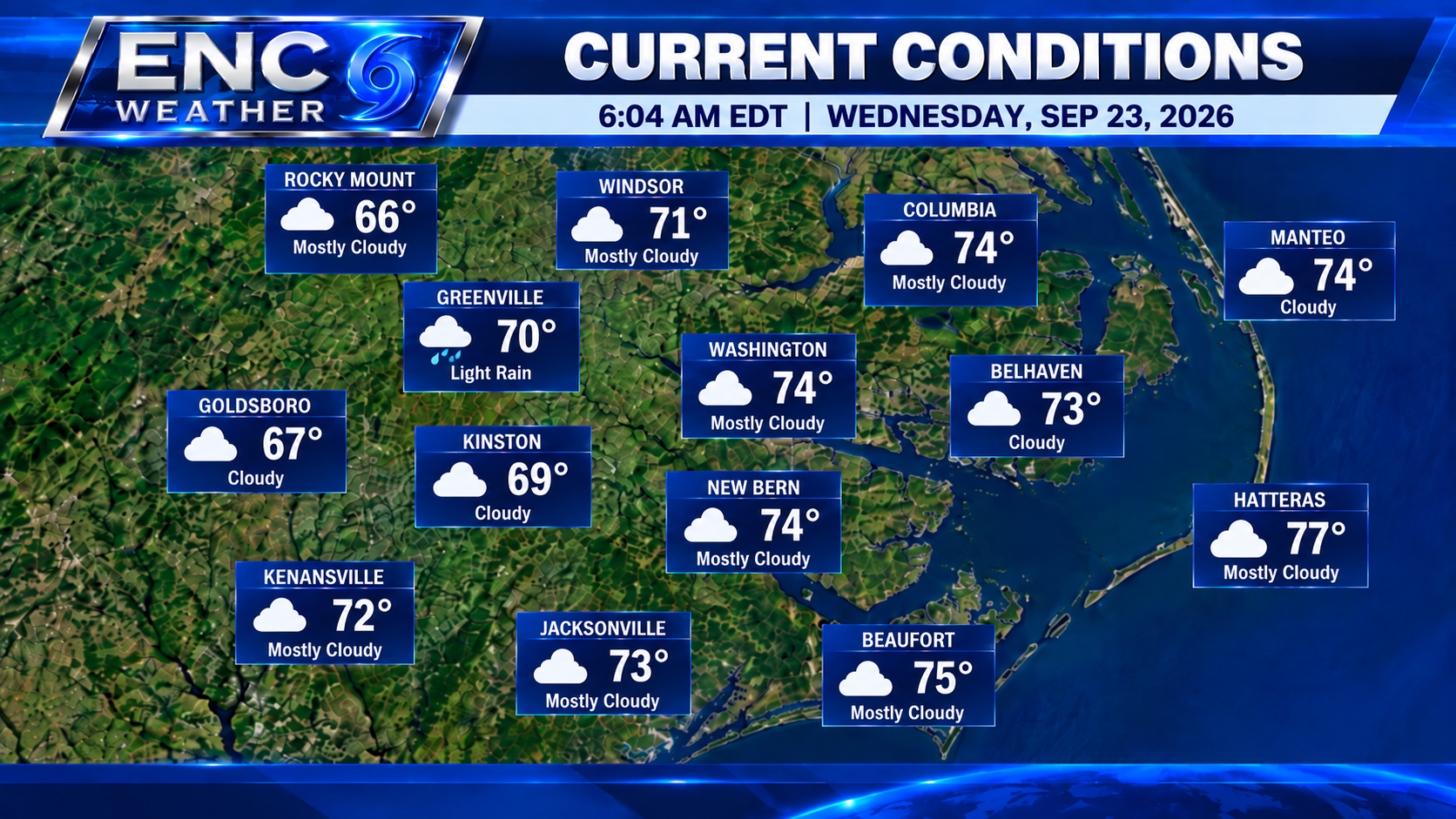
Some lingering drizzle this morning in areas as more showers are expected today. Surface analysis shows the surface front as shifted south of the region with the low pressure set to take center stage later this week sitting a few hundred miles off Cape Hatteras. Offshore winds have already begun to increase with the pressure gradient between the strong high pressure to the north and the coastal low. Winds will continue to increase as the low strengthens over the coming days and lifts northward. This will create several days of coastal impacts for ENC with high surf and coastal erosion bring the greatest risk going into this weekend.
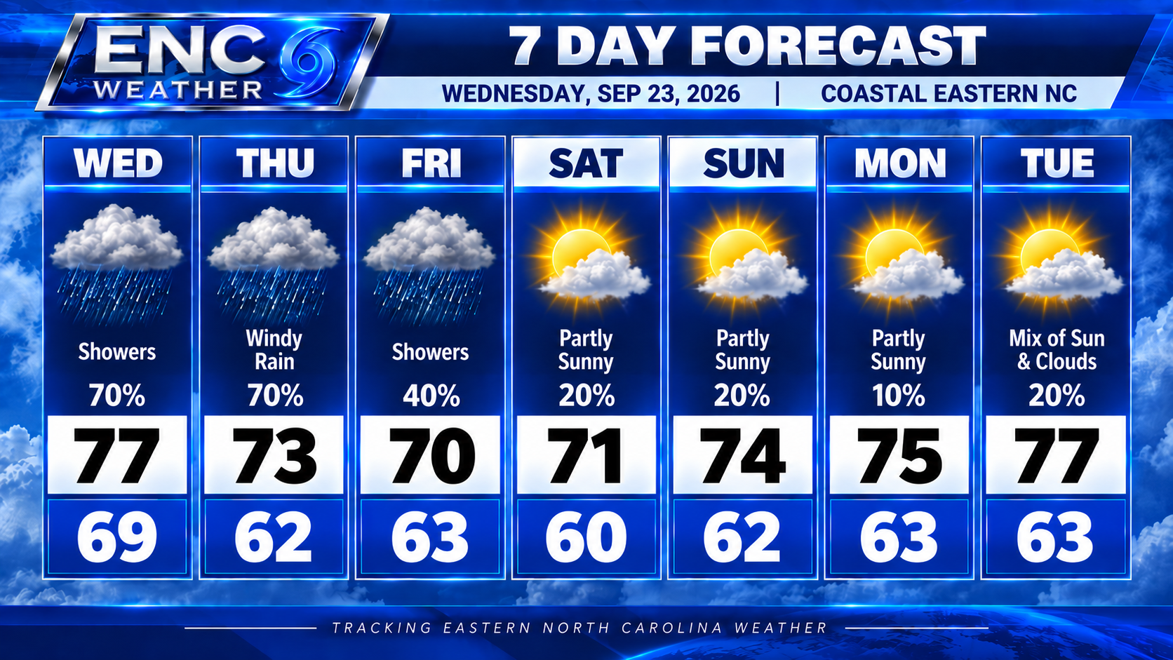
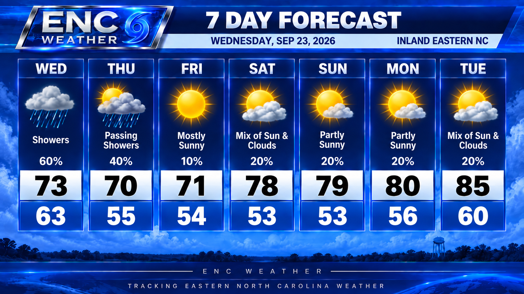
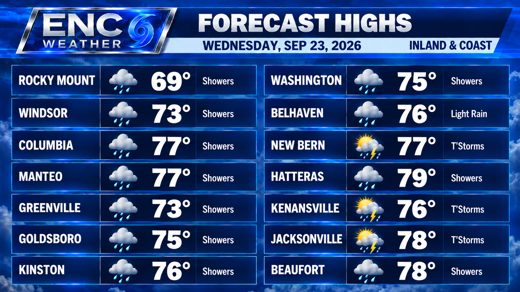
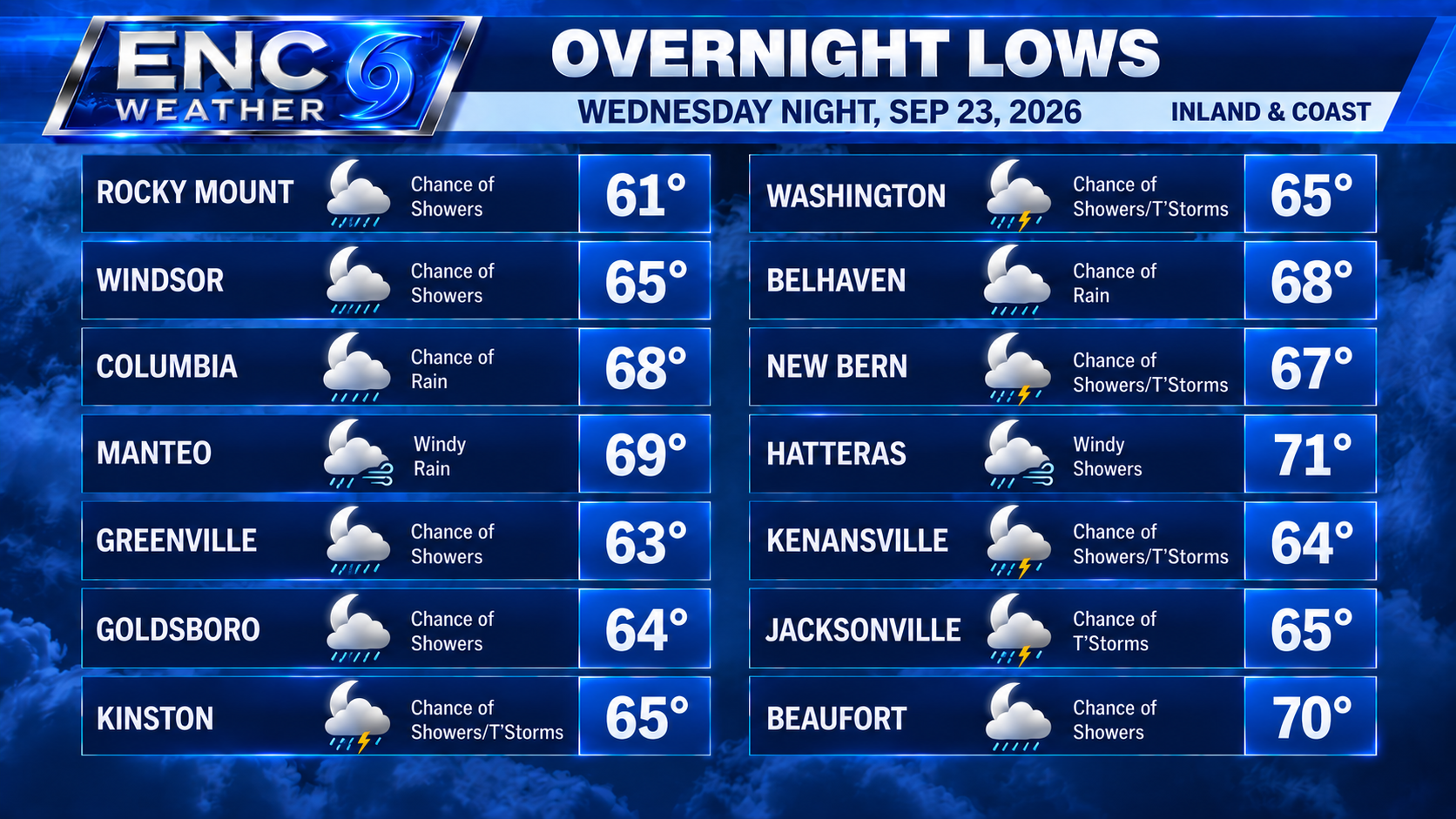
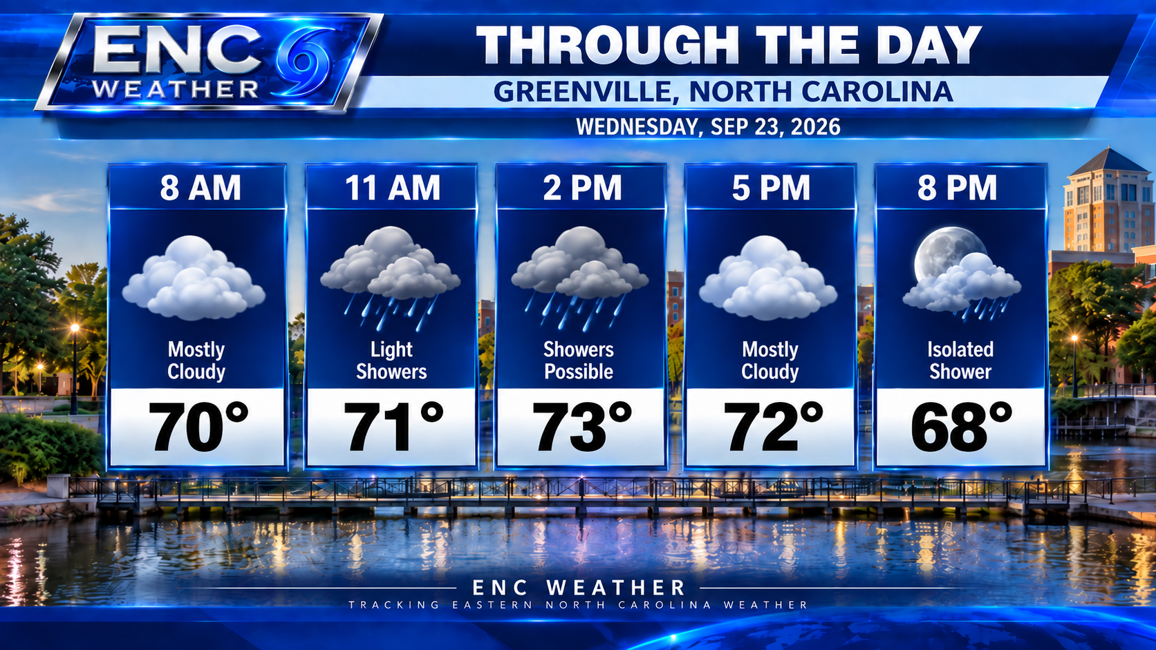
Wednesday we should see scattered showers and possibly a few thunderstorms but coverage and intensity look to be less than yesterday. Highs today will top out in the mid-70s inland to upper-70s along the coast. Overnight lows will fall to the low-to-mid 60s inland/around 70 coast.
Thursday, inland sections will begin to dry out as dry air begins to filter in from the north. Any lingering showers should remain mostly near the coastal sections through the day on Thursday. Winds should be at their peak at this time as the low really starts to deepen off the coast. It looks as though the low will be far enough away that rain chances should be near zero through the height of the event.
Dry air remains in place through the weekend with temperatures running in the mid-to-upper 70s and lows in the mid-50s.