Watching A Coastal Low For This Week
Good morning, ENC. I hope everyone is having a wonderful start to one of our final days of summer.
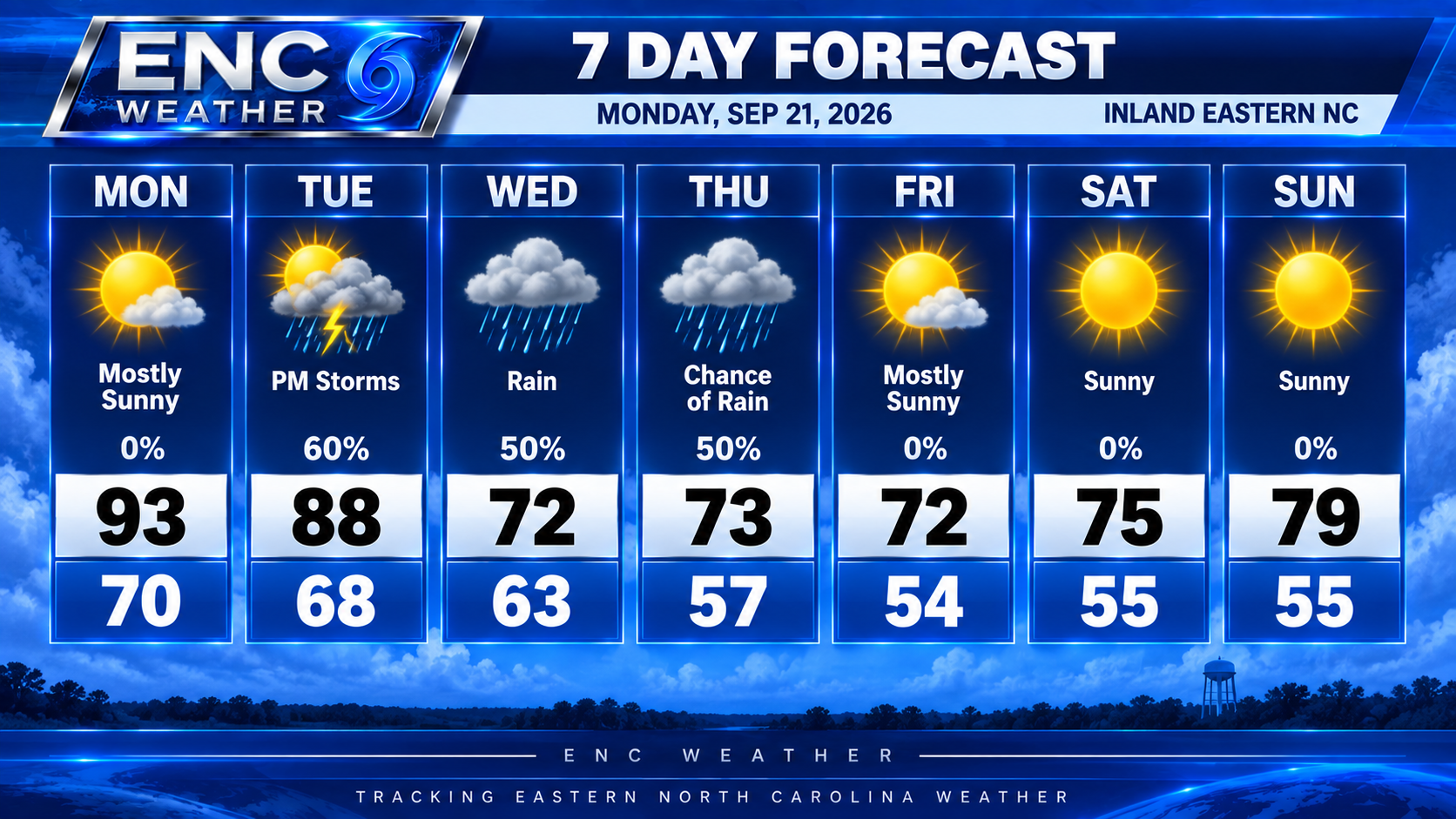
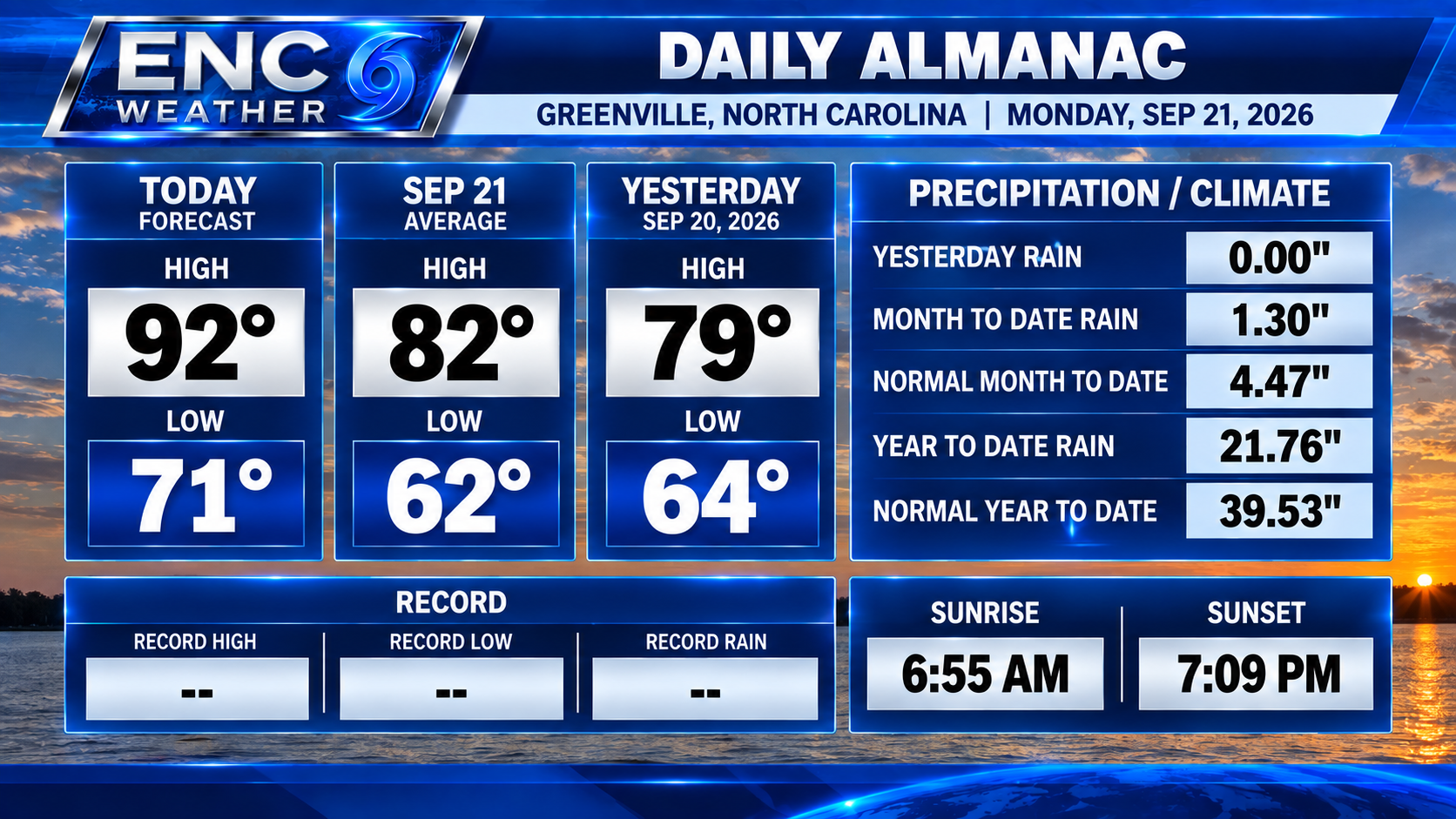
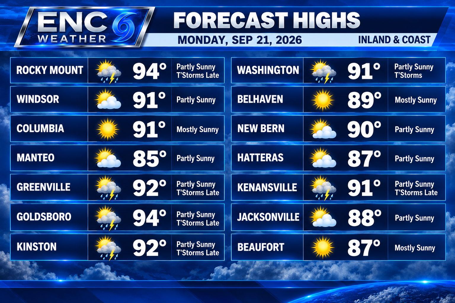
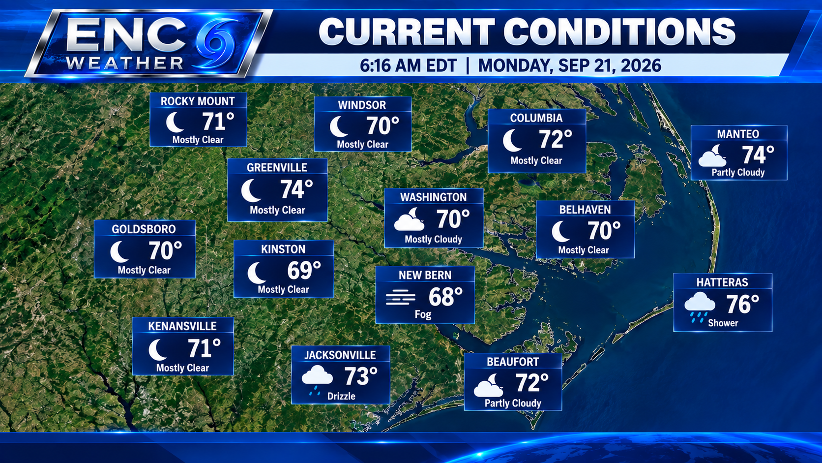
Some patchy morning fog across the area will begin to burn off after sunrise, leading to another hot day with highs in the low to possibly mid 90s across the area. We could see an isolated shower or thunderstorm develop late this afternoon, mainly across northwestern portions of ENC, though most areas should remain dry today. Most of our rain chances will come later this week.
There are a few features we are keeping an eye on this week in the lead-up to the wetter weather. The first is a slow-moving front just to our north. That front will gradually move southward into the area, increasing our rain chances beginning Tuesday as moisture increases across ENC.
Meanwhile, strong high pressure will build to our north. An upper-level low that has been sitting over Florida will begin lifting northeastward while another upper-level trough moves east toward the Ohio River Valley and Great Lakes. The interaction between these features and the surface front should help support the development of a surface low off the Mid-Atlantic coast later this week. That low may deepen offshore while strong high pressure to the north creates a blocked pattern that could cause the system to move very slowly. Uncertainty regarding this scenario remains high, and we will have to continue monitoring future model runs to see whether this pattern actually develops.
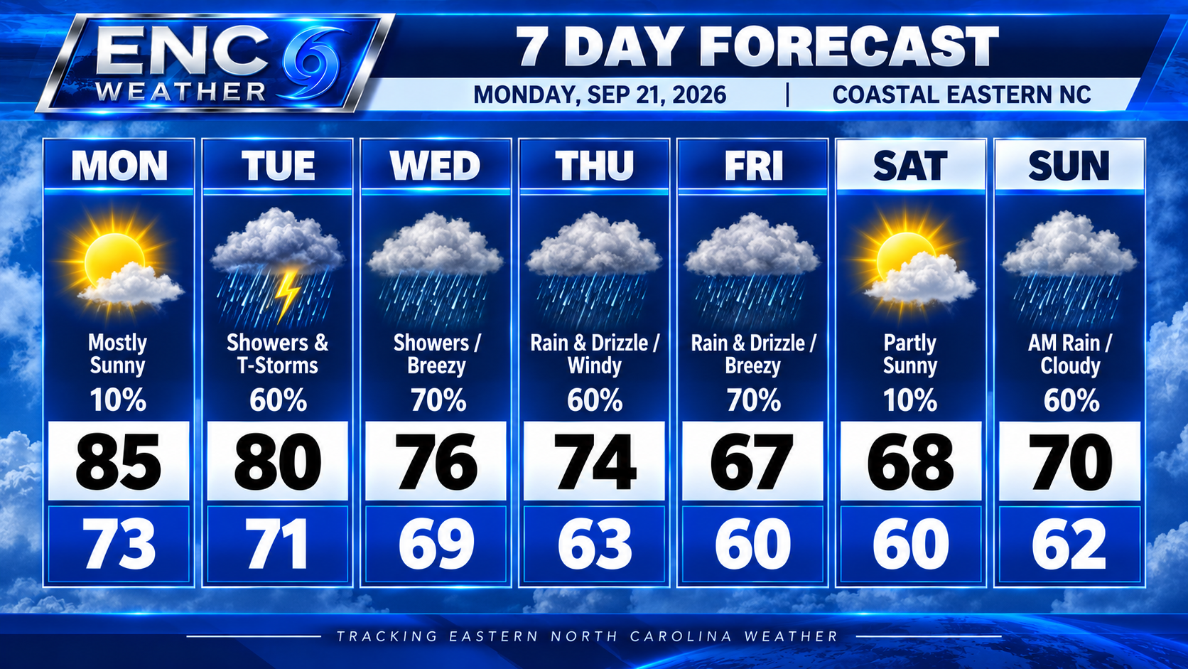
As for impacts to ENC, most of our rain early this week will be associated with the slow-moving front. Right now, the best chance for more widespread rain appears to be from Tuesday afternoon and evening through Wednesday. Scattered showers could linger Thursday and possibly into Friday, but that will depend heavily on where the coastal low develops. A low closer to the coast would increase our rain chances, while development farther offshore would reduce them. We will continue to monitor this developing situation and fine-tune the forecast as the week progresses.
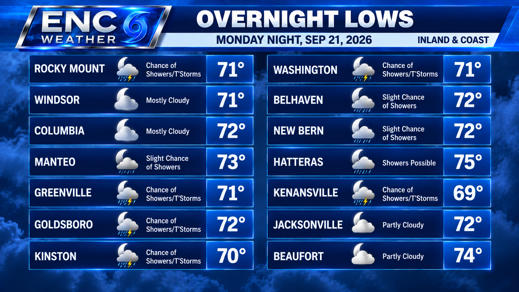
The other impacts from this pattern will be increasing winds and a significant temperature change. With strong high pressure to the north and low pressure developing offshore, northeasterly winds will strengthen and bring much cooler air into the region. High temperatures should fall into the lower-to-mid 70s by Wednesday and remain much cooler through the end of the week. Overnight temperatures will eventually fall into the 50s across much of the area.
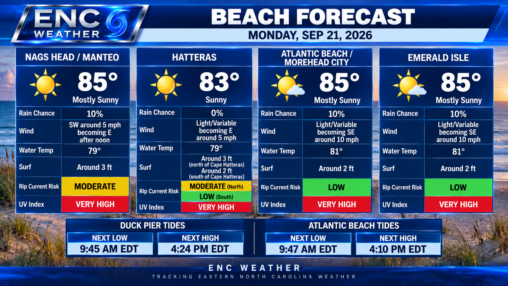
Strong northeasterly winds will also become possible along the coast, particularly later in the week. Exactly how strong those winds become will depend on the position and strength of the coastal low, so that will be another part of the forecast we will be watching closely over the next several days.