Severe Potential Wednesday Updates
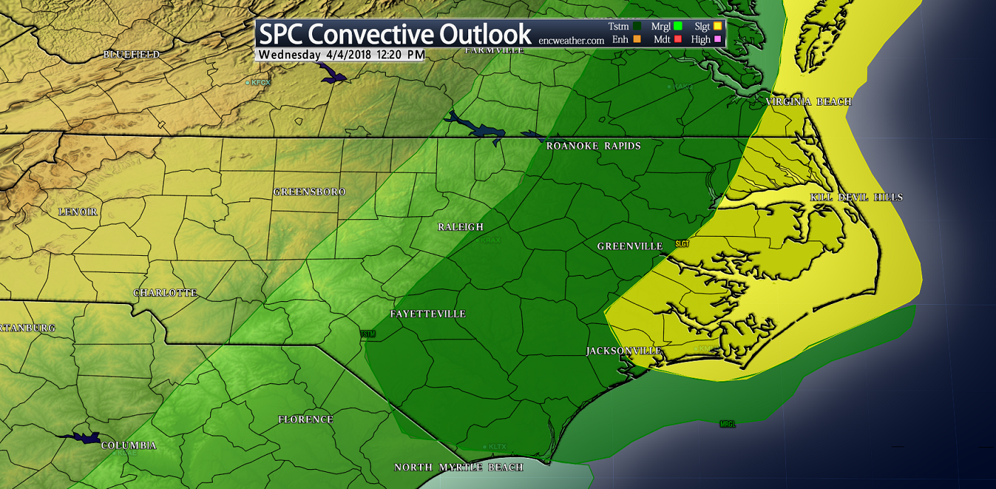
Wednesday’s convective outlook has placed a large portion of ENC within the slight risk category for severe thunderstorms. During the day, a cold front will move in from the west ahead of another shot of cold air. Ahead of this front some instability could be in place for the potential of severe thunderstorms over much of the area. These storms will develop on the leading edge of the approaching cold front and will cross the area near mid afternoon and move offshore during the evening. As of right now, the main threat associated with these storms are strong winds and heavy downpours.
Update (Wednesday morning): I am unimpressed with today’s chance of severe weather across ENC. The SPC maintains a Slight risk over portions of ENC. There could be some isolated convective cells that could have the potential to have strong winds mixed to the surface from heavy downdrafts. There is still a risk and you should monitor the weather today and be ready for severe weather at any time.
Update (Wednesday Noon): The SPC has trimmed off a little on the Slight risk for ENC keeping the greater chance of severe weather over the sounds and Outer Banks. I see very little evidence for any widespread severe weather in this area and feel this should be moved into the Marginal risk category. Still the SPC maintains the risk and populations in this area need to pay attention to the weather and be prepared to take cover if a severe thunderstorm approaches your location.
Temperatures after frontal passage drop into the upper 30s inland to lower 40s along the immediate coast. High temperatures on Thursday will only reach into the lower 60s for most places.
The next chance of rain will come on Saturday which will bring some heavy snow for our northern neighbors but will remain all liquid for ENC.

