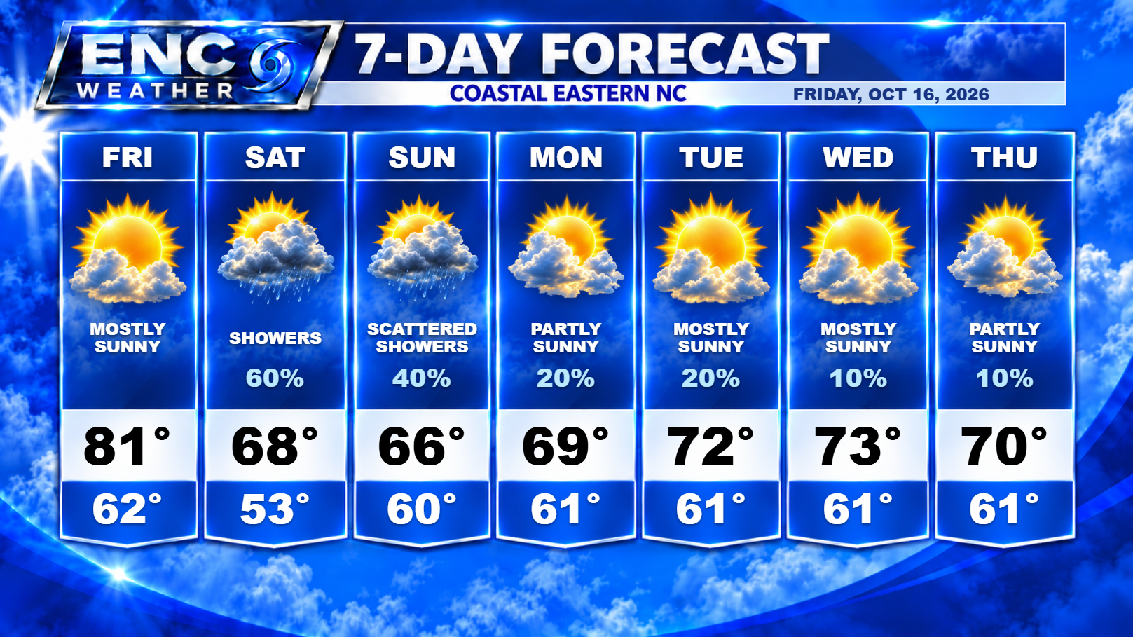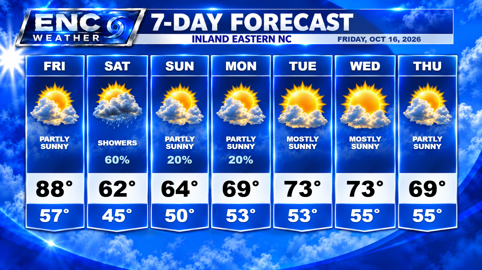
Good morning, ENC! A mild and slightly foggy start to your Friday morning as you head out the door. A frontal boundary is currently sitting over the southern half of ENC from west to east this morning, helping to bring in a little patchy fog to the area. This frontal boundary will lift back north today ahead of the approaching cold front that will reach the area later tonight and into tomorrow morning. Highs today will reach near record highs (record high for KPGV is 90 in 1968) with most inland areas in the upper-80s with the coast in the lower-80s. Today should be the last day of near 90 degree weather for the year (I’ve said it before but its looking much more likely now).
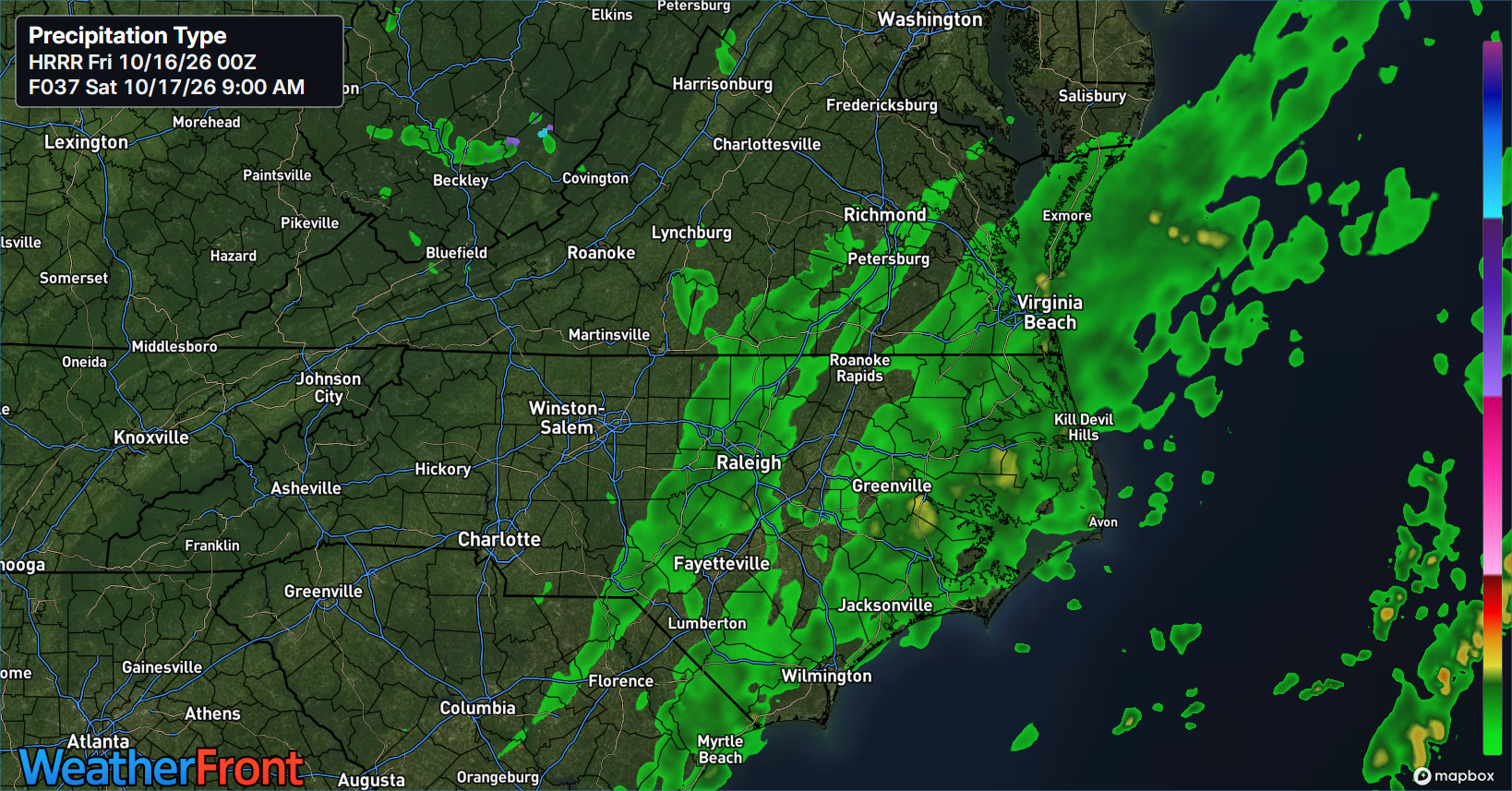
Tonight, the cold front will approach the region and begin to cross from northwest to southeast around 10-11 pm. Scattered showers should hold off until around 2am for western sections and begin to fill in from west to east during the early morning hours on Saturday. The coastal sections could see a couple of scattered showers late Friday night so don’t be surprised if rain starts falling there a little earlier than inland sections. Most areas should be seeing some rain by 9am on Saturday.
How long that rain persists on Saturday depends on the complicated setup that has presented itself over the past several days. Yesterday, a few models were indicating the chance that the upper-level trough would break off and for a low just off the North Carolina coast on Saturday. The GFS, which was resistant to this solution originally, has started to adopt this solution as well. There is still considerable uncertainty as to the location of the developing low. Most of the ensemble models now indicate that the low will develop off the coast but there is some spread as to how far off the coast and how strong. A closer placement to the coast brings more rain to the region. A stronger developing low brings more coastal impacts in the form of high surf and beach erosion.
There is also the possibility the closer it tracks to the coast, and in the weak-to-non-existent steering currents it will find itself in, that this low could bring rain chances to ENC (especially the coast) well into next week. Unfortunately, forecasting the future track of cut-off lows is very difficult so we will have to monitor this daily to see how this will impact next week’s forecast. For now, the forecast will show low probabilities for precipitation everyday though that number may increase as time passes.
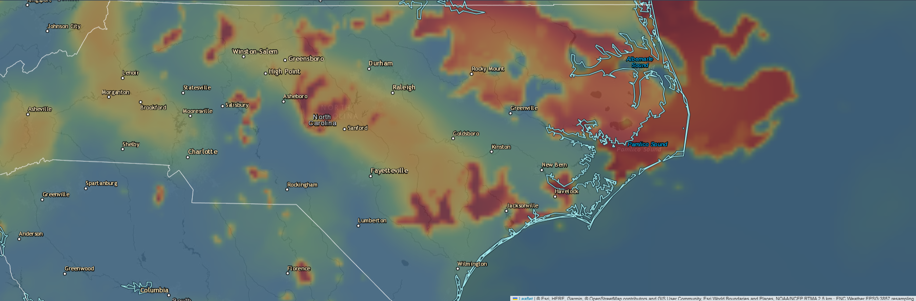
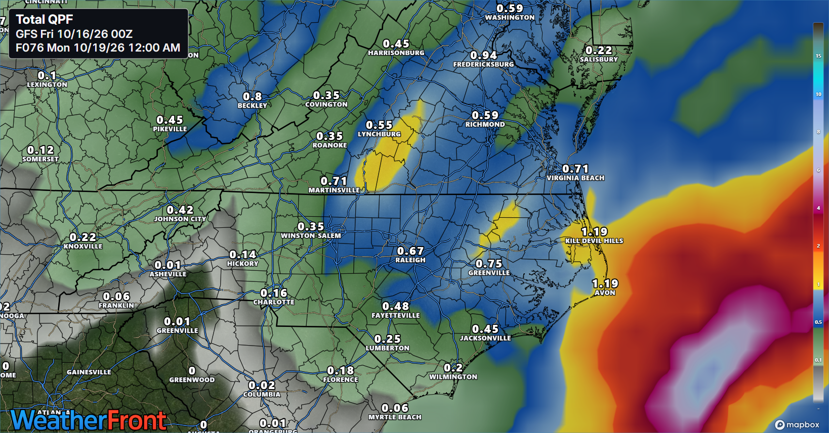
As for forecast rainfall amounts this weekend, I believe the coast will have the best chance at seeing 1+ inches while the northern half of ENC has a good chance at .5 to .75 inches while the southern half of ENC will see a little less in the .25-.5 inch range.
Finally, I don’t want to forget the other big story from this frontal passage: the much more seasonal temperatures that will follow. Forecast highs this weekend will drop down to the low-to-mid 60s with lows dropping down into the mid-40s. Temperatures only rebound into the low 70s as we start the work-week with lows in the mid 50s.