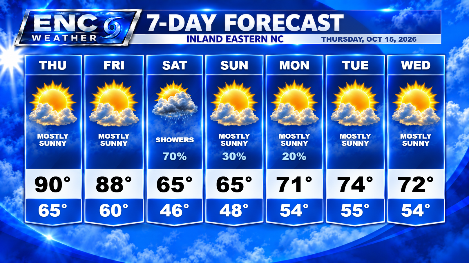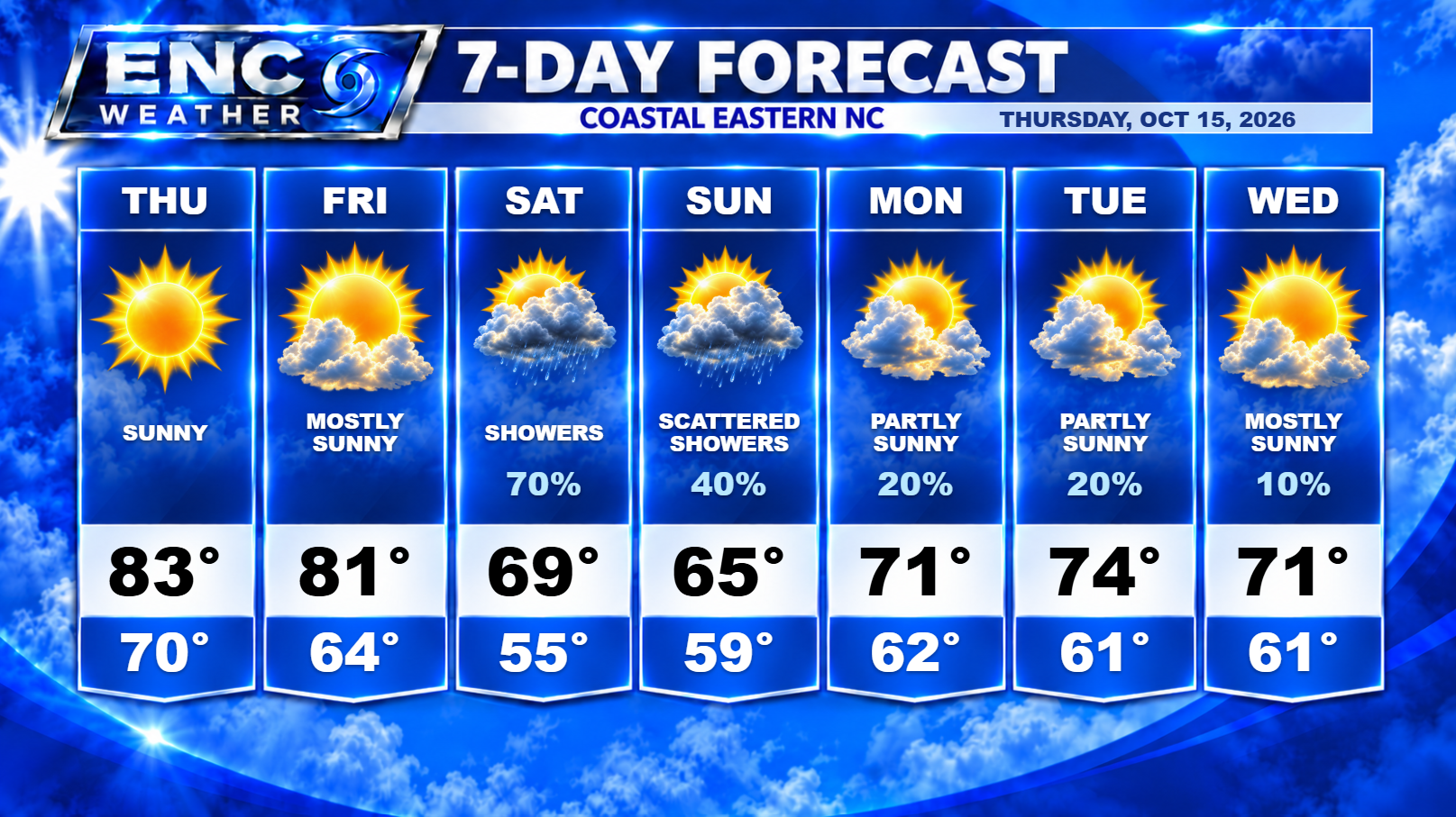
Good morning, ENC! We have another two pleasant days ahead of us before the next weather system impacts the area. Today we should see mostly sunny skies with highs mainly in the upper-80s to near 90s inland and to the southern half of ENC/mid-80s along the coast. Temperatures in the far northeastern sections of ENC could be slightly lower due to a cold front that will slowly dip southward this afternoon before retreating northward as a warm front tomorrow.
What was looking to be a straight-forward weekend forecast has taken a turn for the complicated (because why wouldn’t it?). So what has changed? Well, quite a bit. First, it looks like there will be slightly more moisture available for the passing cold front to tap into increasing the overall rain chances somewhat over ENC. Second, and most importantly, most uncertain, is what happens once the front pushes off the coast.
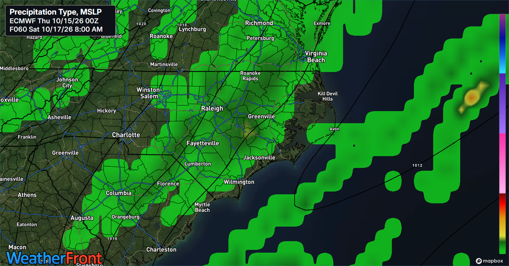
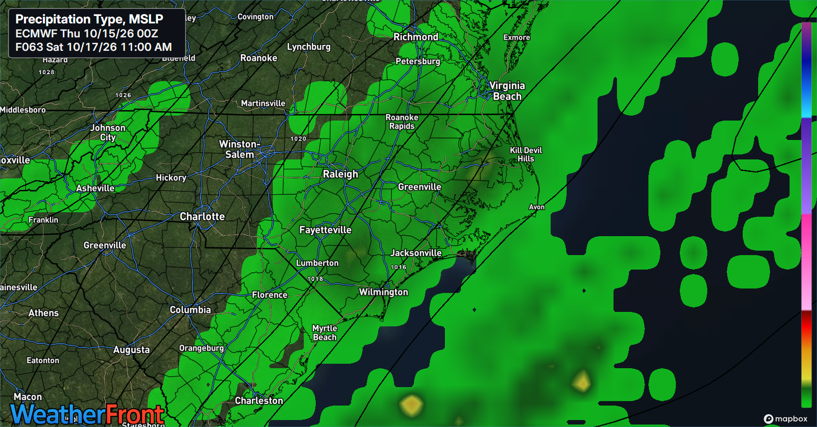
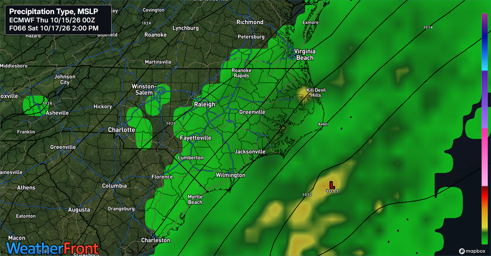
We have a couple of models (Euro, AIFS, RRFS) that create a cut-off upper-low just off the coast with a surface low developing just over the Gulf Stream. In this scenario, the forecast becomes extremely uncertain. A coastal low (in a favorable environment to strengthen) in a weak steering current off the coast means there is no way to know how much of an impact this will have on our weather, either this weekend of next week.
There is a chance this develops very close to the coast and hangs out there for a while. This could bring rain to the area for most of the day Saturday (this is what the previously mentioned models indicated). It could then drift far enough offshore that rain chances decrease for most of the area (coast probably sees the best chance of rain here). A series of high pressures will pass to the north which will keep the low in place off the North Carolina coast. Where it goes after that is a toss-up at this point. It could traverse back west and bring rain chances back into the forecast for ENC or it could stay over water and not impact ENC (rain-wise) at all next week. We are in a wait-and-see situation in terms of what to expect next week, unfortunately.
The increase in pressure gradient will increase the winds through the weekend and into next week. This will impact the coastal waters significantly during this time-frame.
Now, on the other hand, we still have models that indicate that the front will push well offshore before any of this happens and the impacts to ENC will be minor through the weekend and into next week (GFS, CMC, GEFS members). The impacts to the coastal waters would still be there but to a much lesser extent.
Bottom line: What we do know about the upcoming weather this weekend is that the chances of rain for Saturday have increased. The cold front still moves through on Friday night, but the rain that does develop will be more stratiform rain falling behind the passing cold front through Saturday. I do believe we have a much better chance at seeing some sort of rain but how much and for how long will depend on which forecast model ends up verifying this weekend. Right now, I’m personally leaning towards the more conservative GFS (less impacts) forecast for now while the NWS is leaning towards the more aggressive Euro. I will be monitoring the situation over the next few days as the details get ironed out and hopefully we will have more certainty as we head into the weekend.