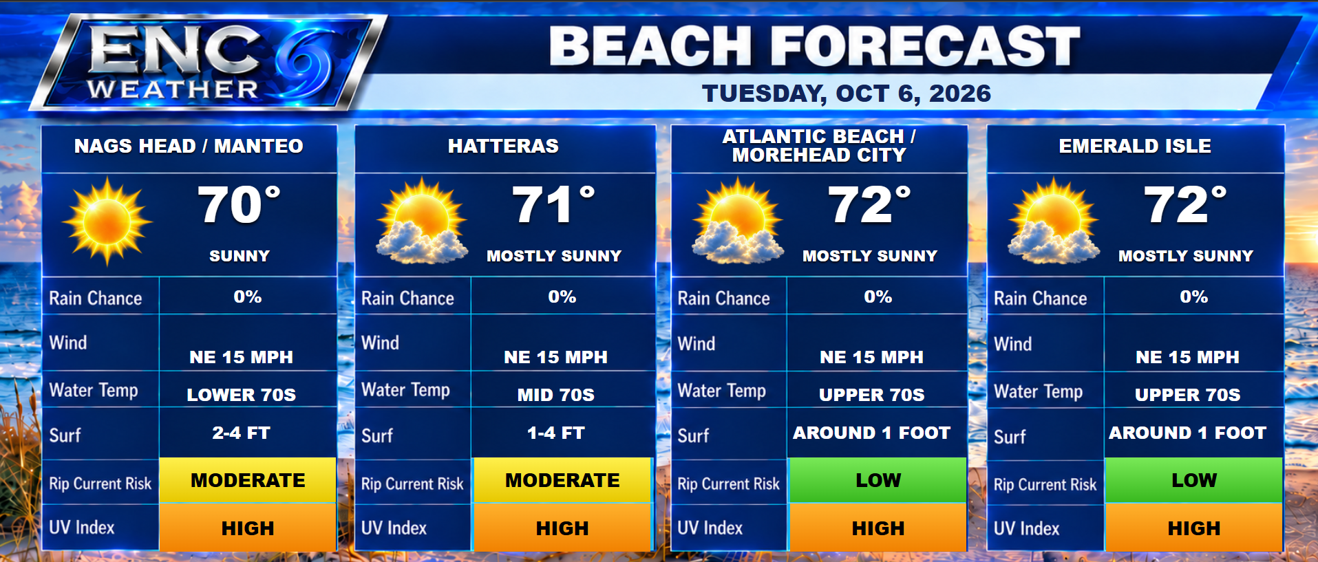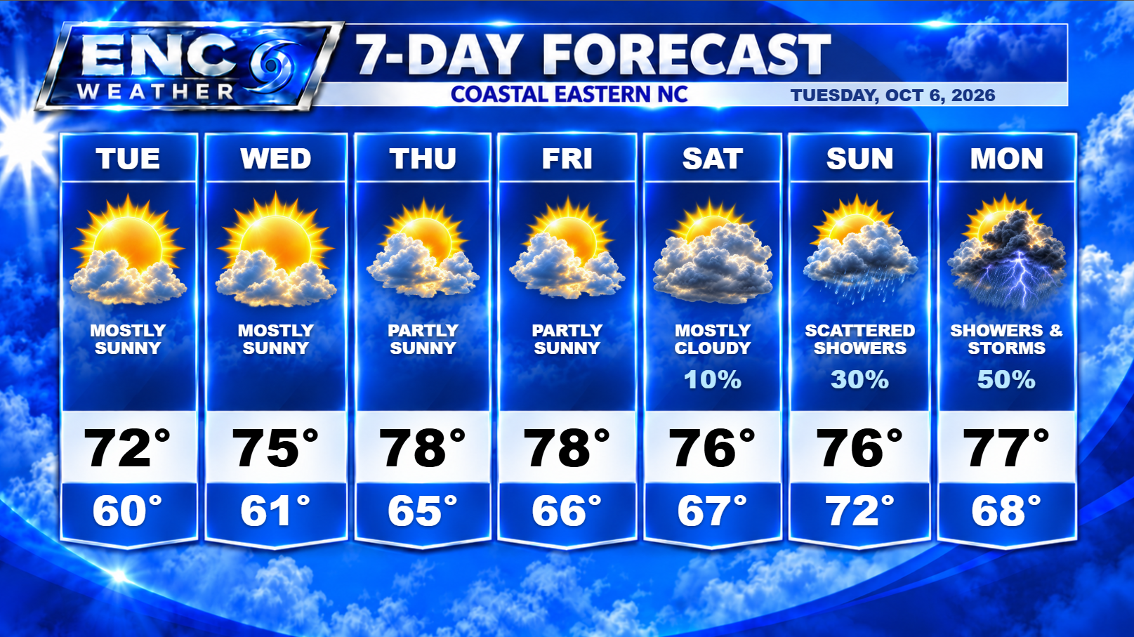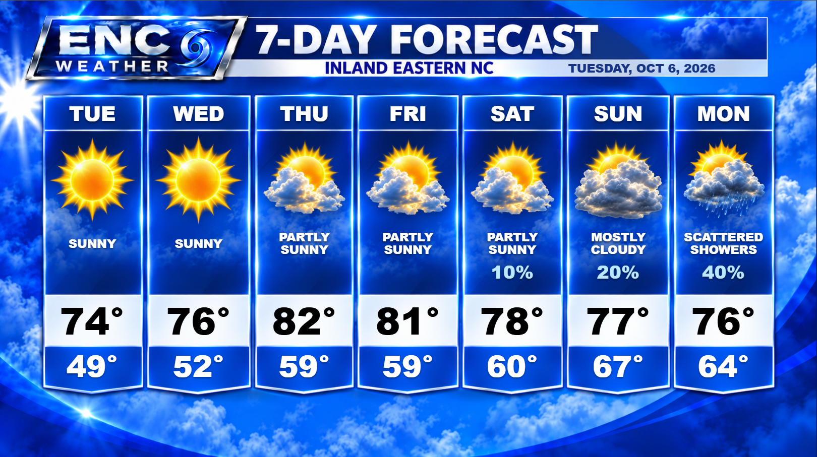
Good morning, ENC! Now that the rain and clouds have finally pushed well offshore this morning, we begin what is going to be a beautiful fall week. High pressure just to the north will keep northeasterly winds in place across the area for the next two days which will help keep the temperatures just below average for this time of year. Expect highs in the mid-70s and overnight temperatures dropping down possibly into the upper-40s inland as conditions for radiational cooling overnight will be favorable. Along the coast, the low temperatures will drop down to the lower 60s.
Mostly sunny skies will prevail through most of the week as high pressure remains dominant over the area and the frontal system to the south remains parked over the Gulf Coast region.
Southwesterly flow returns on Thursday which will allow temperatures to warm up slightly into the lower-80s (upper-70s coast) as we approach our weekend.
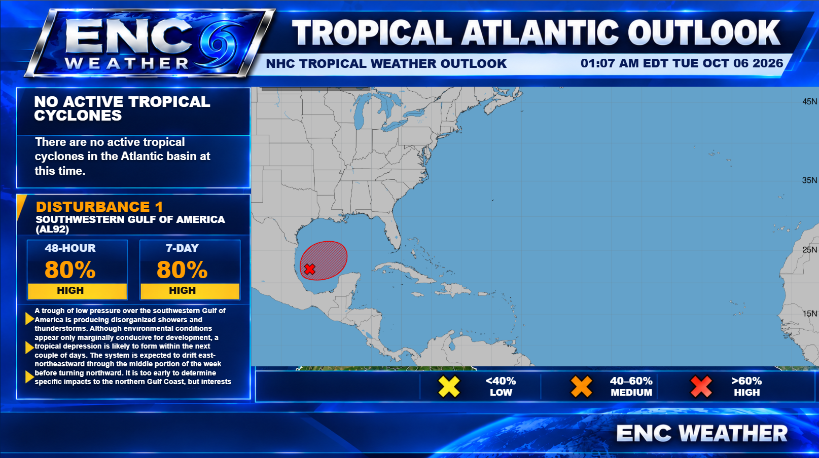
As I mentioned in the October 1 forecast update, the area to watch for our next rain-maker is the Gulf region as I was concerned this set up could potentially produce some type of system over the next week. Right now, Invest 92L is the system in question. Currently sitting in the Bay of Campeche, the NHC has given it an 80% chance of development over the next 48 hours. Now what happens over the next week is currently unknown but there are a couple of theories. It is possible that over the next couple of days, it could rapidly strengthen as it travels slowly over the southern Gulf, potentially reaching category 1 hurricane strength at some point. I think the potential is small at this stage but it does have a narrow window of favorable conditions for this to happen, whether or not it is able to take advantage of this window of opportunity is yet to be seen.
The more likely forecast for future Isaias is for it to become a tropical depression/storm over the next couple of days before being picked up and turned northward by an upper-level trough that will pass over Texas by the end of the week. As it moves north, it will begin to enter unfavorable upper-level winds for further tropical strengthening and as it interacts with the upper-level system along the coast, I imagine it will begin to transition into an extratropical system. This transition, if it does occur, doesn’t minimize the treat it poses to areas in its path at all. If this forecast does verify, the impacts to the Gulf coast, and to many Southeast States could be quite severe. The interaction with the upper-level system will bring heavy rains, winds, and the potential for tornadoes across the southeast.
What this means for ENC: As Isaias moves northward and transitions to an extratropical system, the frontal boundary currently over the Gulf Coast, will lift northward bringing with it abundant Gulf moisture and the chance for some heavy rain over ENC by the late weekend/early next week. We will need to continue to monitor the situation over the coming days and the resulting impacts to our weather for this weekend as it could be quite significant if the right conditions come together.
I will try to provide daily updates on Invest 92L as the week progresses.