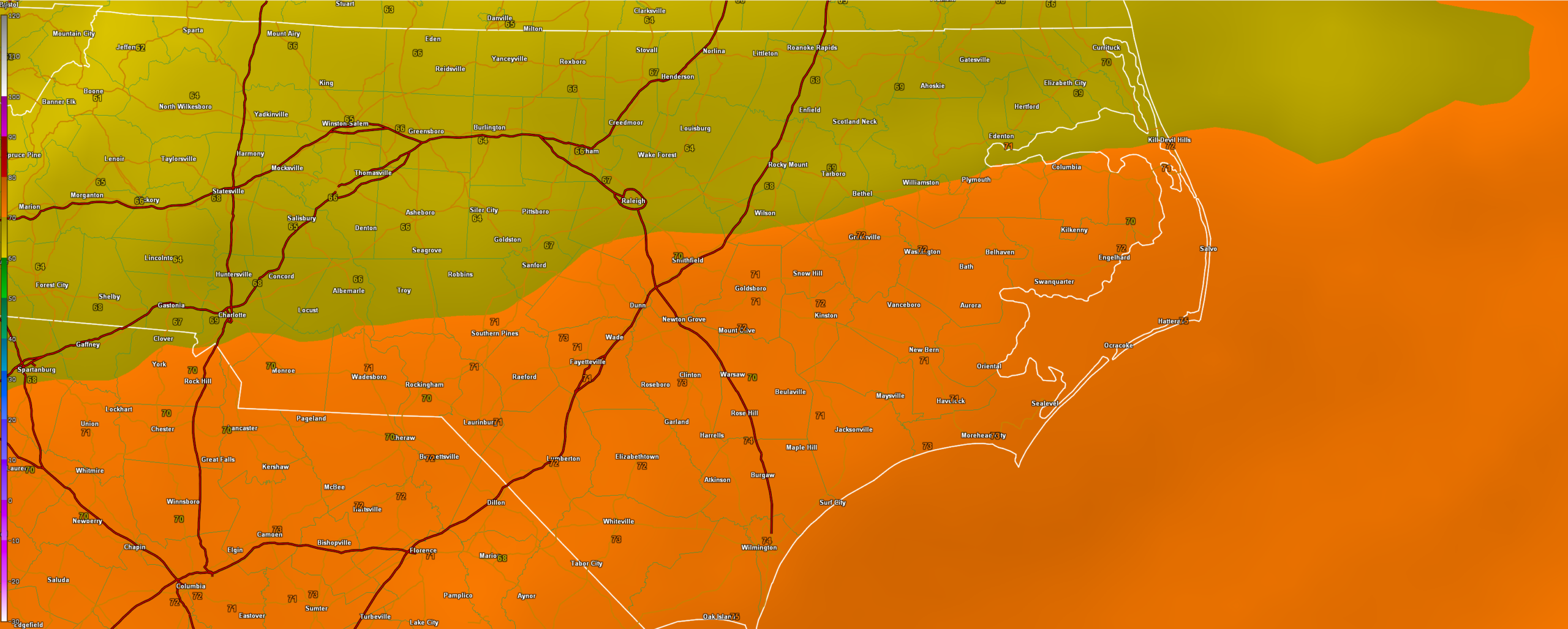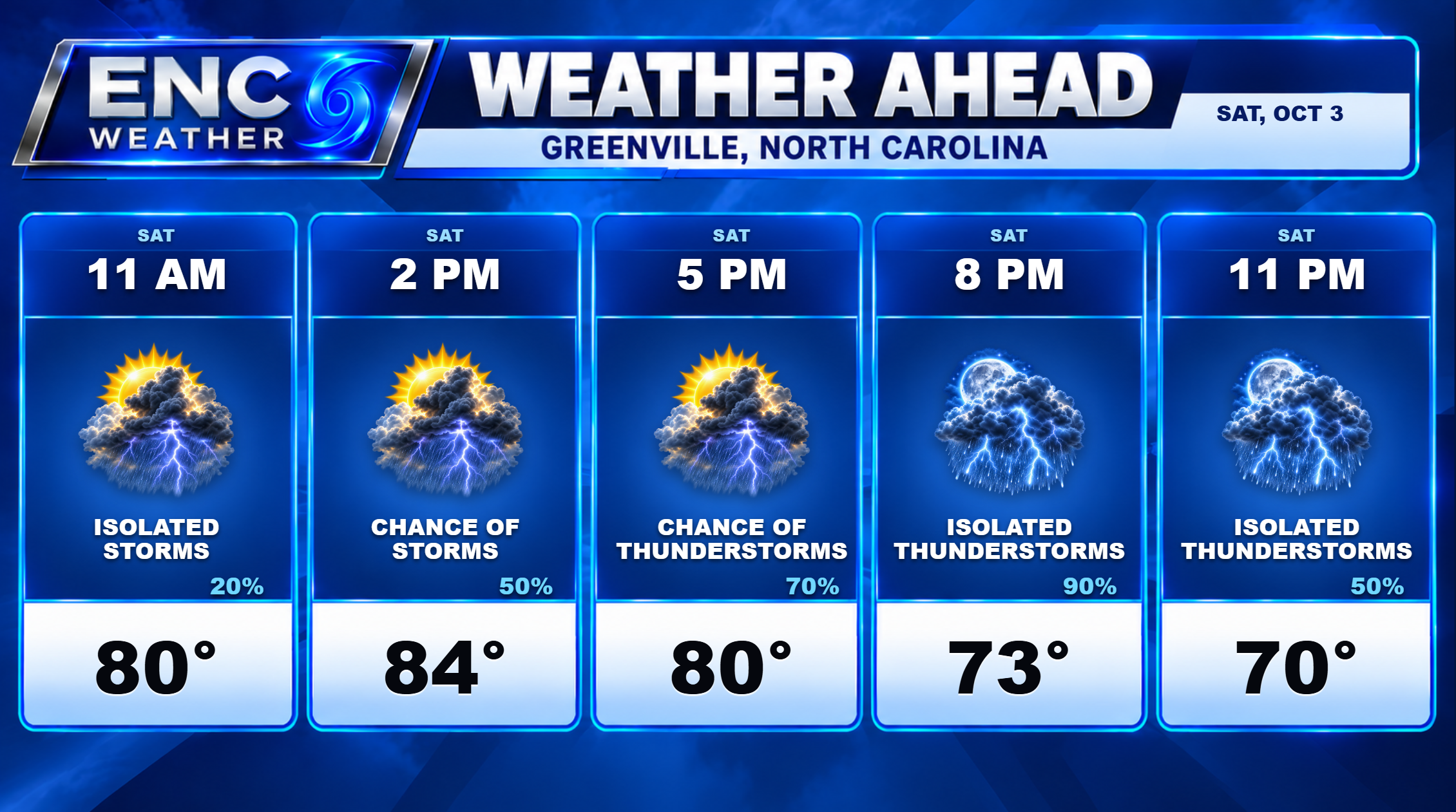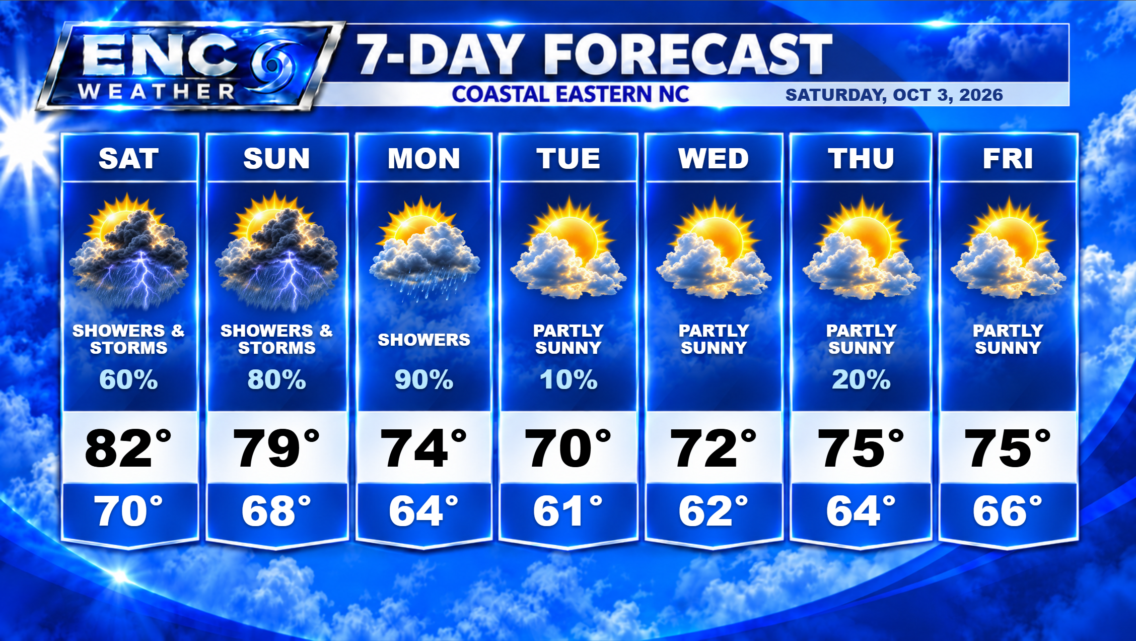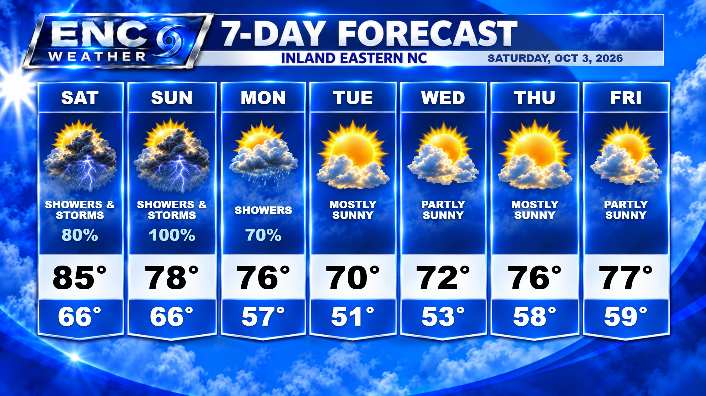
Good morning, ENC! The atmospheric moisture has arrived as advertised with dewpoints already climbing into the 70s. There was some patchy morning fog this morning, but that is beginning to burn off and we should see a brief period of sun before the rain starts this weekend. Surface analysis shows the approaching cold front currently over Virginia which will push its way slowly through the area starting today. With sufficient moisture in place and some instability (especially across the southern half of ENC), we should see some scattered showers and thunderstorms begin to fire up around the 9-10am time period and persist through the rest of the afternoon. It looks like the best chance for the heaviest showers and storms appears to be south of 264 with isolated possibilities north. With the scattered nature of these storms, some areas could potentially see 1-2 inches of rain while others may see little-to-no rain at all. Highs today should top out around the low-to-mid 80s. Rain chances diminish somewhat overnight though I can’t rule out a stray shower or two through the overnight hours.
More widespread rain for Sunday as the frontal boundary stalls and meanders over ENC. This will bring concentrated rain showers for most of the area though it looks like the southern and coastal sections have the best chance at seeing the heaviest precipitation. This will be an all-day event as the front will remain in place until the next upper-level trough/cold front kicks it out early Monday. Light rain will linger through the overnight hours on Sunday and into early Monday morning until the front starts moving away from the coast. Rain will end from northwest to southeast through the day Monday. High temperatures on Sunday will depend on the exact placement of the front. I expect temperatures to be mostly in the upper-70s, although if the front moves further northward during the day, temperatures could rise into the lower-80s on the warm side of the front.
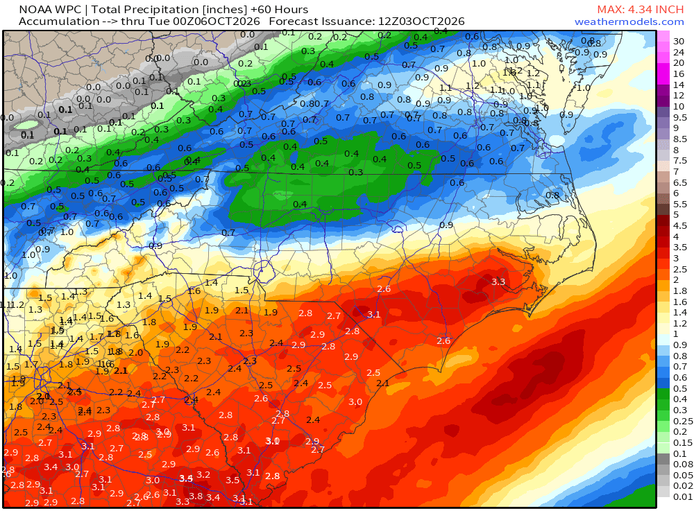
Forecast rainfall totals for the event should be in the 1-3 inch range with the possibility of locally higher amounts of 3-4 inches (mostly in the southern sections). To the north, rainfall totals should be on the lower side with about 1-2 inches expected.
After the front moves away from the area, high pressure should dominate the weather with a northerly/northeasterly flow through the middle part of the week. This will bring in much cooler, drier air to the region with high temperatures only in the low 70s on Tuesday and Wednesday and overnight temperatures in the low-50s inland/low 60s coast.
The Tropical Atlantic is expected to remain quiet over the next seven days, continuing to be one of the calmest seasons on record, if not the calmest.