Good morning, ENC! A very foggy start to our weekend as atmospheric moisture begins to increase across ENC. We have several dense fog advisories in place so if you are traveling this morning, be careful on the roads.
Another above average temperature day in store for the east as high pressure off the coast continues to bring a southwesterly flow across the southeast. The upper-ridge will hold in place for another day before moving east ahead of the approaching trough. This trough will be weakening as it moves east and as a result, the approaching cold front will begin to lose a little steam as it reaches ENC.
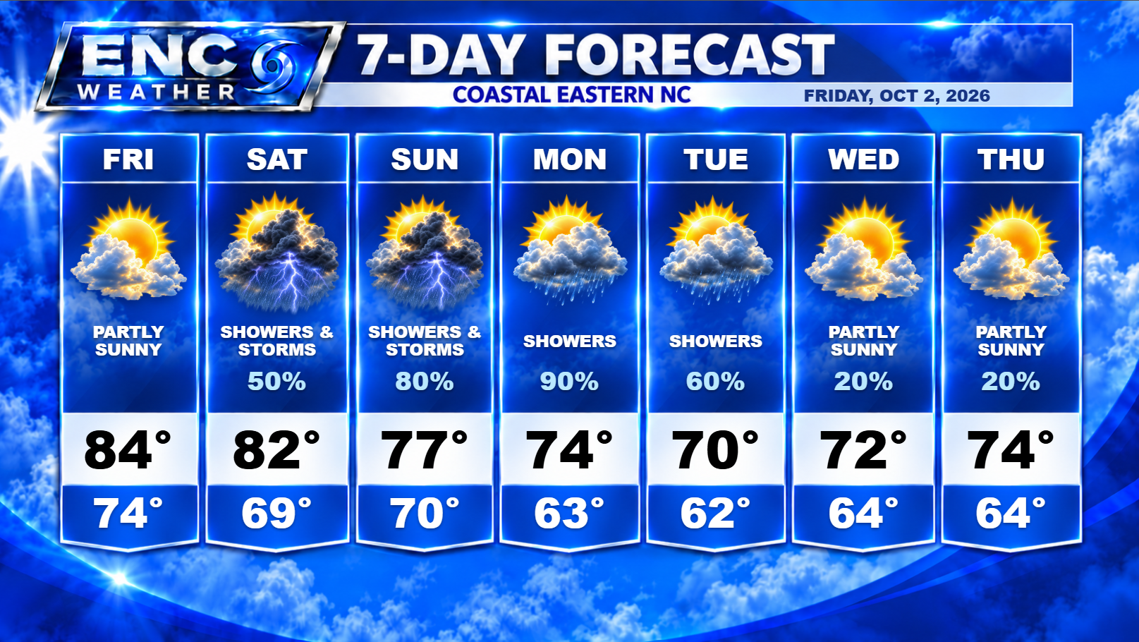
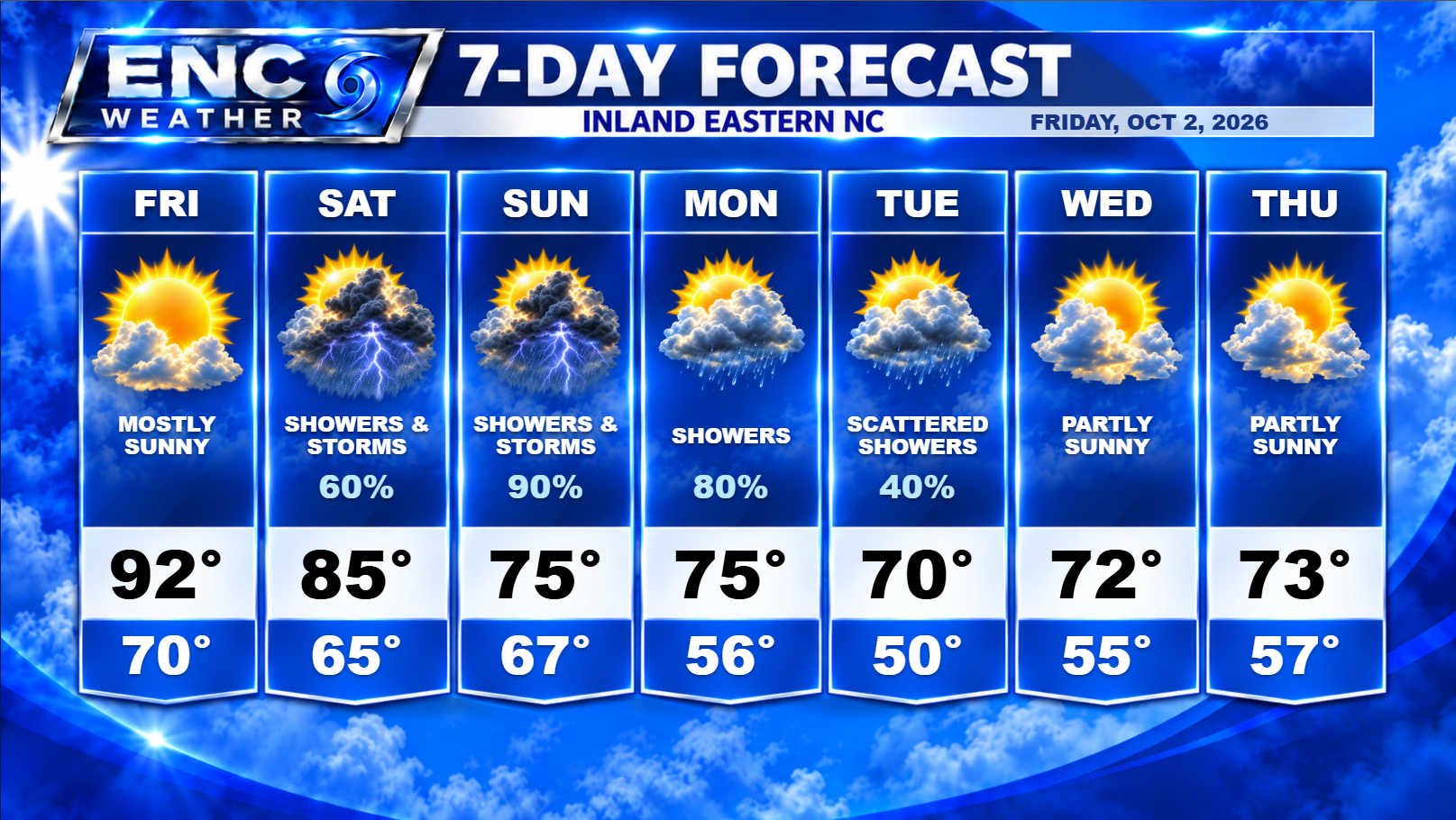
As for impacts, for Friday, we should see Gulf moisture start to filter into the area this afternoon. I don’t anticipate any rain this afternoon as a result but conditions might start to feel a little more muggy than they have the past couple of days. I do expect mostly sunny skies for today with highs reaching into the lower-90s inland to the low-to-mid 80s along the coast.
Rain chances start to increase on Saturday as more moisture filters into the area. Right now, the areas that have the greatest chance of seeing rain are the southern half of ENC. There could be some showers in the northern half, however I expect it to be a little more isolated in comparison. I expect temperatures on Saturday to only top out in the mid-to-upper 80s.
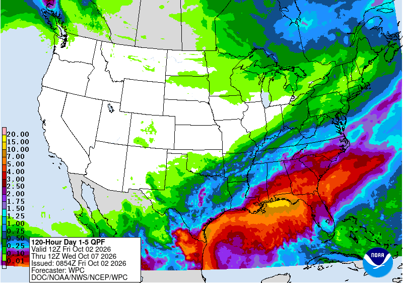
Rain chances increase dramatically Sunday as the slow moving cold front finally reaches ENC. This should kick off more widespread rain, with rain being heavy at times, across the entire coverage area. We could see rainfall totals in the 1-2 inch range with locally higher amounts. The front will be very slow to move off the coast so rain should stick around for most of the day and possibly into the overnight areas ending from northwest to southeast.
The forecast for Monday and Tuesday becomes a little complicated. Depending on the location of the weekend front, and the timing/strength of the next approaching upper-level trough (and associated cold front), we could see some light rain showers possible over the area on Monday and Tuesday (probably a better chance on Monday than Tuesday as it looks like enough dry air will filter into the area by that time). We will have to see how this develops over the weekend.
After these systems pass next week, high temperatures will return to below normal for early October with highs in the low-to-mid 70s and lows in the 50s (inland)/60s (coast).
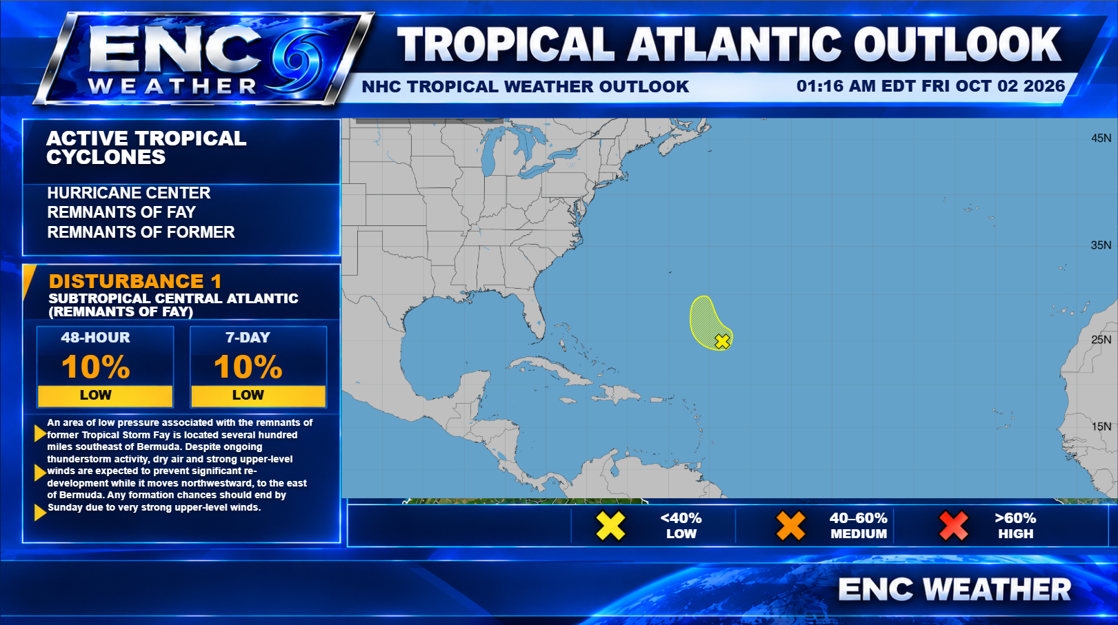
What remains of former Tropical Storm Fay continues to traverse the Tropical Atlantic. Its difficult path from the Azores, to nearly becoming the season’s first hurricane, never giving up along the way despite the hostile environment just shows how unfavorable the Tropical Atlantic is for sustained development. Fay will continue to fire off thunderstorms for the next day or two but will reach an unfavorable upper-level environment by the end of the weekend which should further weaken Fay. What remains of Fay will most likely get swept up in the system moving off the east coast by the end of the weekend and that should be the end of Fay’s brave story.
I hope everyone has a wonderful weekend!