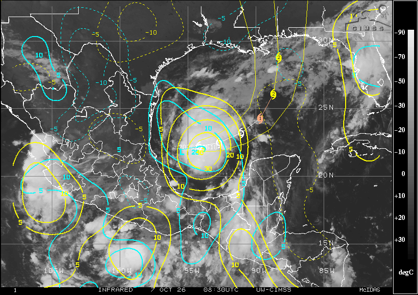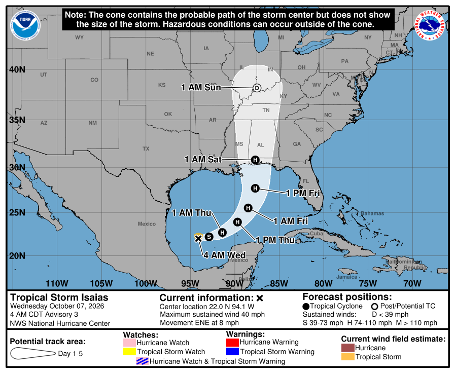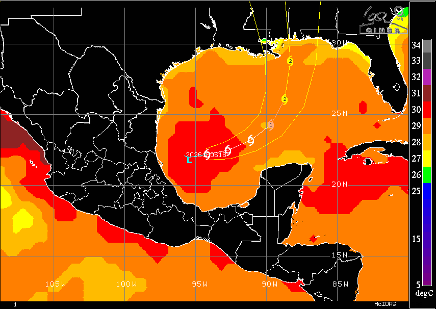
Tropical Storm Isaias has joined the club of named storms this year. Classified yesterday afternoon as a Tropical Depression, it has slowly strengthened into a Tropical Storm as of 5am Eastern. With winds currently at 40mph, it isn’t forecast to remain there for much longer. In fact, Isaias may become the first hurricane of the 2026 season and the first hurricane since Hurricane Melissa in late October 2025.
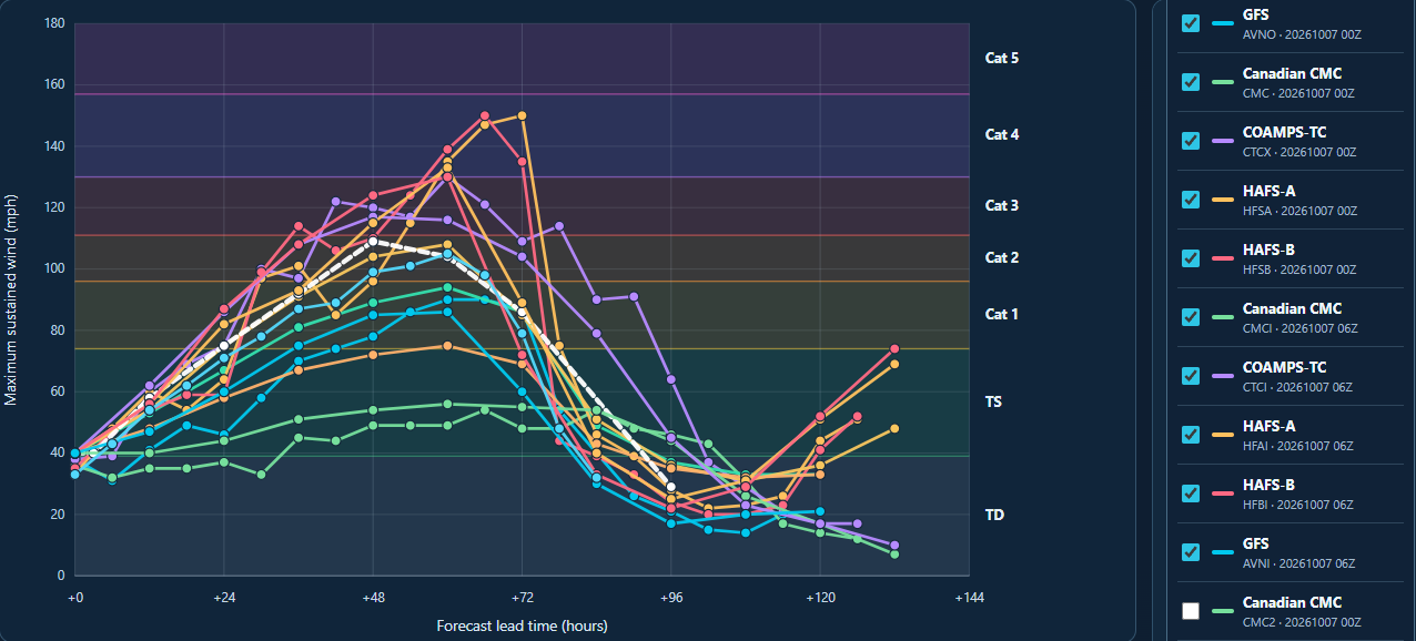
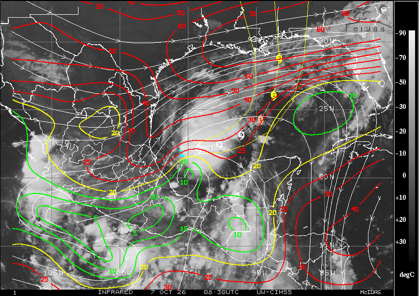
Currently, Isaias is in a very good environment for strengthening. Sufficient water temperatures, good surface convergence and upper-level divergence is setting it up for steady strengthening over the next day or two. Right now, it is experiencing some southwesterly shear on the northern side of the storm but it doesn’t seem to be disrupting the system too much at this time. As it begins to drift eastward throughout the day, it will stay in a favorable environment for strengthening. Most of the forecast models do show Isaias reaching at least a category 1 hurricane with several models showing a good potential to reach category 2. There are some models that indicate the potential to even reach category 3 strength, which isn’t off the table at this stage, but I will wait to see how it progresses today to see whether that possibility will hold up. Right now, I do think a category 2 hurricane does look more likely but I can’t rule out the potential for it to strengthen to a category 3 storm.
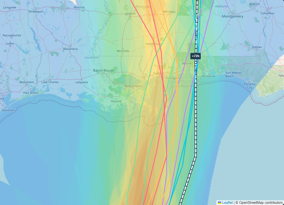
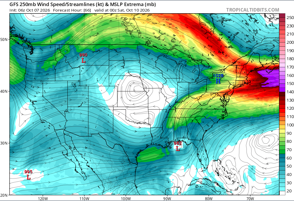
What will ultimately drive the system next is the upper-level trough that will move over Texas which will turn Isaias northward towards the Gulf Coast. Once the trough picks up the system, we will have a good idea about where exactly along the coast Isaias will make direct landfall. Right now, the official forecast track from NHC brings the center inland near Mobile, AL while many of the forecast models are slightly to the west closer to New Orleans. The greatest impacts from this storm will be felt to the east of the center so even if the center doesn’t make landfall over a particular location, it doesn’t mean the effects won’t be felt. I’ll go into that in a little more detail.
As Isaias approaches the coast, it will begin interacting with the upper-level system that has been sitting over the Gulf Coast for the past several days and will still be present by the end of the week. As it begins to interact with this system, it will begin to transition to an extratropical system. This doesn’t mean that the system is going to weaken significantly and the threat is over. It just means what is driving the system is going to evolve but the impacts will be felt well inland after landfall/transition. With systems like this, the threats that do develop are heavy rain, tornadoes, gusty winds, and flooding. The tornado threat could extend well inland from the coast. Given that this system is going to be making landfall at the start of the weekend, I expect many football games to be moved or postponed due to the extreme weather that the area will experience.
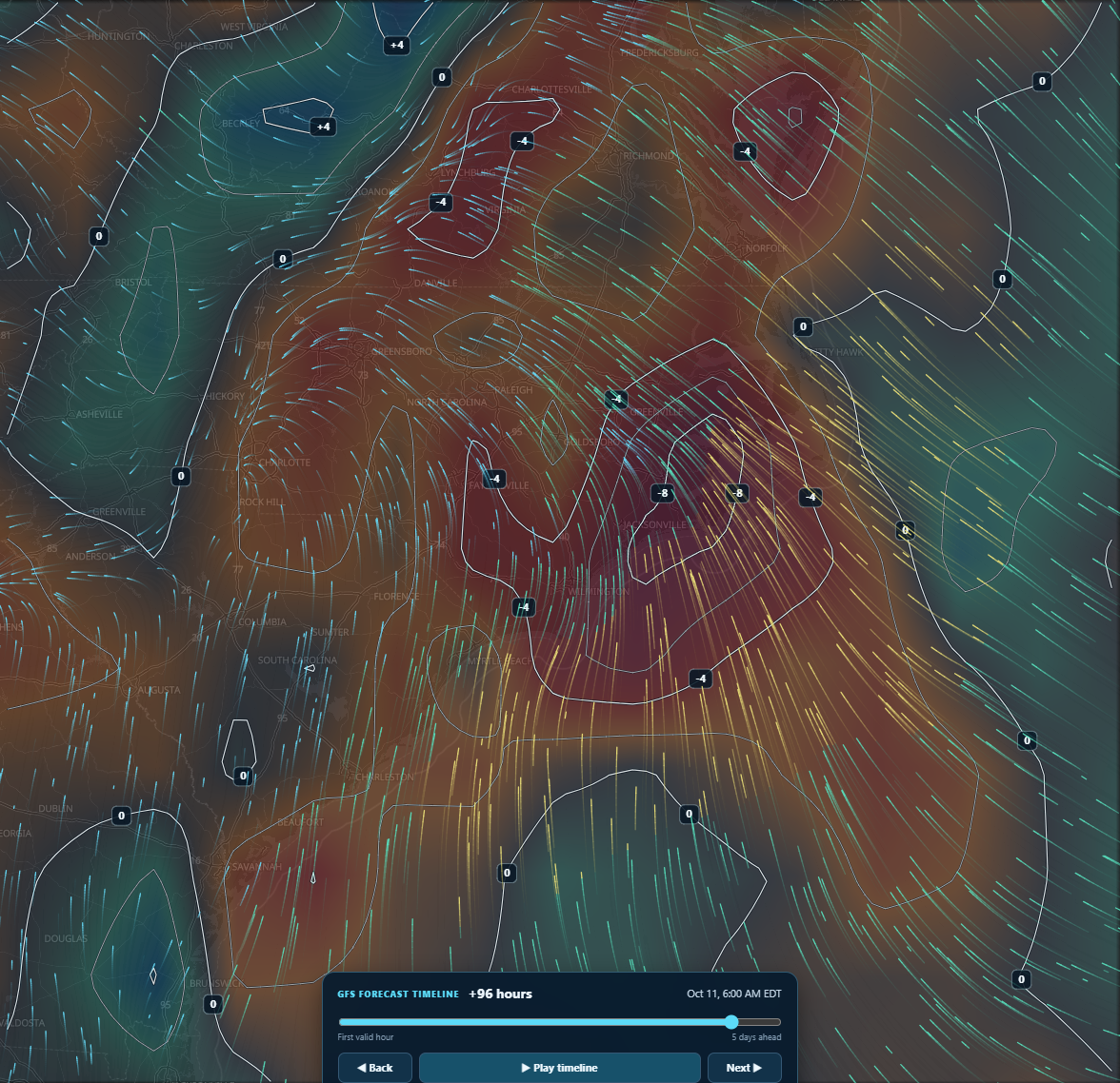
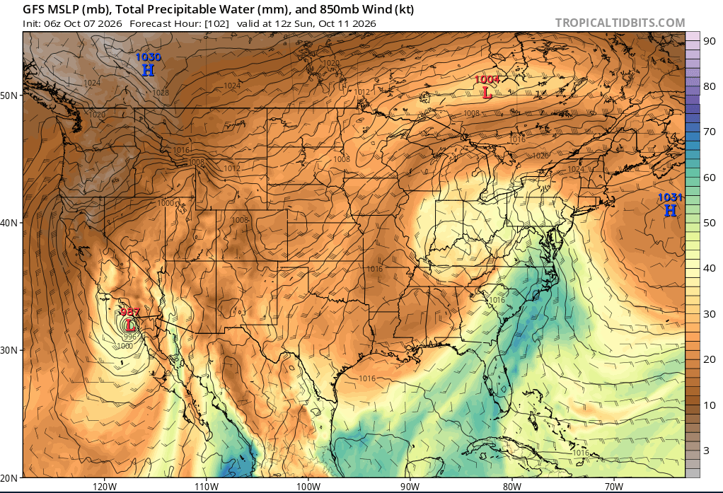
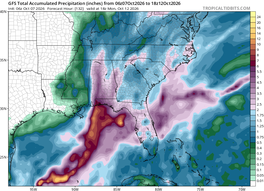
So what does this mean for Eastern North Carolina? Well, we won’t experience the landfall of a hurricane along our coast but there will be impacts as a result of Isaias. If that name sounds familiar, ENC dealt with Isaias back in 2020 when it brought winds of up to 100mph along the coast. This year’s edition will bring mostly the threat over heavy rains on Sunday and Monday. As Isaias interacts with the frontal system along the Gulf Coast, the front will begin to move northward as a warm front as Isaias moves inland just east of the Mississippi River. This will filter into the region a lot of Gulf and Atlantic moisture. Strong high pressure is forecast to be just off the Northeast Coast by Sunday. This will set up an area of surface convergence around central/eastern North Carolina along with the increased moisture from the Gulf and Atlantic, could set up for very heavy rainfall over a narrow corridor where this convergence ultimately sets up. Forecast models do indicate this possibility with a narrow strip of higher rainfall totals through Monday.
We will need to keep an eye on how Tropical Storm Isaias develops as it could have implications on our late weekend forecast so keep coming back for more updates throughout the week.
Be sure to check out the all new Tropical Model Guidance Center to keep up with the latest model guidance for Isaias and other systems in the Atlantic/East Pacific.