Fall Returns With A Better Chance Of Rain
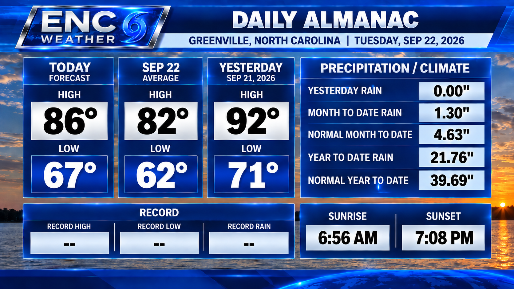
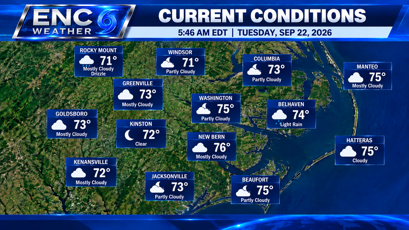
Good morning ENC! Welcome to the last day of Summer! The last day of Summer will bring the beginning of fall-like temperatures but first we must get through a little rain. Currently most areas are under mostly cloudy skies with morning temperatures starting out in the low 70s.
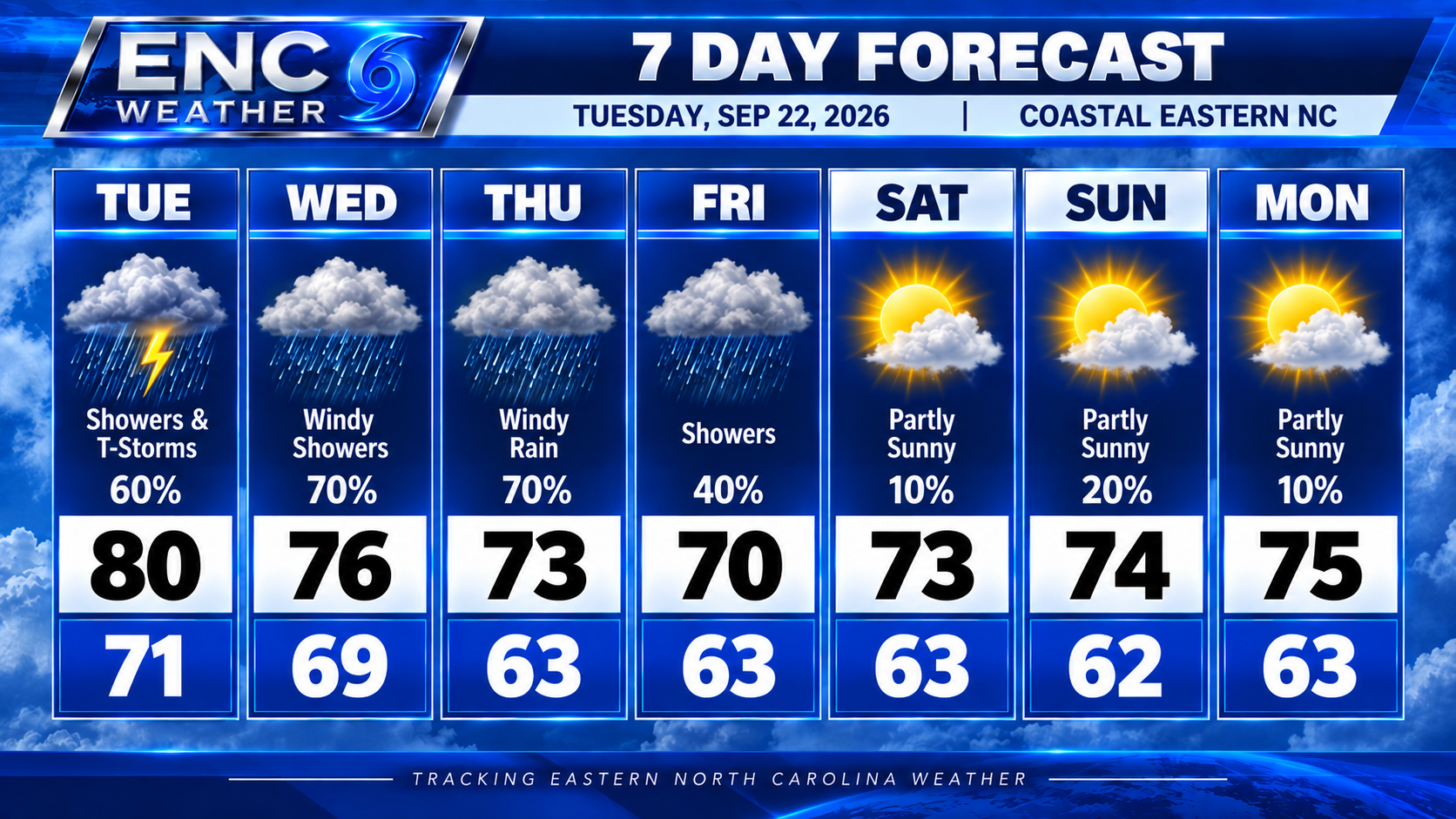
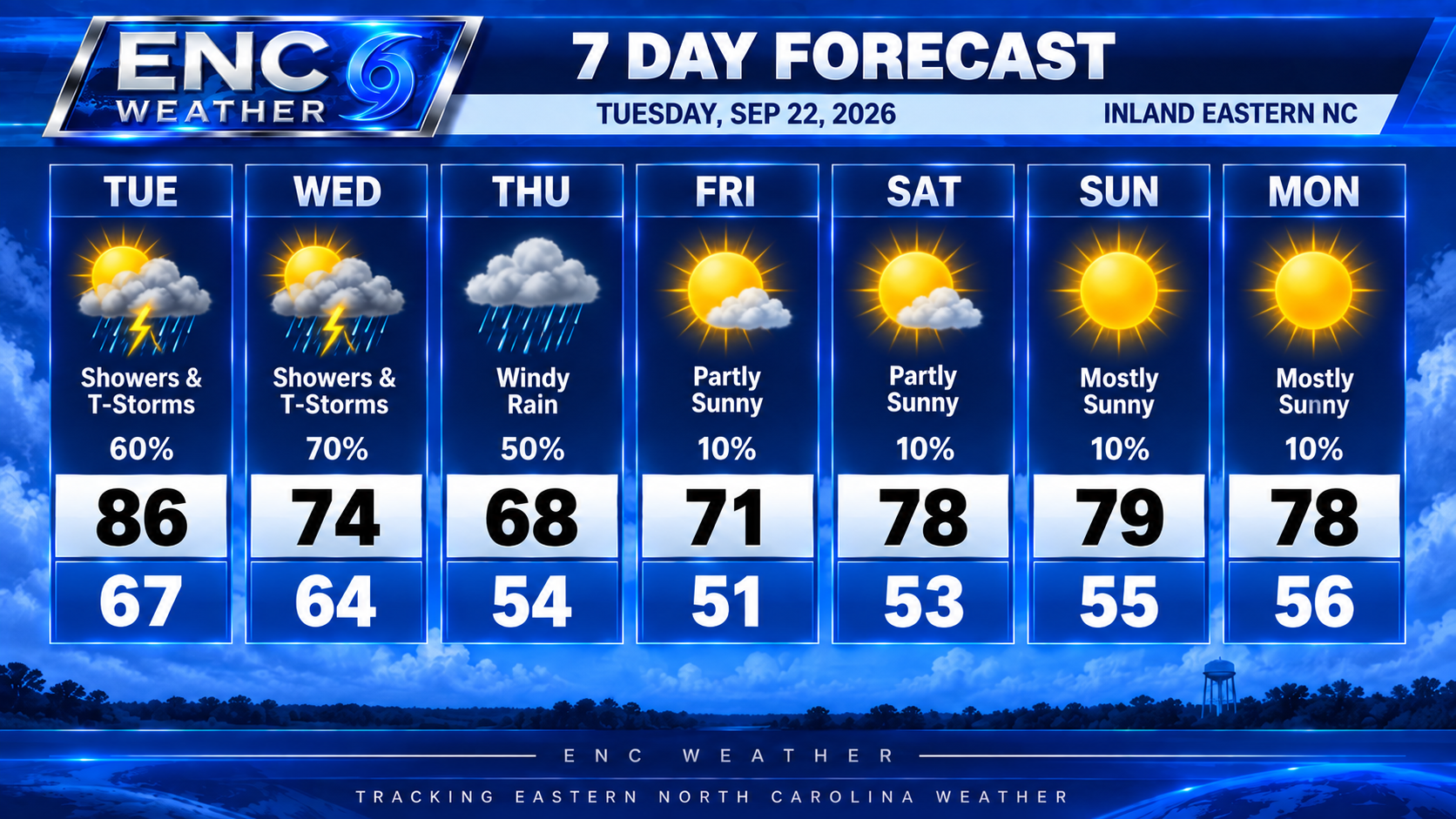
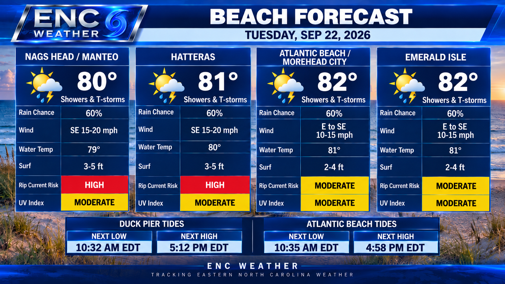
The cold front to the north will slowly drift southward throughout the day and onshore flow from the upper-low off the southeast coast will filter in enough moisture to kickoff scattered showers and possibly a few thunderstorms later today. I don’t expect the coverage to be widespread so some areas will see a healthy amount of rain while others may see little to no rain. Any showers that do form do have the potential to be heavy with a 1-2″ possible if the showers persist long enough. There is a slight risk for excessive rain over the far western counties later today (mainly along and west of I-95). Rain chances along the coast will be higher with the presence of a coastal trough. Expect rain chances starting early this morning and persisting throughout the day.
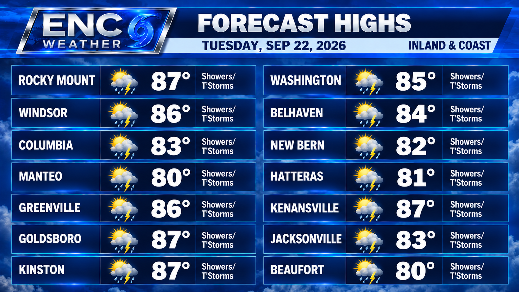
Forecast highs today will be slightly lower than originally forecast with highs only reaching into the low-to-mid 80s inland with mostly low 80s along the coast. These numbers may be lower for those who see showers early in the day.
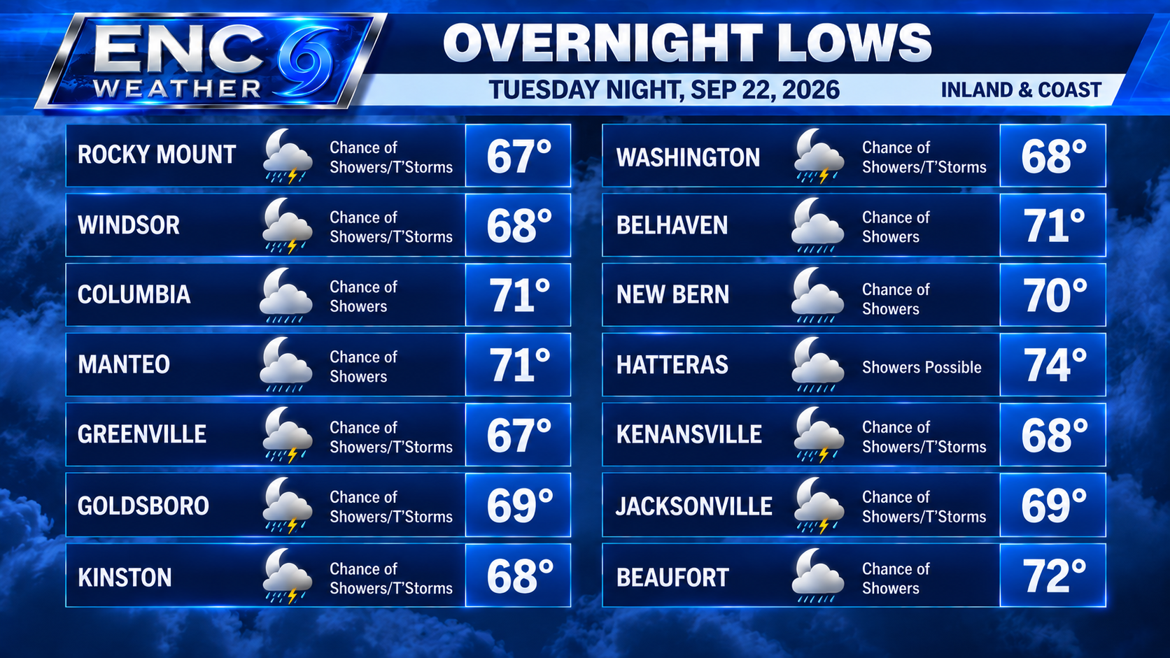
Overnight, rain should diminish somewhat but can’t rule out a couple of stay showers with temperatures dropping down to the mid-60s inland/near 70 coast.
Rain chances should remain elevated through early Thursday as the front continues to slowly move south. Just off the coast, the upper-low moving northeast of the coast and the upper-low approaching from the Great Lakes/Ohio River Valley Region will induce a coastal low of the east coast and deepen as it slowly meanders off the Northeast Coast. As it deepens, the pressure gradient across the area should tighten and produce a period of strong northeasterly winds across the area. These winds will be stronger just off and along the coast where dangerous surf conditions can be expected over the next several days. We will have to monitor the progress of this system as we go through the rest of the week.
These strong northeasterly winds will usher in much cooler and drier air starting on Wednesday/Thursday and lasting throughout the weekend. High temperatures are expected to drop into the low 70s inland with the possibility of even reaching the upper 60s at the peak of the coastal event. Temperatures along the coast will also drop to the lower-70s though it might be a stretch to reach the 60s. Low temperatures will drop down to the low-to-mid 50s during this stretch.
This weekend looks good for most areas as the coastal low is currently forecast to stay far enough away from the region to keep rain chances near 0%. Temperatures will only reach the upper 70s during the day with overnight lows in the mid-50s.