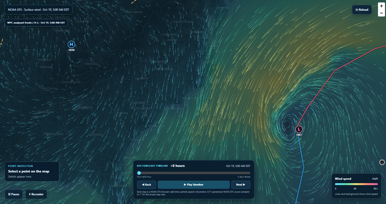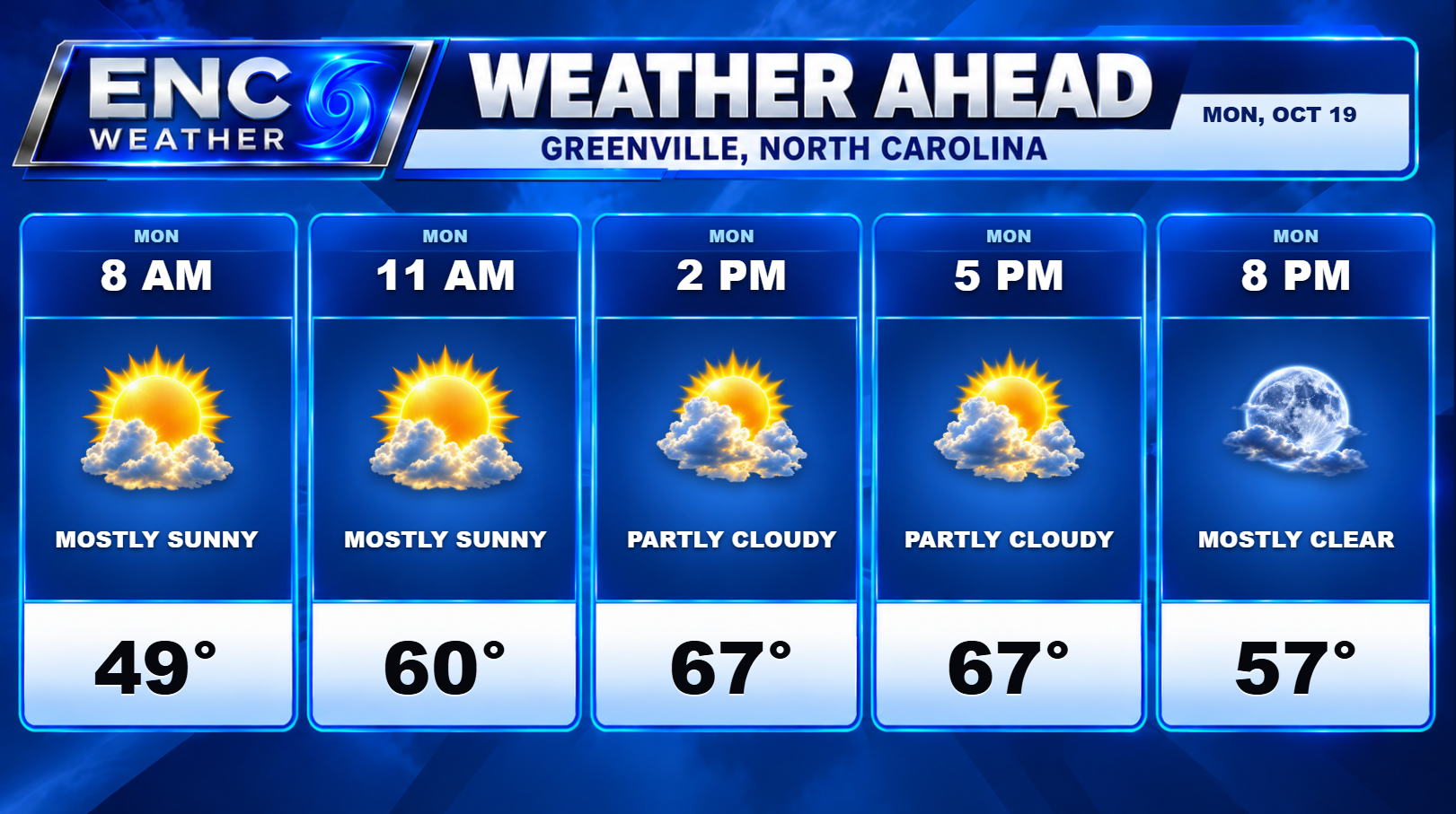
Good morning, ENC! I hope everyone had a wonderful weekend. It was a rainy and windy start to the weekend but the sun did come out on Sunday but the wind stuck around. After the front passed on Saturday, the low pressure that was forecast to develop off the NC coast did develop and is currently moving very little. High pressure is building in to the northwest which is only going to reinforce the pressure gradient leading to continued gusty winds for ENC. This will continue to create problems for the coast in the form of large surf and coastal flooding. There is a coastal flood warning in effect for Hatteras and Ocracoke Islands. There is a 40% chance that this low could potentially develop into a subtropical system over the next week however the impacts to ENC will remain the same regardless.
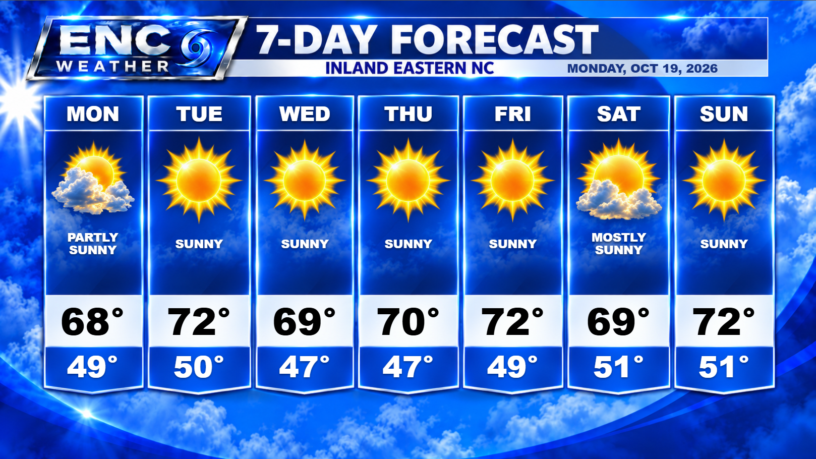
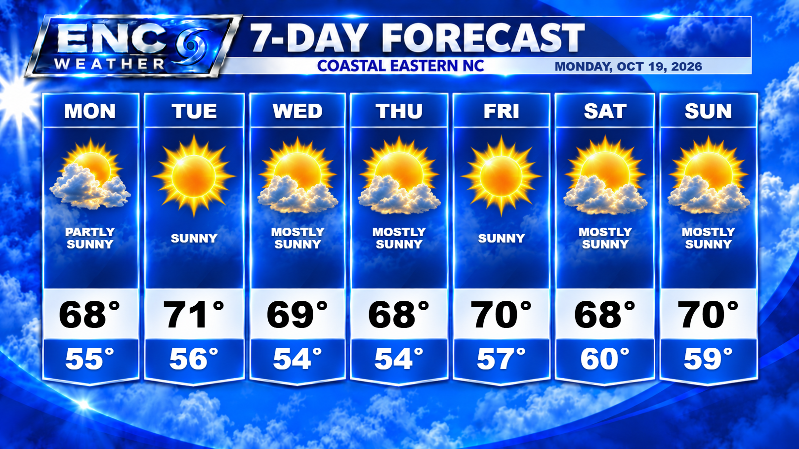
For inland sections, we can expect a few more days of some gusty winds as the pressure gradient will be in place between the high and low for at least the first half of the week. High temperatures should rain in the upper-60s to low 70s with lows in the upper-40 to lower-50s. Dry, sunny conditions should prevail throughout the week with no chances of rain for quite some time (although, coastal sections could potentially see some showers move onshore at times if the low happens to meander close enough during that time). The winds should start to subside by the latter half of the week as low pressure starts to slowly move off to the east.
High pressure builds in from the north by the end of the week to solidify our first dry weekend since late September. Highs should stay around 70 as we head into the weekend with lows near 50.