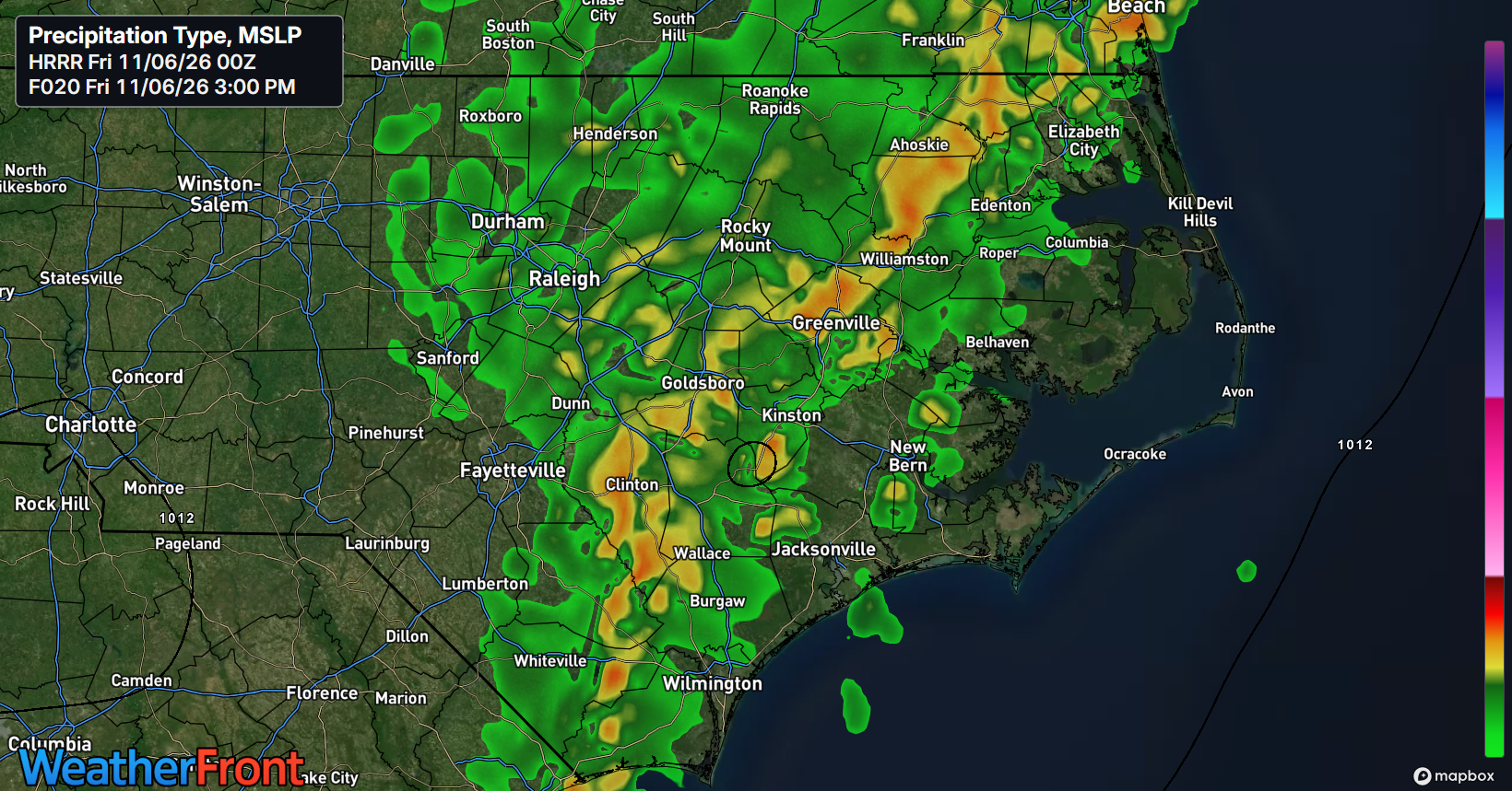
Another warm start to the day as most of ENC waking up to near 70 degree temperatures this morning. There are a few scattered showers out to our west that might migrate into portions of ENC this morning but I do expect most of the activity to begin later today. The slow-moving cold front currently in the western part of the state will move eastward throughout the day as the upper-level trough helps to kick it into gear as it moves east. During the morning hours, what we will be watching is how much cloud cover is around that could potentially limit instability.
If we get enough sun through this morning and into early afternoon, instability could rise enough to raise the risk of severe thunderstorms as the front moves into ENC. This instability is rather modest but still significant for the month of November so if it does occur, we could see some potentially gusty, damaging winds with the isolated potential of a tornado. What I am also watching is the potential for some prefrontal activity around late morning which could limit daytime heating and instability ahead of the front. Whether this happens is yet to be seen but this could be a limiting factor when it comes to potential severe weather this afternoon.
The cold front and lines of showers and storms is forecast to reach western ENC by around 1-2 PM and progress to around Highway 17 around 5 PM. This will be the timeframe where the storms will be the strongest. After this point, with the loss of daytime heating/instability, the line should start to weaken as it moves eastward towards the coast. I don’t anticipate the severe weather threat to extend past 6 PM so it should mostly be isolated to the inland counties.
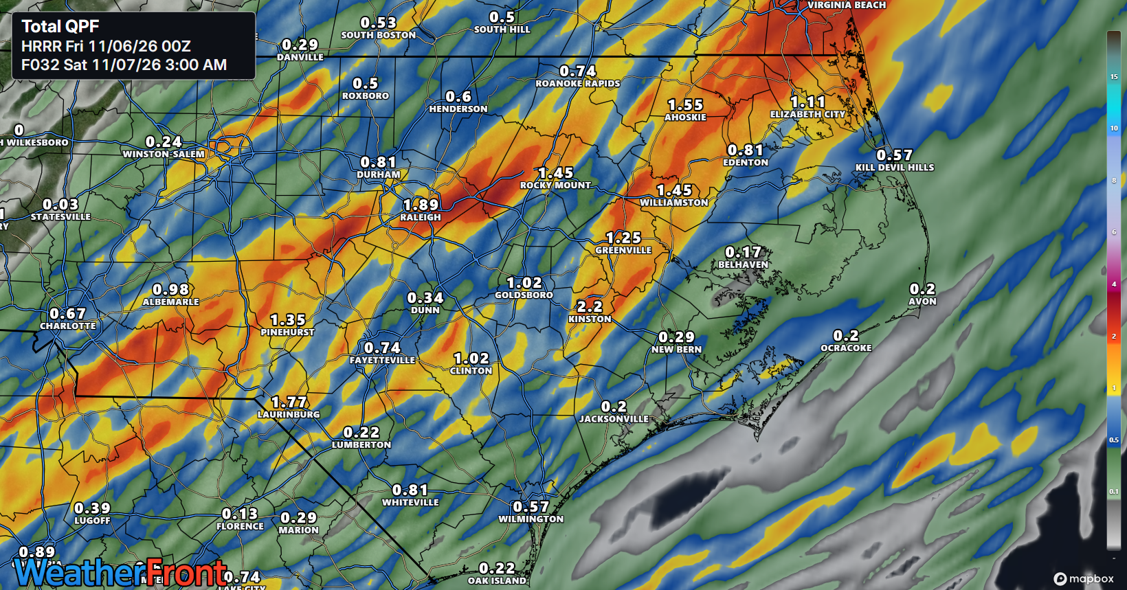
Rainfall totals will depend where the heaviest thunderstorms track. While most areas will see some rain, it looks like the average output could be in the .25-.75″ range outside of thunderstorms with areas receiving a direct hit from thunderstorms could see an excess of 1″. This will be a very welcome rain for most areas as long as the severe aspect remains minor.
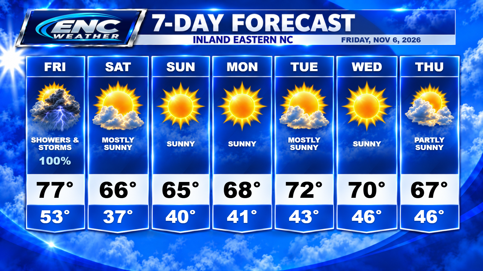
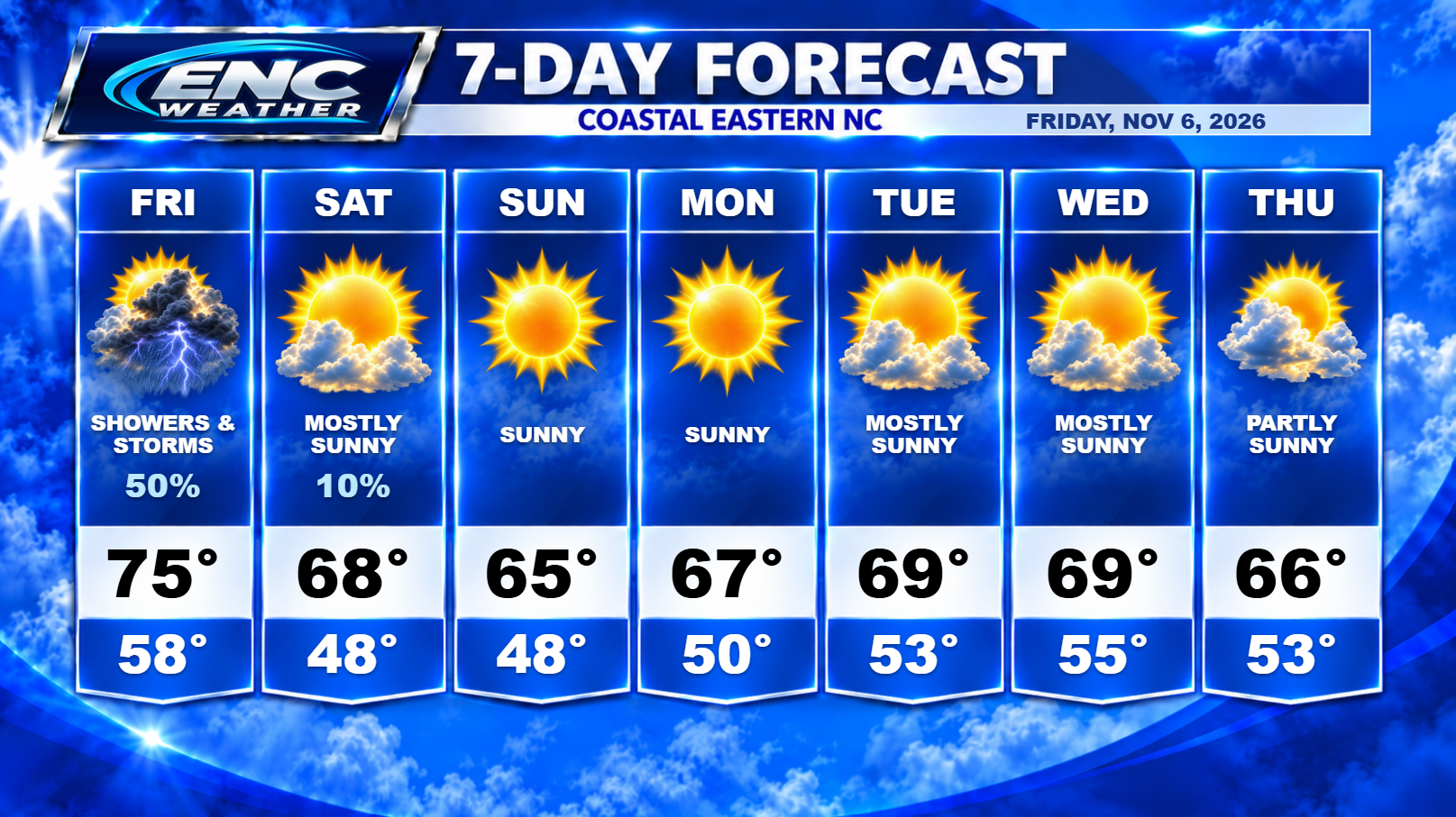
The front should clear the coast through the overnight hours with a return to more seasonal conditions for our weekend and into the next work-week with highs in the upper 60s to lower 70s and overnight lows in the 40s inland/50s coast.
I am keeping an eye on next weekend as next Friday could potentially be our next chance of seeing some rain but also the cool down that will accompany it. We could see temperatures fall to the coldest we’ve see this fall season next weekend with lows dropping down to the 30s and highs only reaching the 50s.
In the Tropical Atlantic, the area of interest that the NHC has been watching for the past couple of days is looking a little less likely to develop with chances decreasing to 30% overnight. There is still a small chance that it could develop into a sub-tropical system over the next couple of days but time is running out and it will eventually enter into an unfavorable environment for development. Whether it develops or not, it will not be a threat to the US.