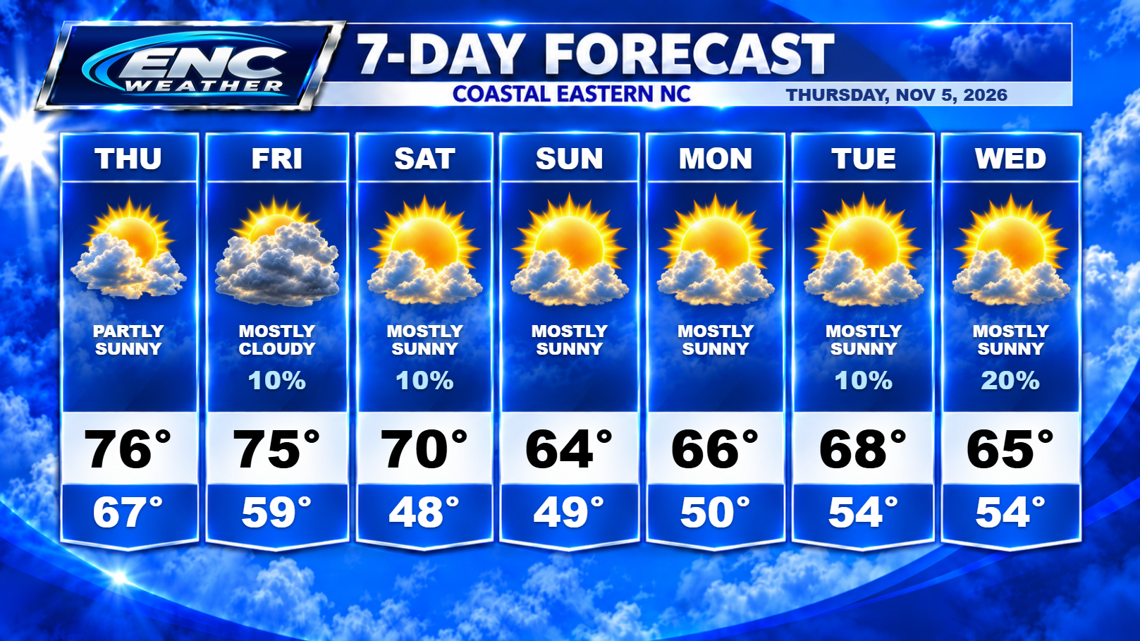
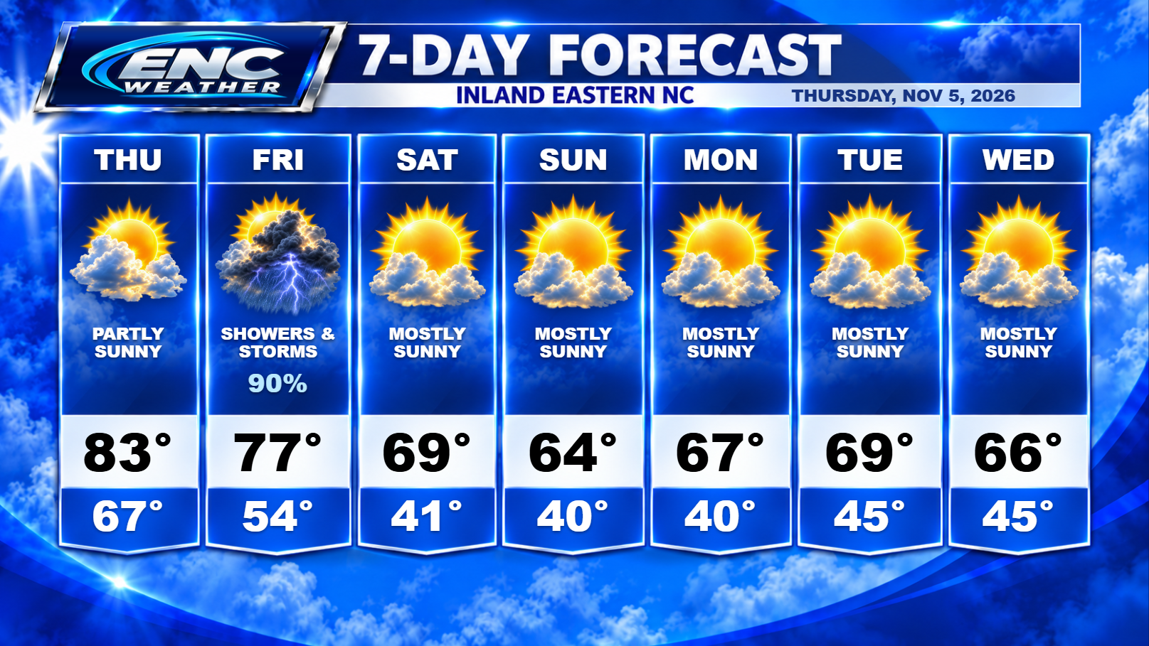
Another milder start to our day for early November as most areas across ENC are waking up to temperatures in the low-to-mid 60s. Expect high temperatures today to reach the low-to-mid 80s inland due to a mostly southerly flow ahead of the approaching cold front which should reach the area late Friday. I don’t expect much in the way of widespread rain today but some areas could see an isolated shower or two today.
Tomorrow is when the action picks up. The previously mentioned cold front will be approaching ENC by Friday afternoon. We do expect widespread showers and potentially a few thunderstorms as instability is expected to be elevated for this time of year. If the timing of the storms coincides with max heating of the day, some of these storms could potentially be severe. The SPC has placed ENC in the Marginal Risk category for severe storms tomorrow with the main threat being strong winds.
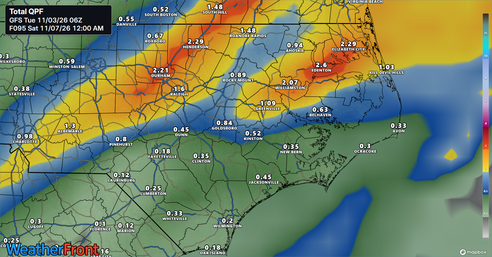
This system will provide some much needed rain to our area with the northern half of ENC seeing the best chances of meaningful rainfall. Of course rainfall totals will be higher in thunderstorms but most northern areas could potentially see .5-1″ of rain from this system. I know we’ve been disappointed in the past with some weaker than forecast rainfall totals but for right now, the chance does exists. If the timing of the frontal passage misses peak heating, rainfall amounts could be reduced.
The front should clear the area early Saturday morning bringing much more seasonable conditions for our weekend and into our next work-week. High temperatures following the frontal passage should be in the 60s with overnight lows dropping into the low 40s.
As for the tropics: The NHC is watching an area out in the Atlantic that does have a slight potential to become a sub-tropical system over the next couple of days. If it does develop, it will be short-lived as it approaches more unfavorable conditions for development. It’s currently moving eastward away from land so it is not expected to threaten the US.