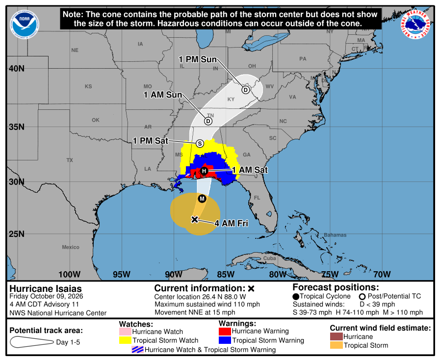
Hurricane Isaias continues its rapid intensification reaching a high end category 2 hurricane overnight and right now, could possibly be a category 3 hurricane a few hours after the last official release. Isaias has been able to withstand the moderate shear just on its northern side as well as fight off the dry air just to its west well enough for the core to take advantage of the very warm waters in the Gulf. There are still a few hours left in these conditions before its starts to encounter wind shear to the north and the weakening begins.
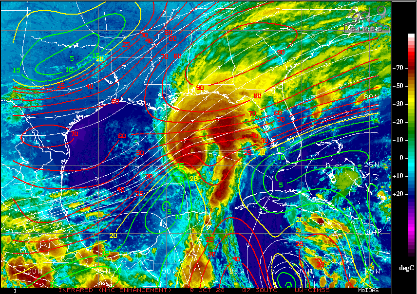
The trough to the west has already picked up Isaias, as indicated by its north-northeast movement at twice the pace it was going a few days ago. This will bring Isaias to the Gulf Coast later Friday as a category 1 or 2 hurricane. Satellite shows a band of convection just to the east of the core of the storm which bears watching as it makes landfall this evening as it could trigger rotation where it moves onshore. This means areas away from the center of the storm could be dealing with potential tornadoes from this band.
Heavy rains and winds will accompany the storm as it moves inland, even as it starts to weaken. It will interact with a frontal boundary already across the Gulf Coast area and move the boundary north as a warm front, bringing with it abundant tropical moisture to most of the southeast. This will set the stage for flash flooding over many areas.
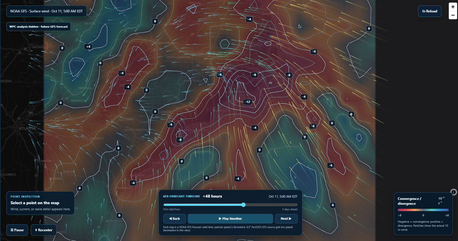
As for Eastern North Carolina, what I have been watching for the past couple of days is still the interaction with the onshore flow from the Northeast Coast high and the approaching warm front. Models still indicated excellent convergence just along the far eastern sections of North Carolina late Saturday night and into early Sunday morning. Combined with the abundant tropical moisture that will be filtering in behind the front will bring a high chance for heavy rain for parts of ENC. The timing of this heavy rainfall appears to be Sunday morning between midnight and 9 am. Rain will begin late Saturday evening but won’t be as intense until early Sunday morning. For Sunday afternoon, I still expect some rain showers to linger across the area but the heavier rain should have moved off the northeast NC coast by around noon.
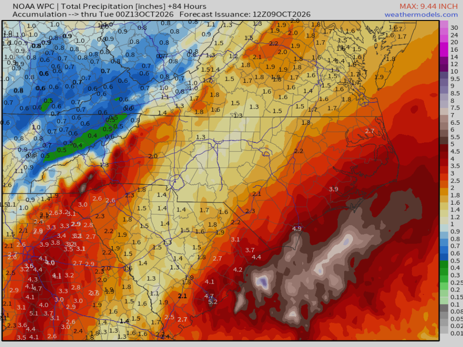
Forecast rainfall totals vary depending on location. Areas closer to the coast could see 2-4 inches with locally higher amounts. Areas further inland could see 1-3 inches. Flash flooding could be a concern Sunday morning as the WPC has some of the area in a level 2 (of 4) risk of excessive rainfall. A flash flood watch may ultimately be issued later if current trends support the need for one.
Rain should depart the area Sunday evening/night from southwest to northeast with mostly sunny conditions expected to return for Monday.
The next update on Isaias from me will probably come after landfall and the system becomes post-tropical.