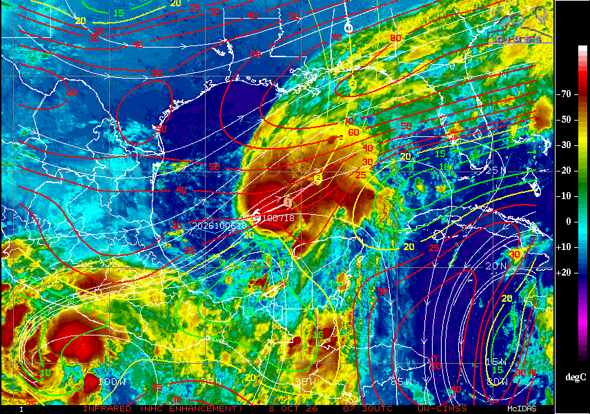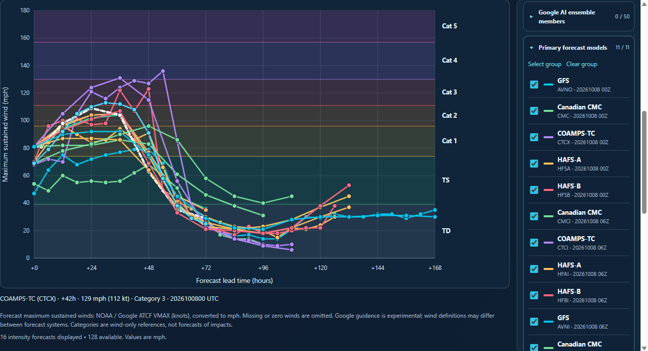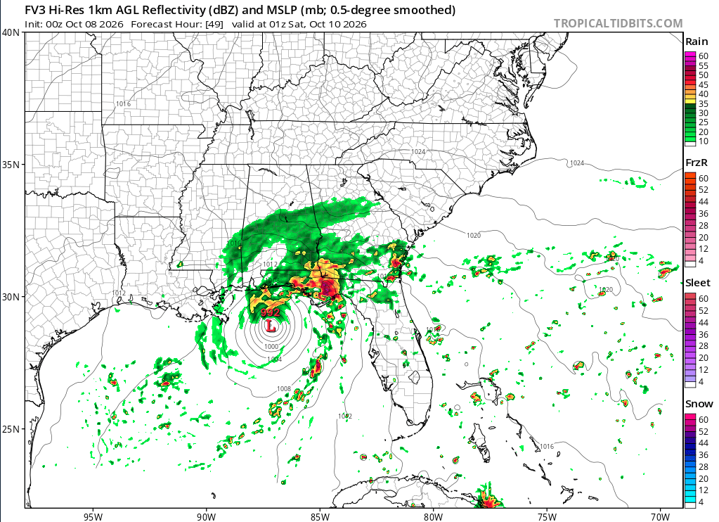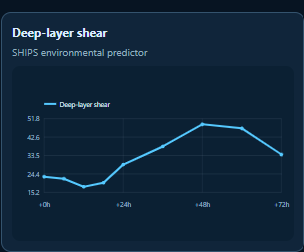
At 11pm last night, Isaias became the first official hurricane of the 2026 season. Since then, winds have increased to 80 mph with a minimum pressure of 979mb, moving ENE at 9mph. Isaias has been strengthening at a healthy rate despite persistent moderate westerly shear. Water temperatures should continue to be favorable for further development for the future track of this storm. However, the upper-level winds will become more unfavorable in about 24-48 hours, limiting the window of opportunity for further strengthening.
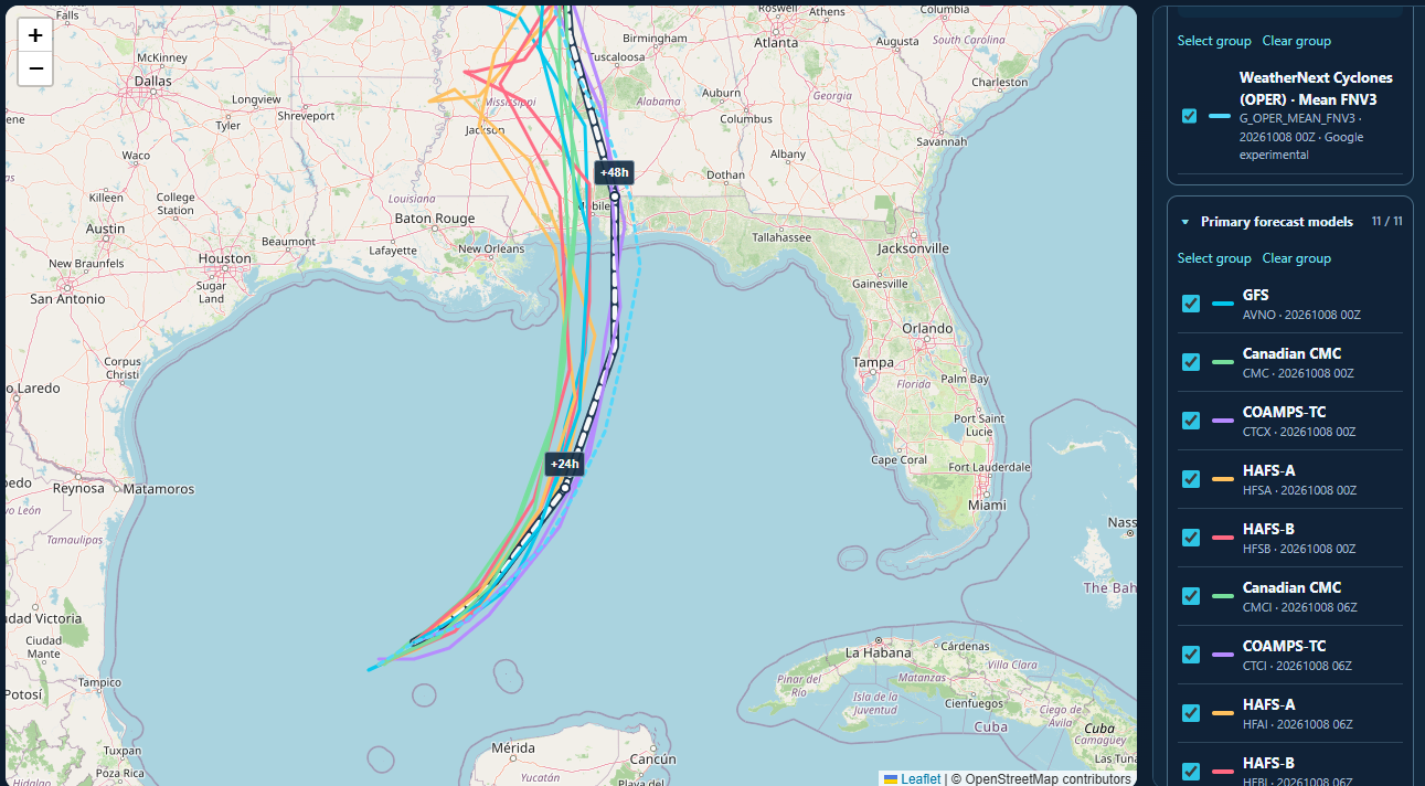
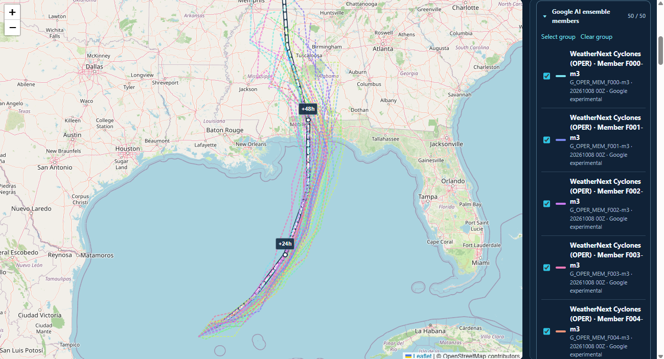
A mid-level trough is forecast to pick up Isaias out of east Texas and move the system initially northeast then north towards the Gulf Coast. This will bring Isaias into much stronger upper-level winds which should help weaken the storm. This leaves the next 24 to 48 hours for the storm to gain some strength which its possible that Isaias could reach a strong category 2 (likely) or low category 3 (less likely but possible) by Friday morning. By Friday afternoon, the effects of the upper-level winds will be in place and the weakening will begin. How much it will weaken before landfall is still up in the air but current forecast is for a category 1 storm at landfall.
Where this makes landfall is still questionable but the exact location of the center at landfall will not be the main story here. As the storm interacts with the upper-level system to the north, it will begin to transition to an post-tropical/extratropical system which will cause the impacts of the storm to expand from the compact storm it is now. So everyone from around Mobile, AL through the Panhandle of Florida will feel the impacts of Isaias at landfall. But the impacts won’t be limited to the coast. With a system like Isaias, the impacts will be felt well inland as well.
Severe weather and flooding rains will spread inland during Saturday all the way through Monday with impacts being felt all the way up through the Tennessee Valley and into parts of North and South Carolina.
Which brings me to what to expect here in ENC.
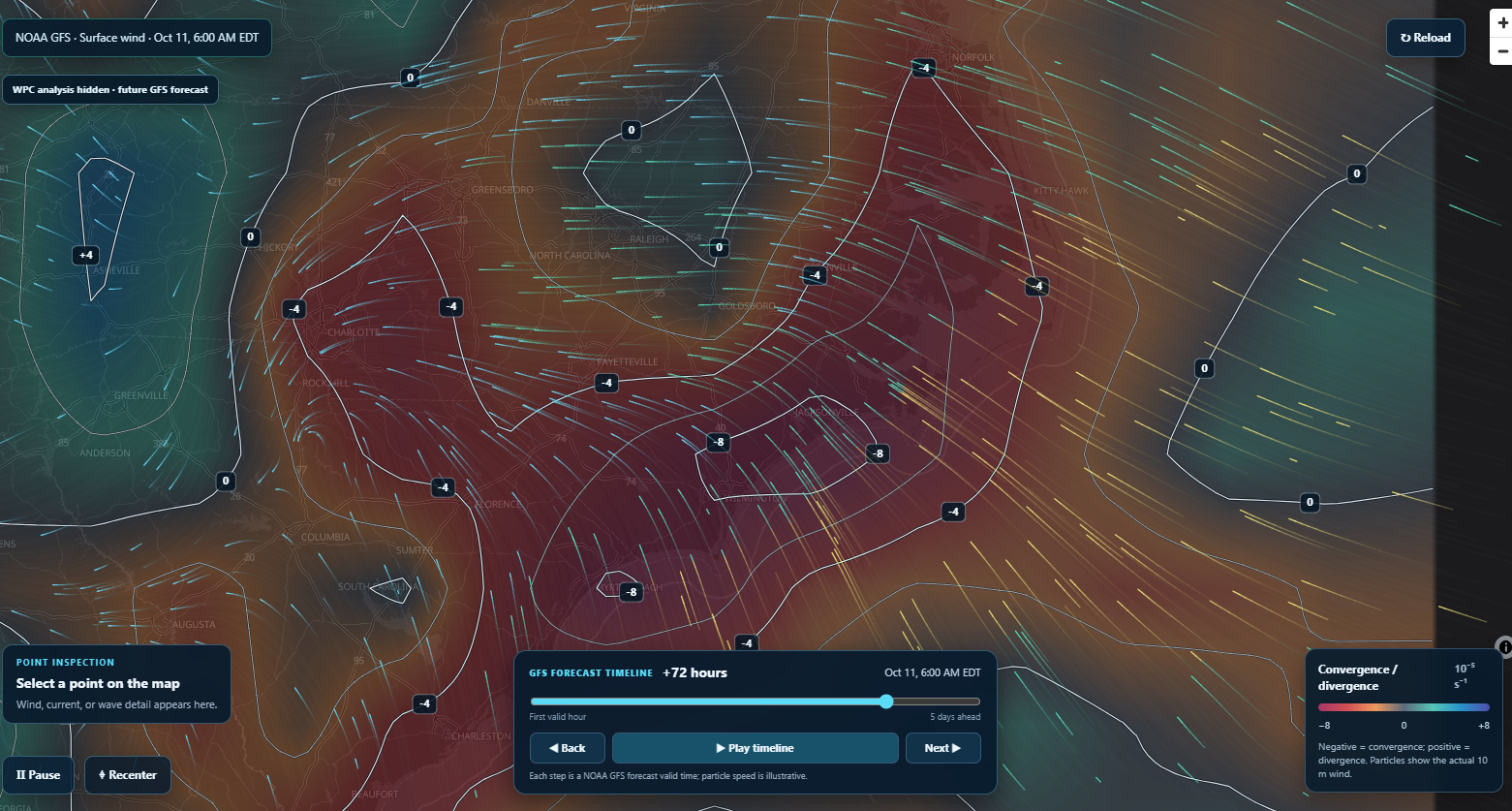
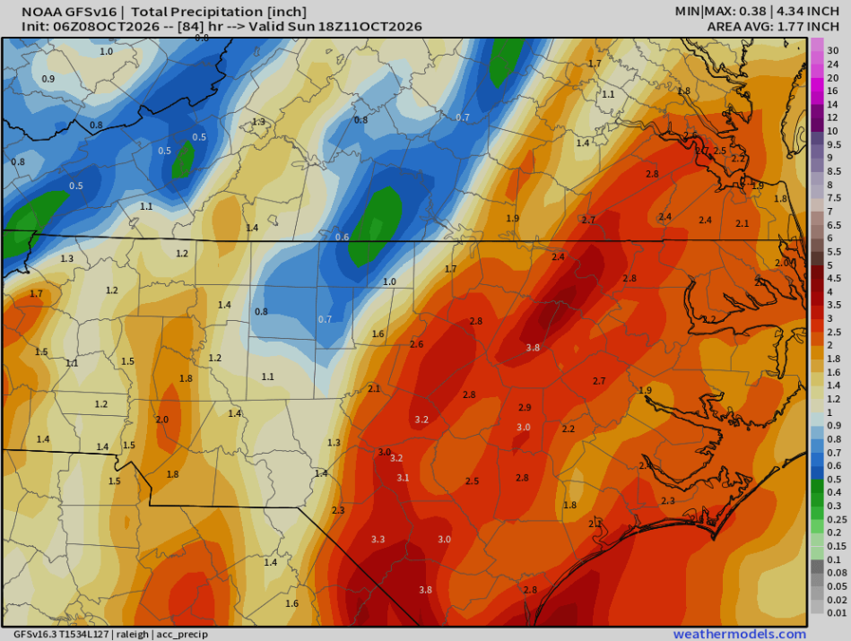
We are in an interesting setup as the system progresses inland this weekend (starting late Saturday night and continuing all day Sunday). We will have Isaias tracking northward, just east of the Mississippi River and a strong high pressure just off the Northeast Coast. The pressure gradient will produce a strong onshore flow for ENC. Isaias will also bring with it a warm front which will also bring increased moisture from the Gulf. With the abundant moisture in place and onshore flow creating convergence over ENC, this could set up a period of very heavy rains across many areas of ENC. Right now, it looks like we could see 1-3 inches for most areas with some areas seeing higher amounts depending where the heaviest rains set up.
This will lead to the potential of flash flooding in some areas with areas south of New Bern being in the highest risk right now.
I will continue to monitor the situation over the next couple of days with updates daily.