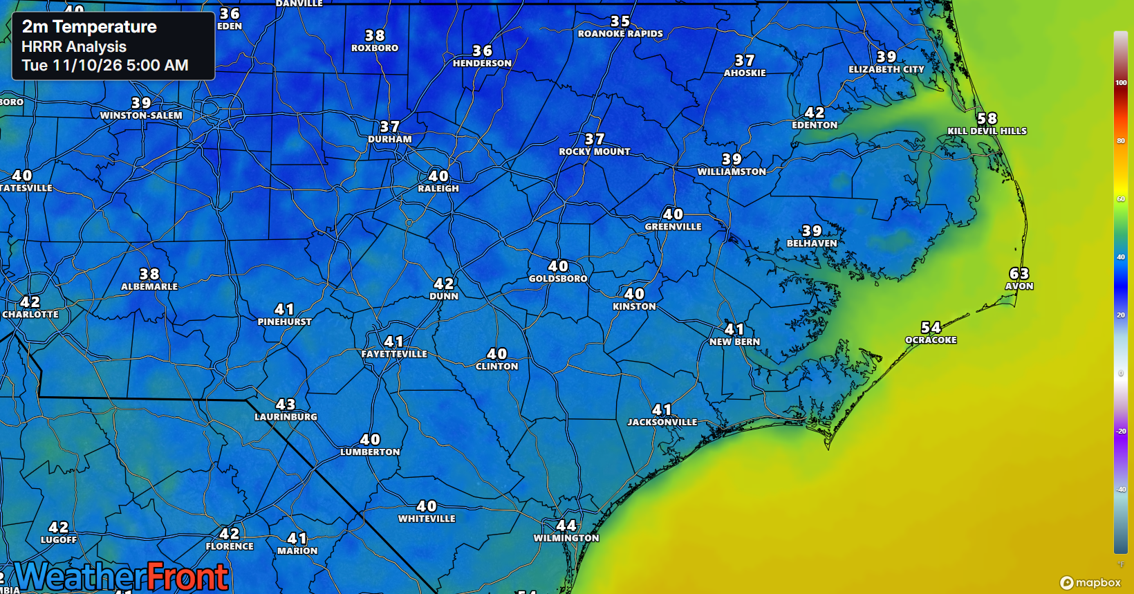
A few areas could see some frost this morning (especially northern counties) as temperatures range from mid 30s to low 40s inland. It doesn’t look like the frost will make it as far south as originally expected so we have a few more days before the next chance of widespread frost makes its way into inland ENC.
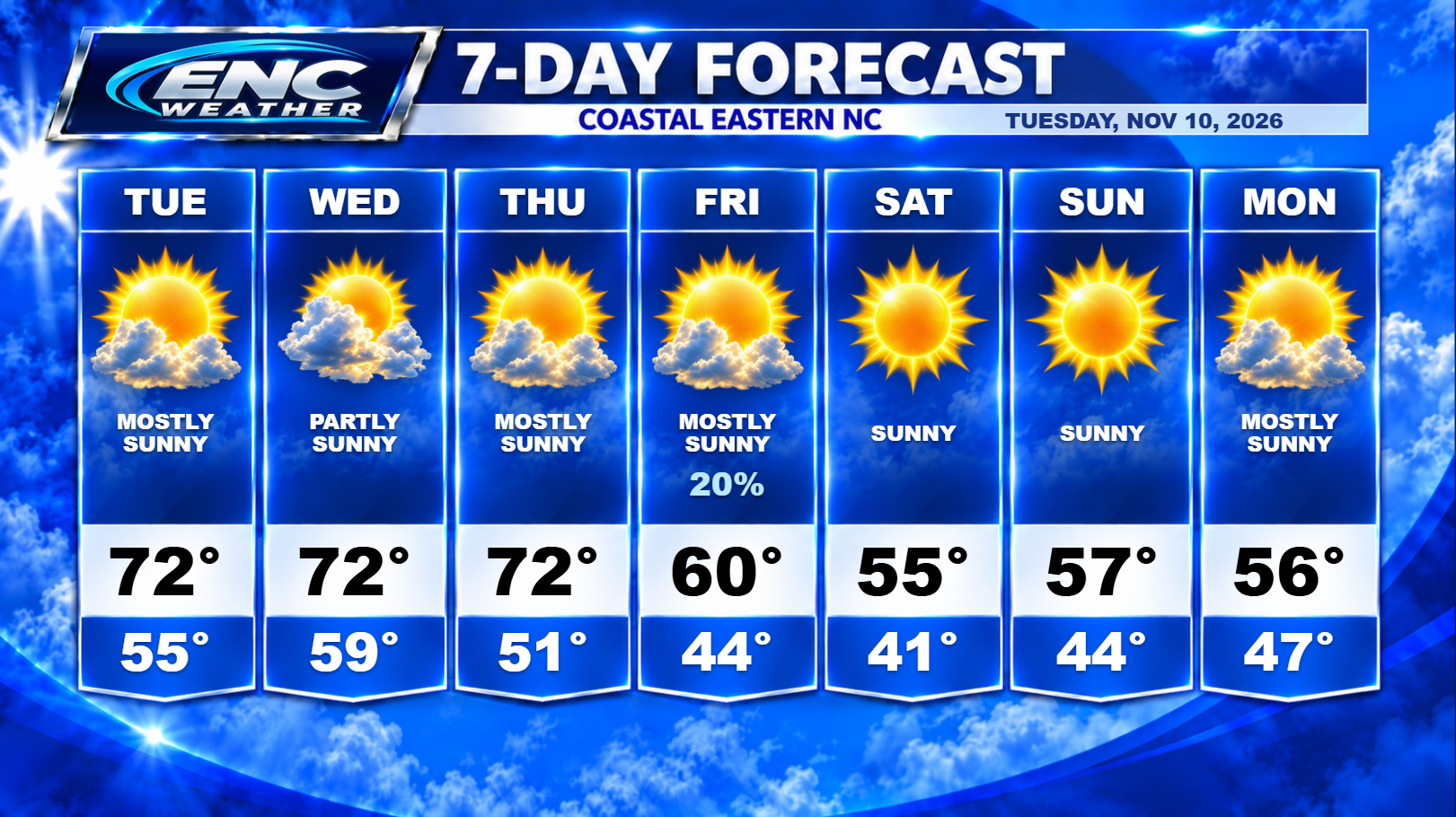
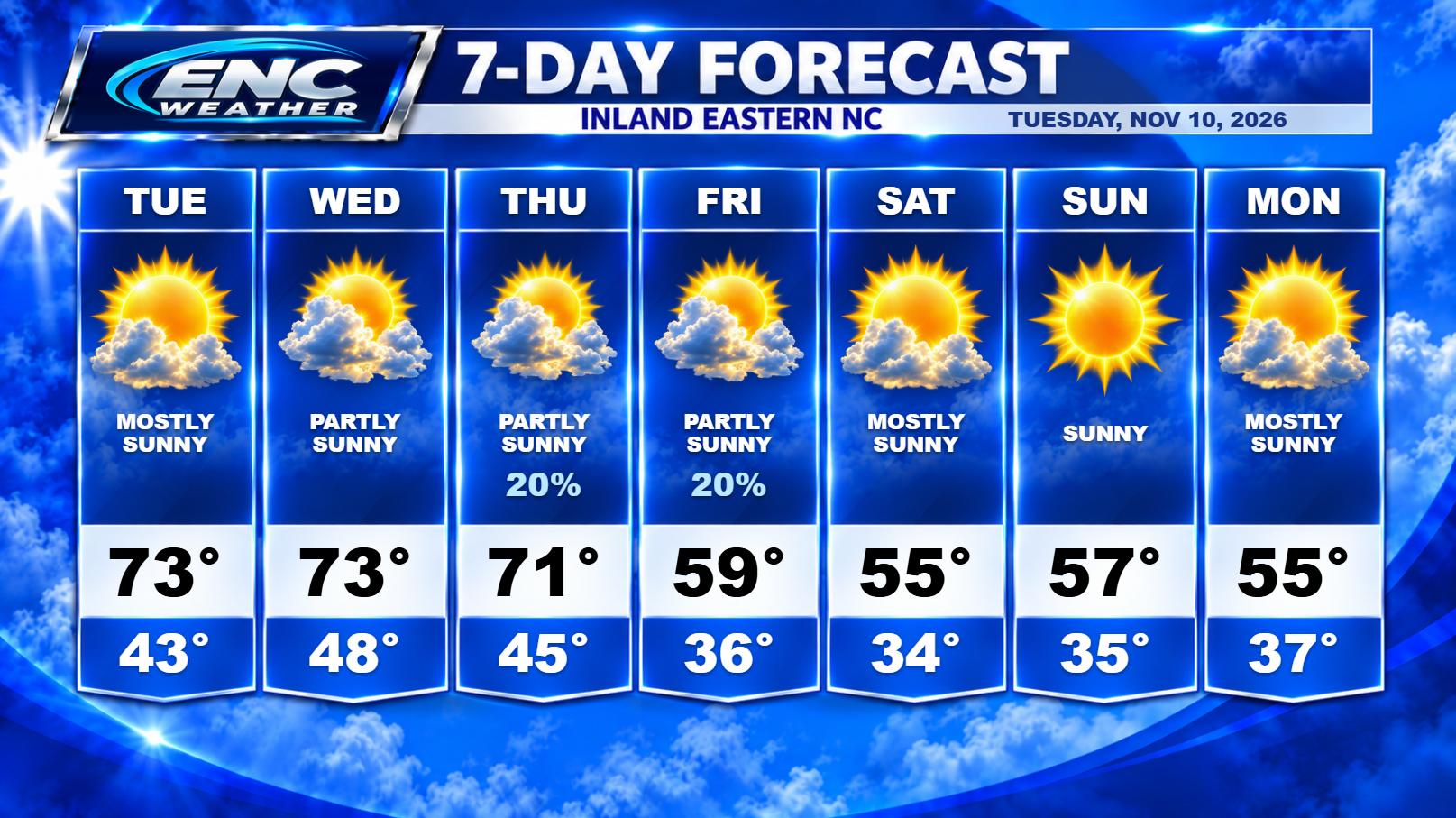
For the rest of today, expect mostly sunny skies with high temperatures reaching into the lower 70s. Temperatures Tuesday night shouldn’t drop as low as this morning so I don’t expect any frost issues at this time.
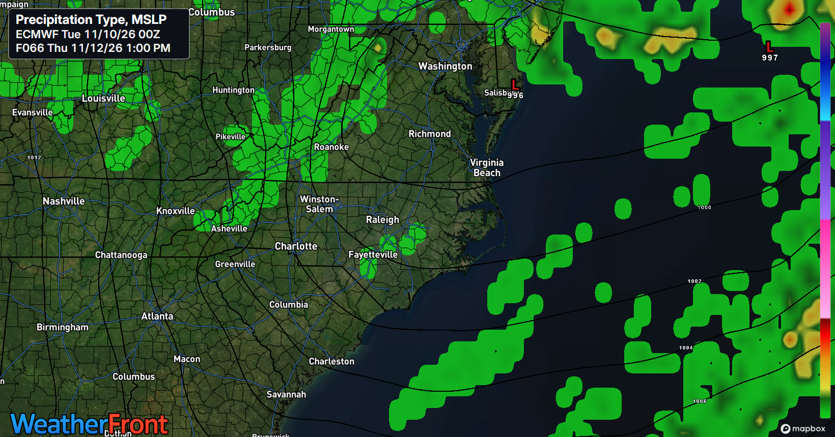
High temperatures for Wednesday and Thursday should remain in the low 70s ahead of the next system which should impact the area starting on Thursday. There has been a little uncertainty with the exact evolution of the next system but models are starting to converge on a similar solution. It looks like the next system will be a Miller Type-B coastal system but will stay far enough to the north to reduce rain chances for ENC quite a bit. There is still a possibility for a few isolated showers to pop up on Thursday and Friday as the system moves north of the area but the chances are fairly low at this time.
The big story from this system will be the cold air that will follow. The cold front is forecast to pass sometime late Thursday which will usher in the coldest airmass of the season. Highs on Friday will struggle to reach 60 with overnight temperatures dropping down into the lower to mid 30s for the weekend. I do expect some frost and freeze advisories for the area this weekend.
Long-range forecast shows high pressure sticking around for the better part of next week so missing out on this next round of rain is going to set up yet another long stint of dry weather for ENC.
The Tropical Atlantic has gone quiet and it doesn’t appear there will be anything to watch over the next seven-plus days as we get closer to the end of Hurricane Season.