Good morning, ENC! I hope everyone was able to manage the round of severe weather yesterday. Fortunately, for ENC, it wasn’t as rough as it could have been. There were a few reports of tornadoes in the ENC area, but the area that saw the most action was central NC with a few tornado reports. I will wait on the final report from the NWS for official numbers and confirmations but I imagine there will be a few that are confirmed.
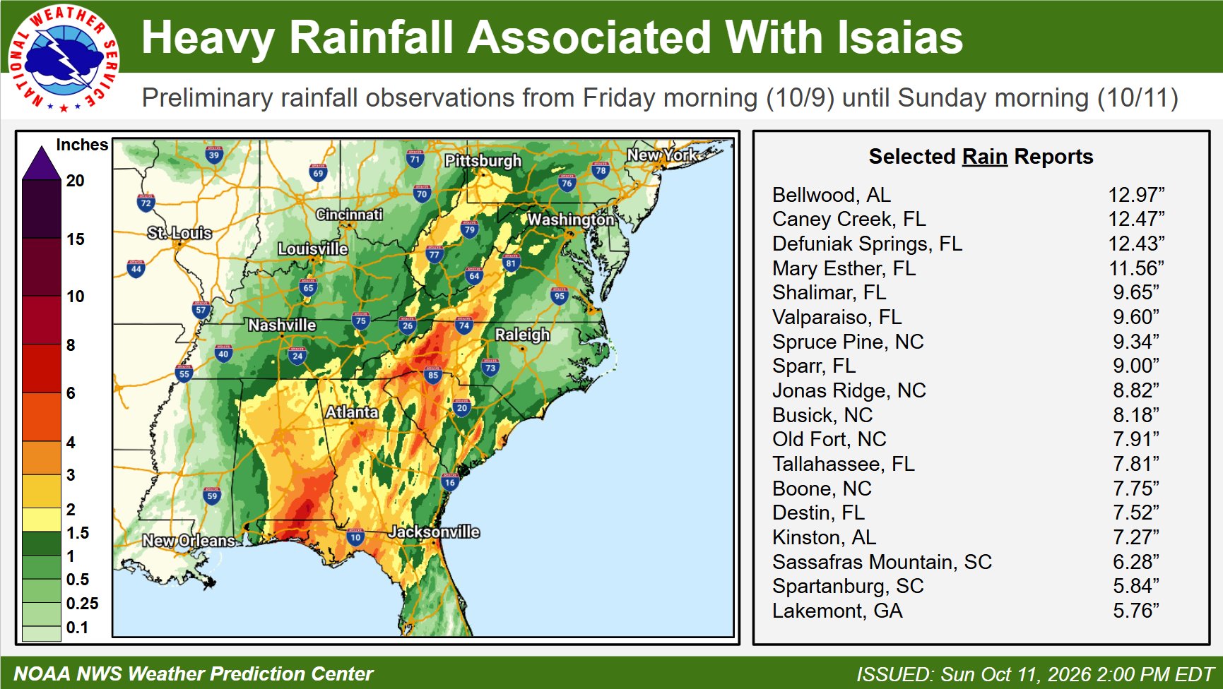
Rainfall totals ended up being lighter than forecast. The storm moved a little quicker than previously forecast which did impact the overall setup for heavy rainfall over ENC. Western NC did take the brunt of the storm (relative to NC impacts of course) with 8-9 inches of rain in some spots. Meanwhile, closer to home, far southern ENC and coastal sections saw the highest totals with 1-2 inches reported while inland areas saw less than 1 inch. But lack of rain has been the story for inland sections this year. At my location, we are running a deficit of greater than 20 inches so the 0.34″ that I saw this weekend won’t even make a dent in that deficit.
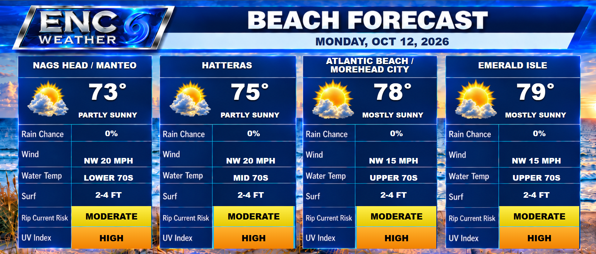
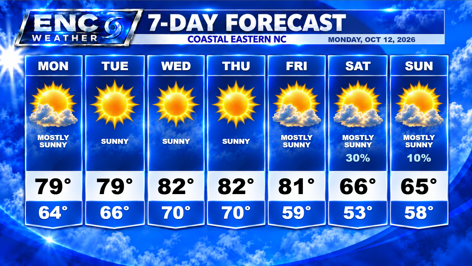
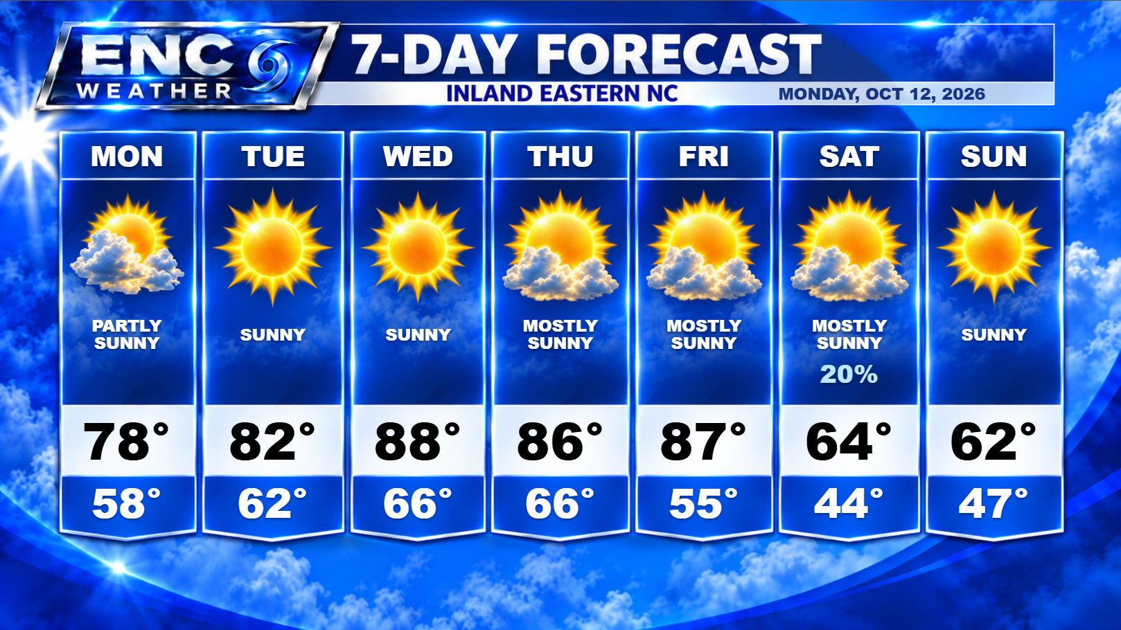
With Isaias now officially out of the weather picture, we should return to mostly sunny to party cloudy skies for you Monday with high temperatures making it to the upper-70s across the area. Lows tonight will be near 60. For the rest of the week, upper-ridge builds into the region which should keep conditions dry with increasingly warmer temperatures throughout the week with highs eventually reaching the upper-80s by Wednesday and Thursday. There is a question about how high the temperatures will get on Friday as high pressure to the north could generate northerly winds which could keep highs from reaching the upper-80s but timing and placement of the high will be important so right now we will have to keep an eye on this and adjust if it looks like this may happen.
By Friday night, a strong cold front will approach the region which will bring in much cooler temperatures. Moisture looks to be limited with this front with most models indicating little to no rain for ENC but this will be something to monitor as the week goes along. The weekend will be much cooler (and windy) with the passage of the front. Forecast highs for this weekend only reach the low-to-mid 60s across the area with lows dropping down into the 40s inland/50s coast.