
ENC WEATHER AVIATION
VFR
KPGV
Pitt-Greenville Airport
Greenville, North Carolina
Elevation 26 ft
Public-use airport
Station observation
Oct 29, 8:55 AM EDT
CURRENT CONDITIONS
Pilot Quick View
63°
Sunny
FLIGHT RULES
VFR
Wind
N 7 mph
Visibility
10 mi
Altimeter
30.27"
Dew Point
59°
Humidity
88%
AIRPORT INFORMATION
Pitt-Greenville Airport
ICAO / FAA
KPGV / PGV
Coordinates
35.635694°N, 77.384083°W
Elevation
26.4 ft / 8.0 m
Location
2 miles north of Greenville
Airport Use
Open to the public
Control Tower
No control tower
ARTCC
Washington Center
Flight Service
Raleigh Flight Service Station
NOTAM Facility
PGV (NOTAM-D service available)
Attendance
0300–2400
Beacon
White-green; sunset to sunrise
ARFF
Index B
Wind Indicator
Lighted
Segmented Circle
Yes
Activated
June 1941
Time Zone
Eastern Time
RUNWAY SYSTEM
Runways
02 / 20
7,175 × 150 ft
Asphalt
HIRL; MALSR RWY 20; PAPI RWY 02 & 20
08 / 26
4,997 × 150 ft
Asphalt
MIRL; PAPI RWY 08 & 26
Airport lighting:
MALSR RWY 20; PAPI RWYS 02, 20, 08 & 26;
HIRL RWY 02/20; MIRL RWY 08/26. Lighting activation via CTAF.
COMMUNICATIONS
Frequencies & Services
REGIONAL WEATHER
Radar & Satellite
Current Radar
Eastern North Carolina
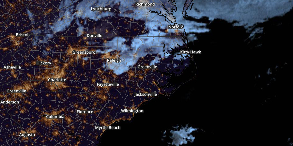
GeoColor Satellite
Eastern North Carolina
Aviation information on ENC Weather is for situational awareness.
Verify current operational weather, NOTAMs and airport information
with official FAA/NOAA sources before flight.