
Tropical Atlantic Surface Analysis
Current surface pressure, fronts, troughs, tropical waves, monsoon trough and ITCZ features across the tropical Atlantic basin.
Latest Tropical Surface Analysis
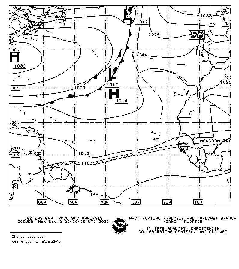
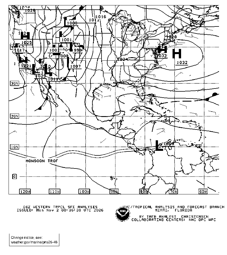
The two official NOAA radiofax panels overlap from 55°W to 70°W and together provide broad tropical Atlantic coverage.
Western Atlantic & Caribbean
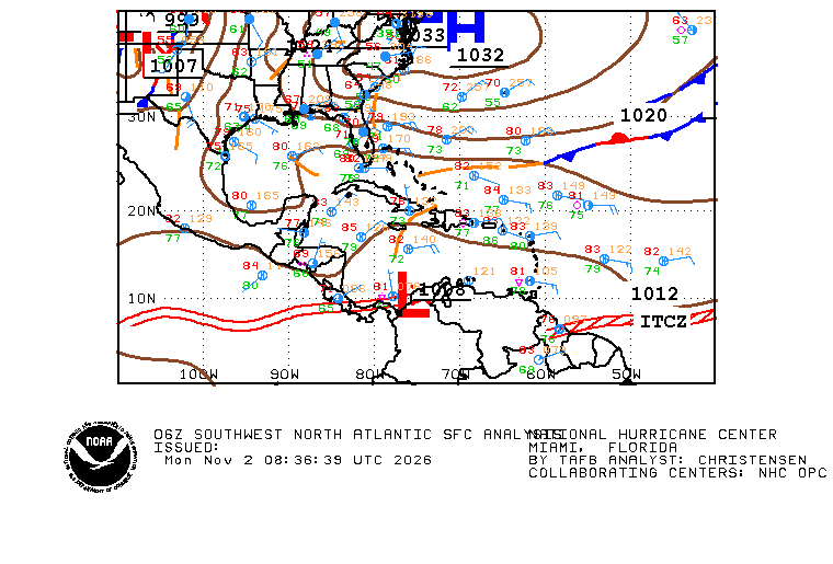
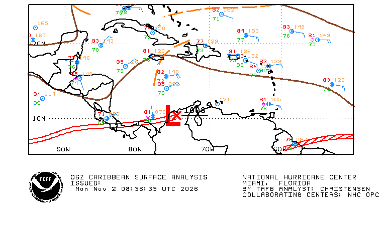
Closer NHC analysis views help resolve fronts, troughs, pressure centers and tropical features near the western Atlantic basin.
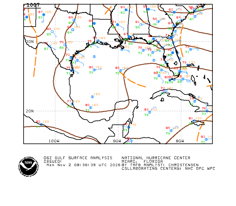
Reading the Surface Analysis
The analysis depicts the sea-level pressure field and the important synoptic features affecting tropical and subtropical weather.
Pressure centers help define the steering flow, trade-wind pattern and areas of stronger pressure gradient.
Cold, warm, stationary and occluded fronts are analyzed along with surface troughs and other boundaries.
Tropical-wave axes identify westward-moving disturbances that can organize showers and thunderstorms.
These convergence zones are key areas for tropical convection and disturbance development across the deep tropics.
Tropical & Marine Tools
Use the surface map together with NHC discussion and forecast products for the full basin picture.
Official Tropical Analysis and Forecast Branch marine products and surface-analysis views.
Open source ↗DiscussionAtlantic DiscussionCurrent NHC Tropical Weather Discussion for the Atlantic basin.
Open →ForecastAtlantic Graphical Forecasts24- through 96-hour Atlantic upper-air, surface and marine graphical forecasts.
Open →AnalysisSurface AnalysisBroader current surface analysis products for weather systems affecting the United States.
Open →