
Atmospheric Teleconnections
Follow the large-scale circulation patterns that help shape North American ridges, troughs, blocking and storm tracks.
Current Phase
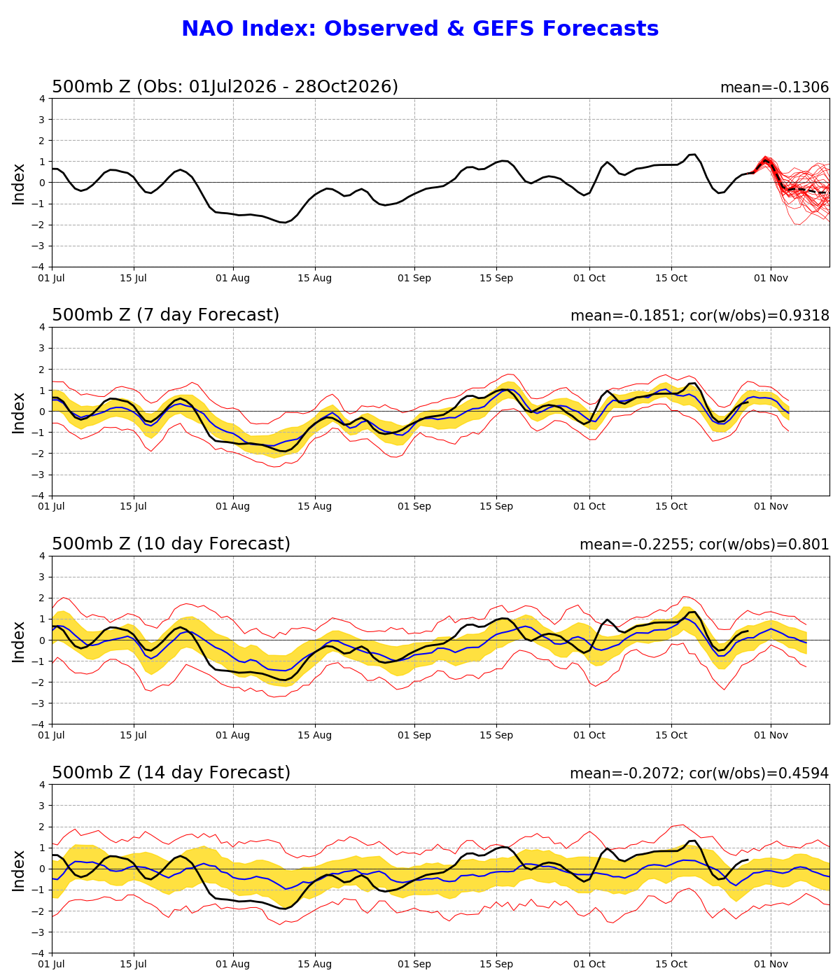
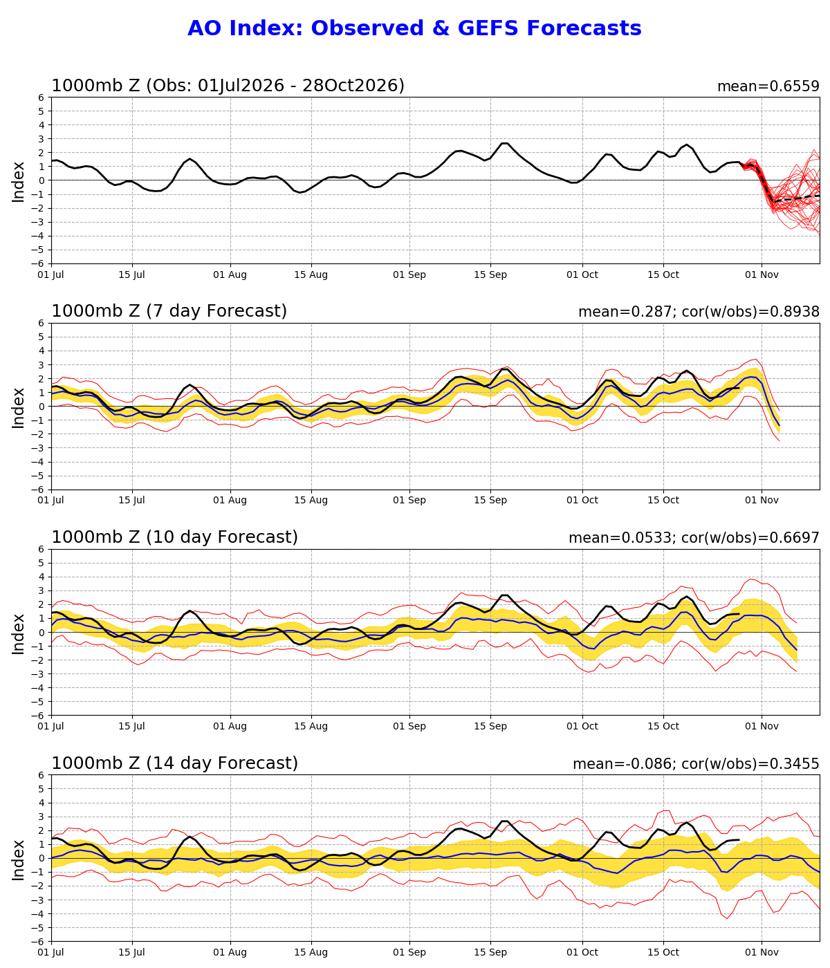
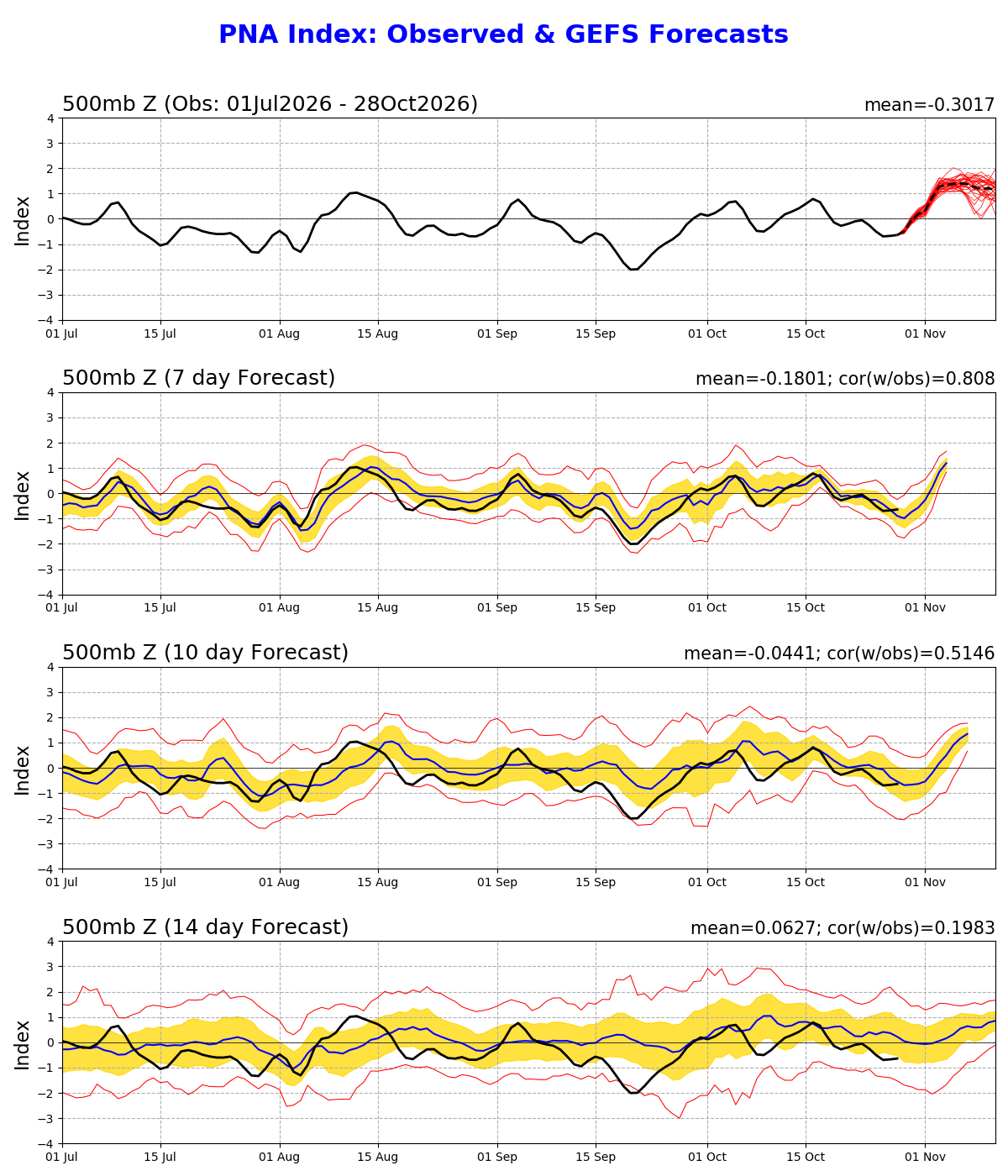
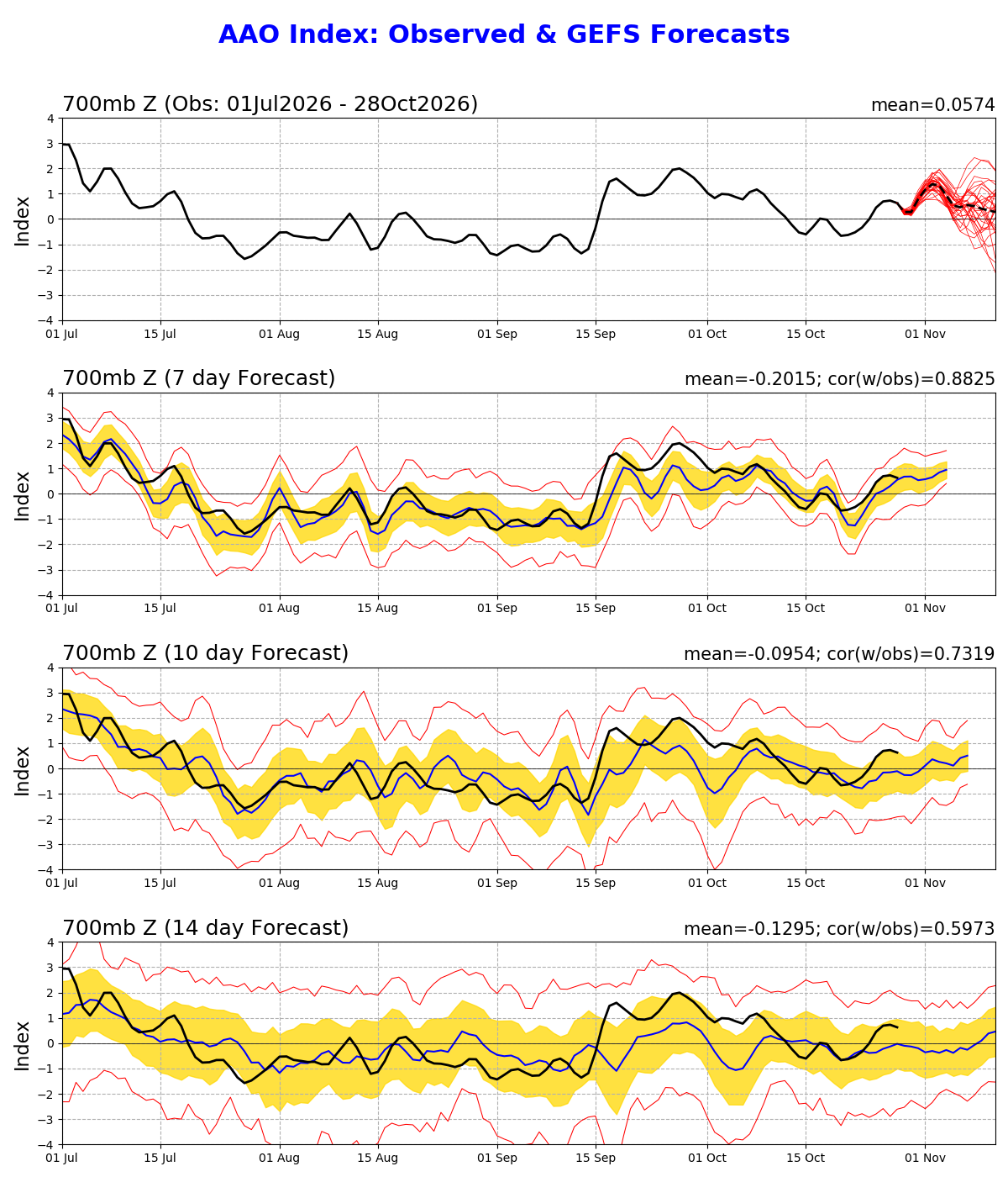
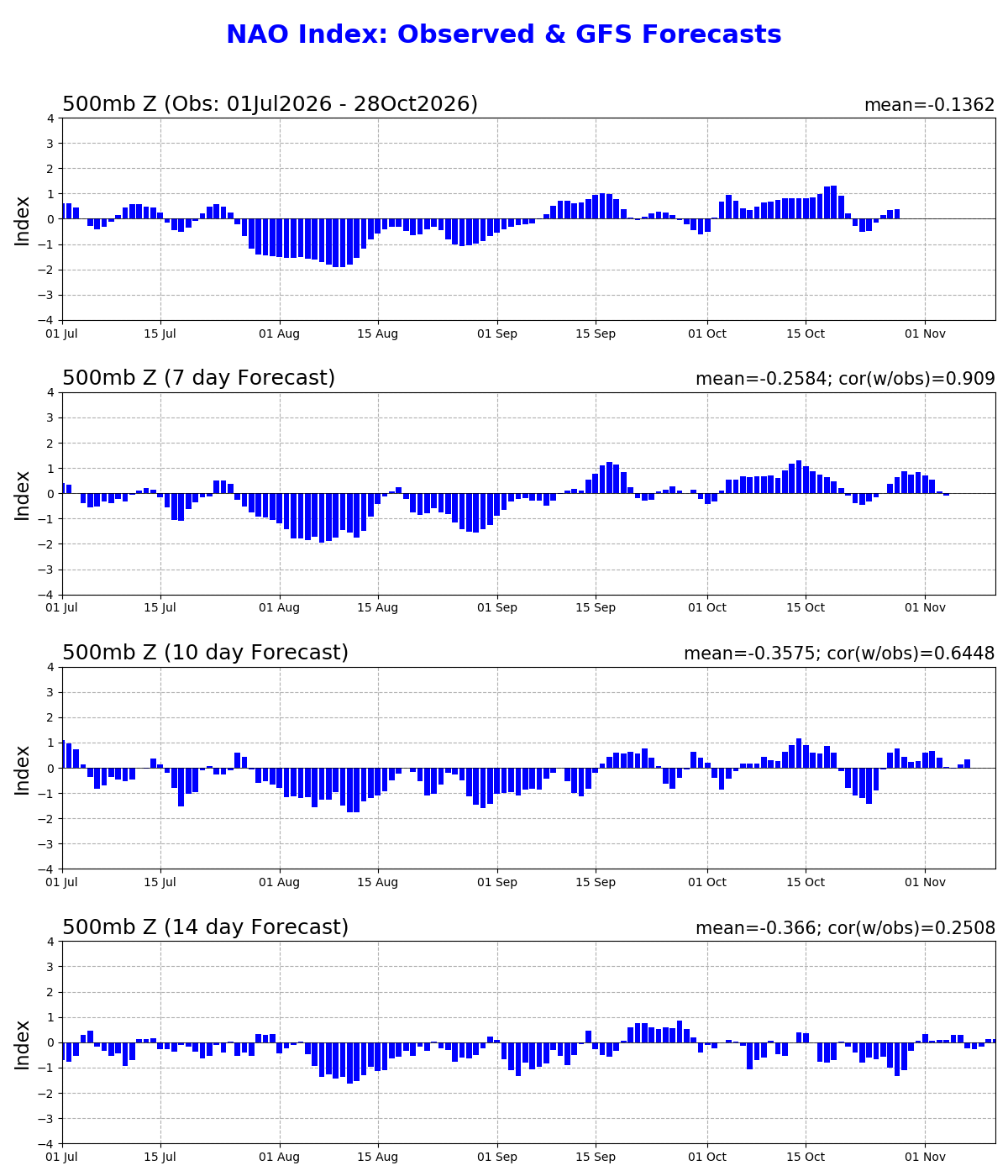
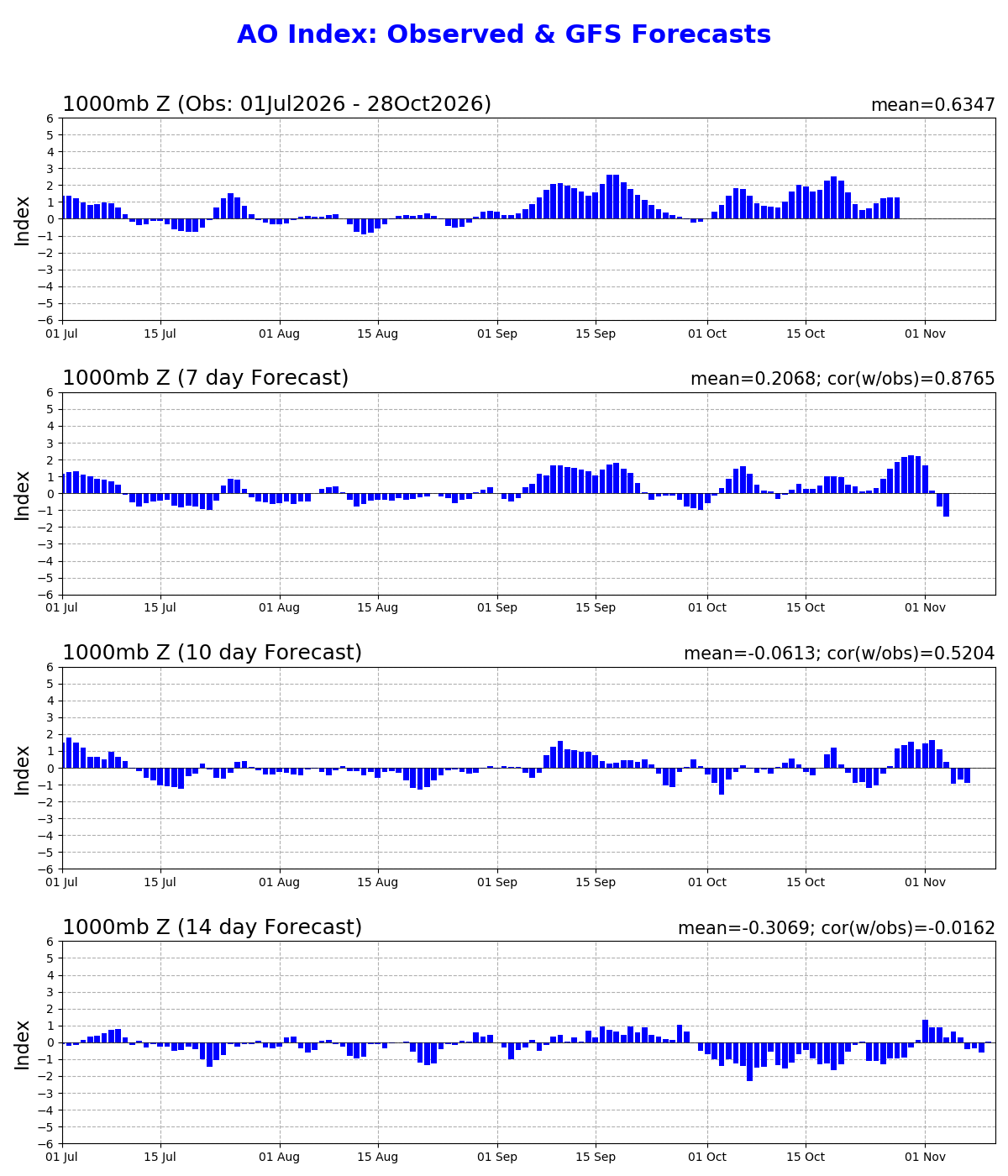
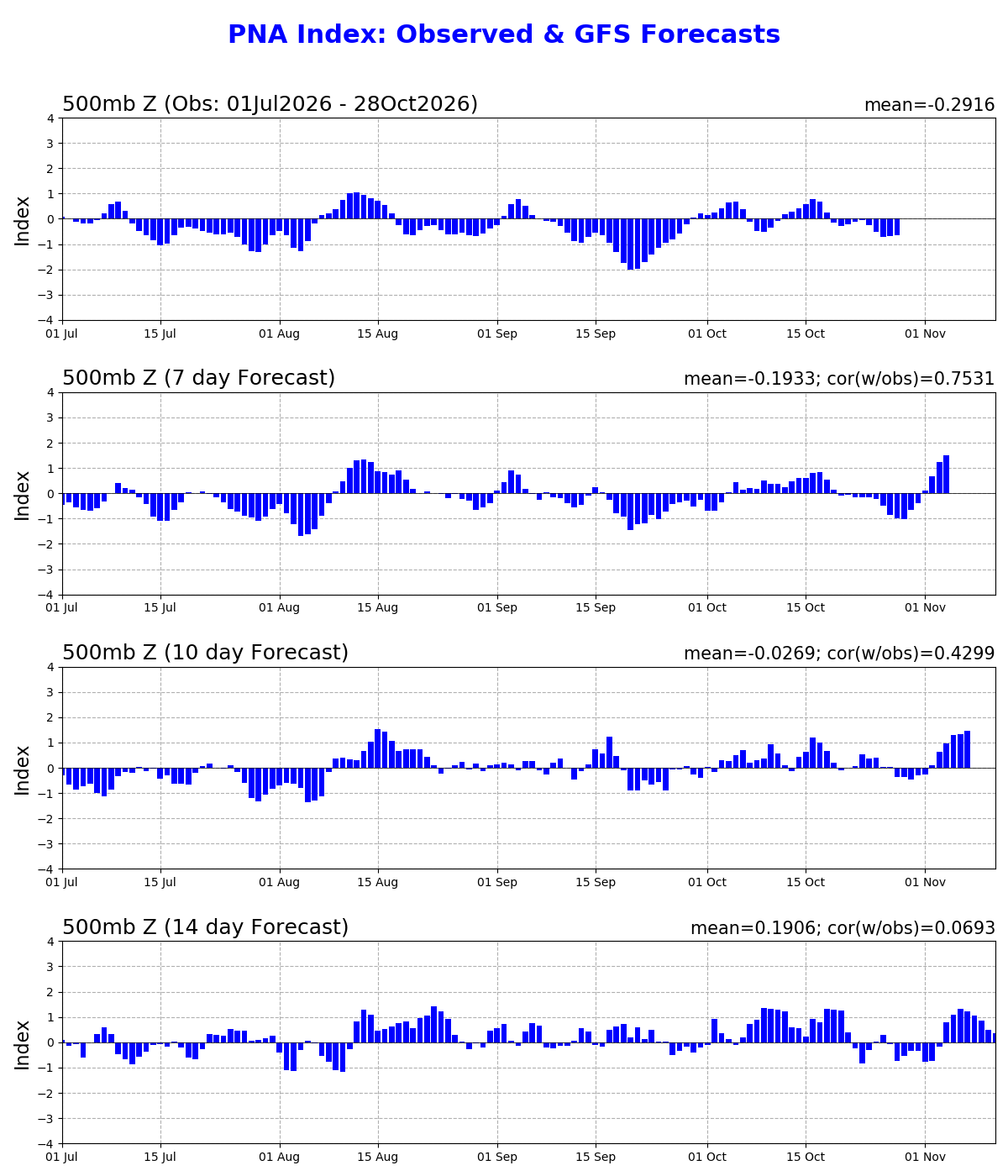
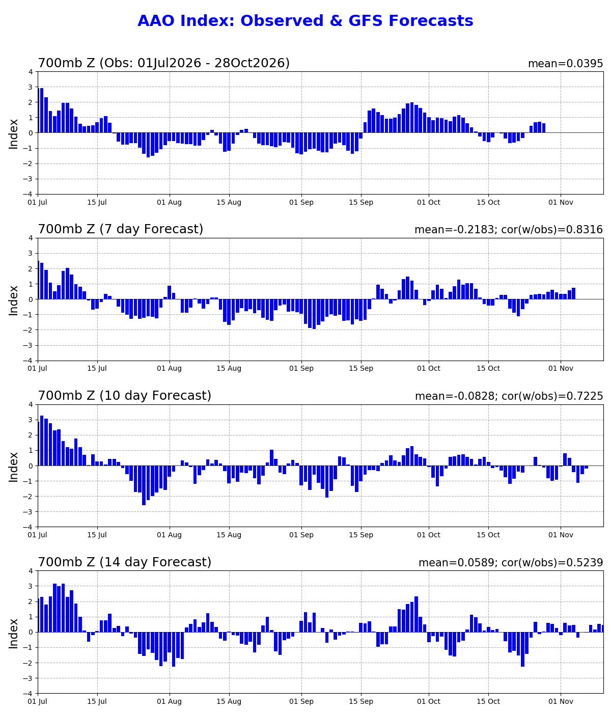
Standardized daily index values. Positive and negative phases describe circulation patterns—not a deterministic local weather forecast.
Useful for monitoring blocking and the larger-scale storm-track pattern affecting the eastern United States.
CPC NAO page ↗Most useful in the cool season when assessing the broader potential for Arctic air intrusions into the eastern U.S.
CPC AO page ↗Directly useful for judging the broad western-ridge/eastern-trough tendency over North America.
CPC PNA page ↗Included for completeness; its direct connection to day-to-day Eastern North Carolina weather is much weaker than NAO, AO or PNA.
CPC AAO page ↗Forecast Spread & Ensemble Mean
The red members show individual ensemble solutions. The ensemble spread becomes increasingly important farther into the forecast period.
Positive vs. Negative Phase
These are broad circulation tendencies. Local Eastern North Carolina weather still depends on the complete synoptic pattern and forecast timeframe.
A stronger North Atlantic pressure gradient generally favors a more zonal Atlantic flow pattern.
A weaker or reversed North Atlantic pressure pattern can favor Greenland/North Atlantic blocking and a more amplified eastern North American pattern.
Lower-than-average Arctic pressure and a stronger circumpolar flow tend to keep colder air more confined to higher latitudes.
Higher-than-average Arctic pressure and a weaker, more meridional flow can increase opportunities for cold air to move southward.
The positive PNA pattern features higher heights over western North America and lower heights over the southeastern United States.
The negative phase broadly reverses that height pattern, favoring lower heights in the West and higher heights farther east.
The positive AAO phase generally corresponds to lower pressure over Antarctica and stronger westerlies around the Southern Ocean.
The negative AAO phase generally corresponds to higher Antarctic pressure and a weaker or more equatorward Southern Hemisphere westerly belt.
GFS Outlooks
Use the deterministic GFS together with the ensemble guidance above rather than treating a single model run as the forecast.
How to use these indices
For ENC, the value is in pattern recognition rather than treating an index as a stand-alone forecast. NAO can help frame North Atlantic blocking, AO can help characterize the larger Arctic circulation, and PNA can help identify the broad ridge/trough configuration across North America. Their effects can reinforce or oppose one another.