
Surface Analysis
Track fronts, pressure systems and the near-surface weather pattern from Eastern North Carolina to the continental scale.
Local Surface Overview
Current MRMS radar provides the local Eastern North Carolina view, paired with official WPC surface analyses below.
Current Surface Analyses
Official WPC charts provide the larger-scale context for the fronts and pressure systems affecting the East.
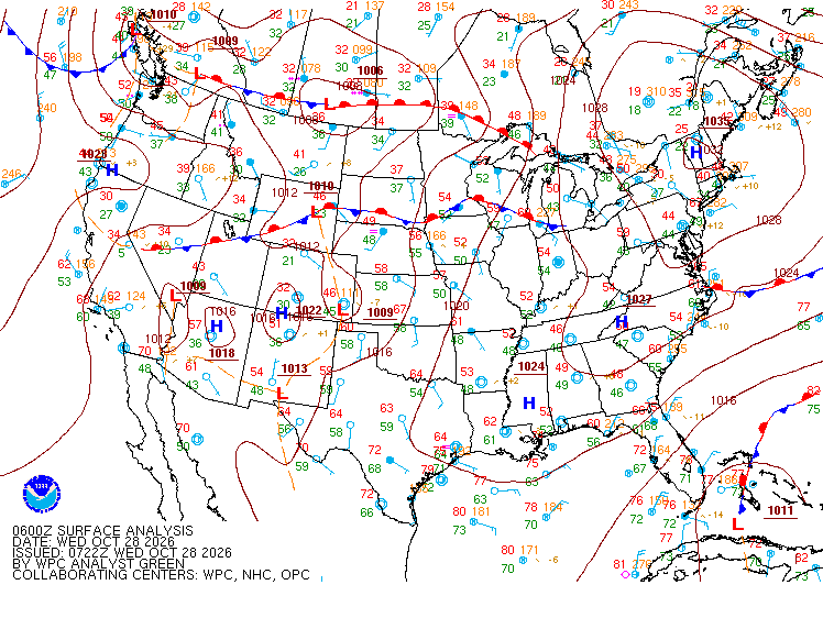
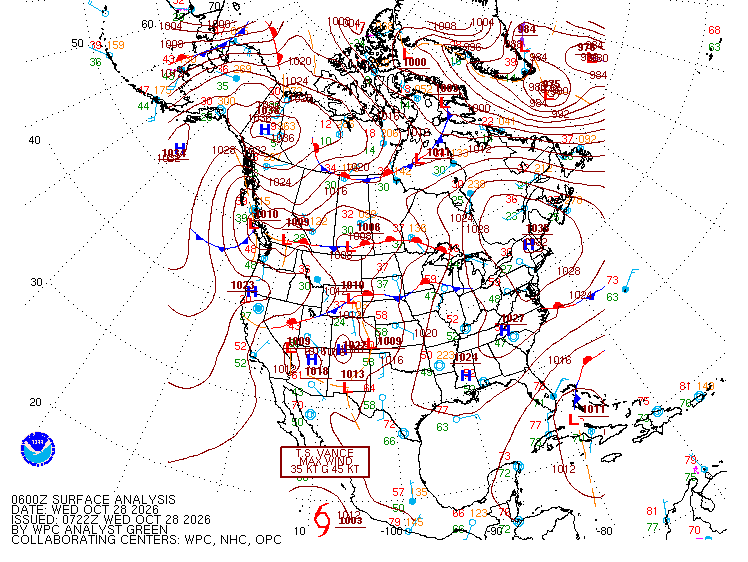
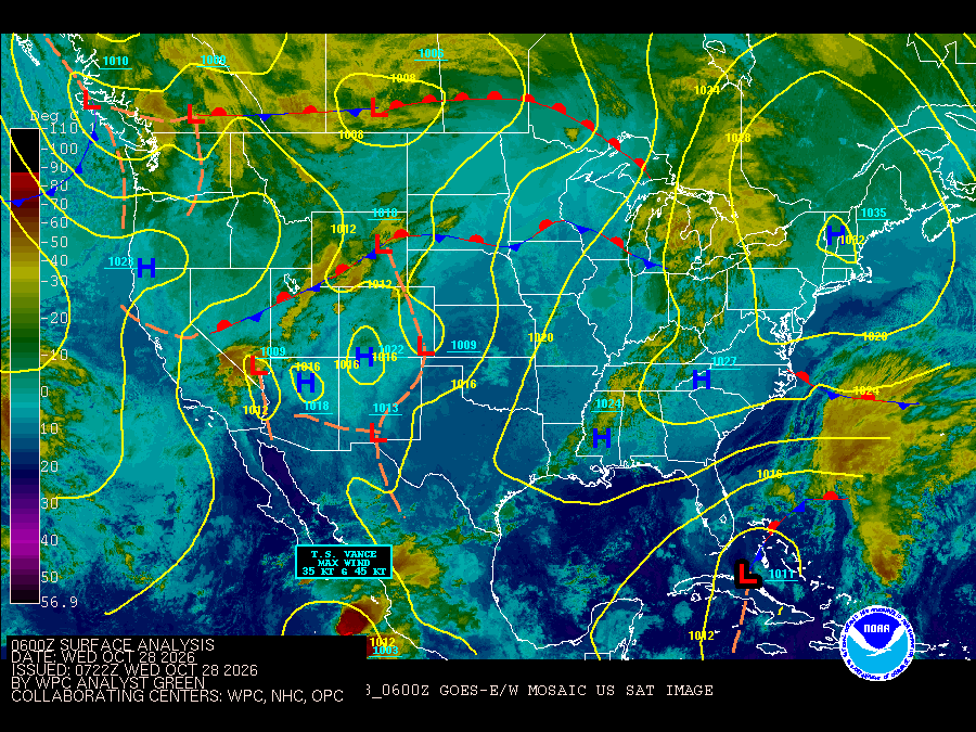
Reading a Surface Chart
Surface analyses identify boundaries between air masses and centers of high and low pressure. The symbols point toward the direction in which a moving front is advancing.
Colder air advancing into warmer air. Wind shifts, temperature changes and bands of showers or storms commonly occur near the boundary.
Warmer air advancing over cooler air, often accompanied by broader cloud and precipitation areas.
A boundary with little net movement. Persistent weather can develop when moisture repeatedly follows the front.
Forms as a faster cold front overtakes a warm front, typically near a mature low-pressure system.
Surface pressure maximum; often associated with sinking air, though sensible weather depends on the full pattern.
Surface pressure minimum around which fronts and areas of organized precipitation frequently develop.
Explore the Analysis
Use the official WPC tools for interactive viewing, historical charts and short-range surface forecasts.
Pan, zoom and inspect current and archived WPC analyses.
Open WPC → Forecast Surface Forecasts: Days 1–2WPC analyzed fronts and sea-level-pressure forecasts from 6 through 60 hours.
Open WPC → Aviation Aviation Surface AnalysisWPC surface-analysis products organized for aviation interests.
Open WPC → Archive WPC Surface Analysis ArchiveRetrieve historical surface analyses by date and valid time.
Open WPC →The surface pattern is the starting point
Fronts and pressure systems help explain where air masses are changing and where forcing for clouds, precipitation, wind shifts and temperature changes is concentrated. For Eastern North Carolina, the broader WPC analysis is useful for seeing approaching systems well before they reach the local radar domain.