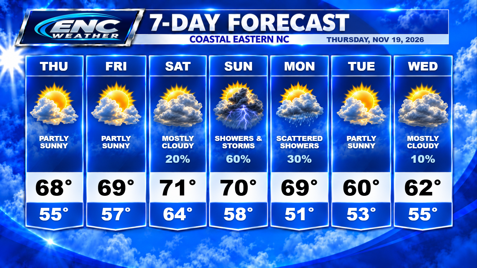
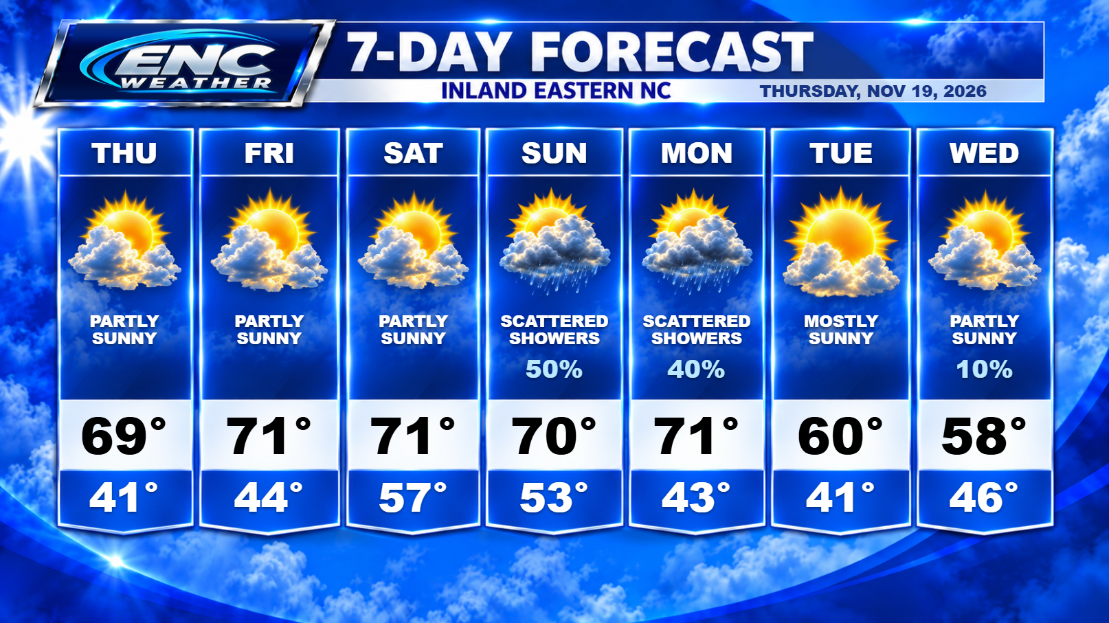
One last cold start this morning as inland sections reach near freezing temperatures. Temperatures should start to warm a little the next two days with overnight lows not dropping as low with some expected cloud cover to hold off max radiational cooling over the next couple of nights.
While the weather over the next couple of days should remain calm, our attention turns to the potential coastal low forecast to develop off the Florida coast. Not much has changed since yesterday with still some uncertainty over what impacts we will see in ENC. What we do know, it does appear that the low will develop. Most models do show development off the coast of Florida. What is unknown at this time is the forward speed, strength, and track.
First, speed will matter here. There is an upper-level trough crossing the CONUS over the weekend. This will serve to pick up the storm and ultimately turn it northeastward and cause it to pick up speed. The movement prior to the upper-trough’s arrival will tell us how far west (and thus, how far inland) the storm will travel Saturday and Sunday. A faster initial speed will bring more impacts inland to South and North Carolina. A slower initial speed and it could keep the impacts limited to coastal sections.
Second, strength here is still yet to be determined. It’s not often we get systems like this late in the season, but this one has seemed to find the sweet spot favorable for development. Whether its able to take advantage of the rare situation its been placed in is yet to be seen. This low will be over the very warm waters of the Gulf Stream and will be in an area of low shear for the duration of its northward initial track. Normally, this would be ideal conditions for strong strengthening of a warm-core low. If it is able to take advantage of the situation, it could potential develop into a tropical or subtropical system. Now, it’s important not to confuse classification type with impact type here as the impacts between the two are identical.
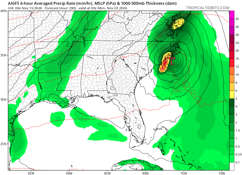
Third, the track. I touched on it with speed but I will focus a little more on what we know so far about the track. Right now most of the models are showing a pretty good initial forward speed. This will take it parallel to the southeast coast with the center potentially making landfall somewhere along the South Carolina and North Carolina coast. My current thinking is (and has been since yesterday) similar to the current AIGFS run taking the center up through the Pamlico and Albemarle Sounds (west of Cape Hatteras) and up the east coast. This track would reduce the severe threat for inland areas but would open up the possibility for very heavy rainfall along and east of highway 17. Along the Outer Bank, there would be a slight severe risk but gusty winds and heavy rain would be the main threats with some possible beach erosion.
As for rainfall estimates: it all depends on the ultimate track. Closer to the center, you could see upwards of 2-3 inches of rain (possibly locally higher amounts). Away from the center, probably closer to .25-1 inch possible. Hopefully in the next day or two as the low develops and we start seeing all the pieces come together, we will be able to nail down a more detailed forecast regarding the eventual track and impacts of this system.
Right now, the important take away isn’t what this system will be classified as but what impacts it will bring to ENC. It does appear likely that this will bring heavy rain, some gusty winds, and the typical coastal impacts that are associated with tropical-like systems.