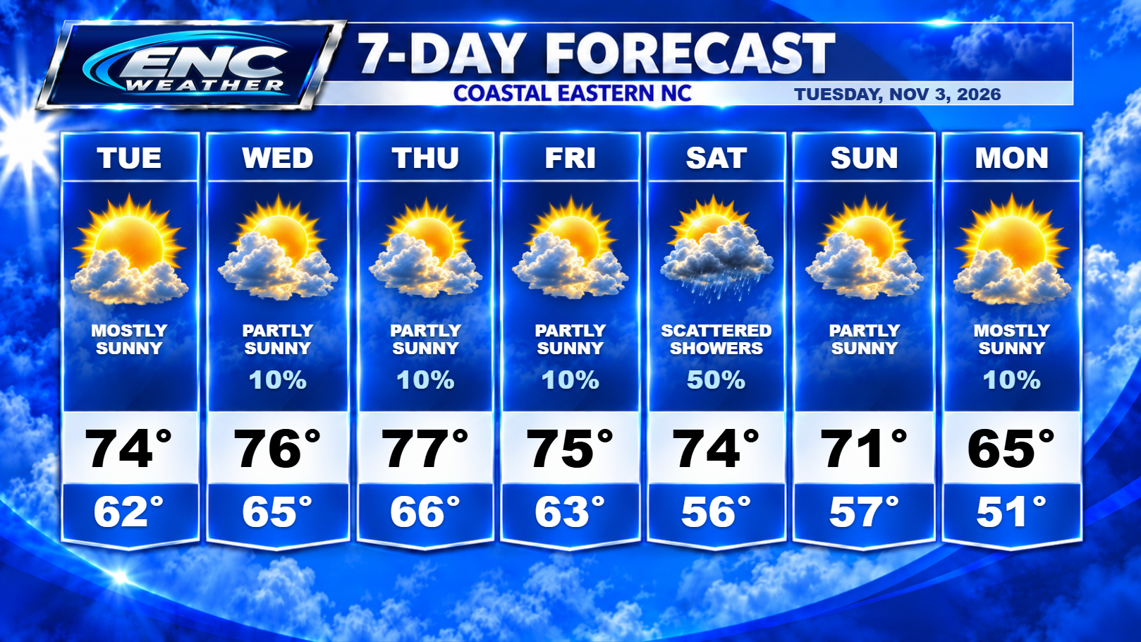
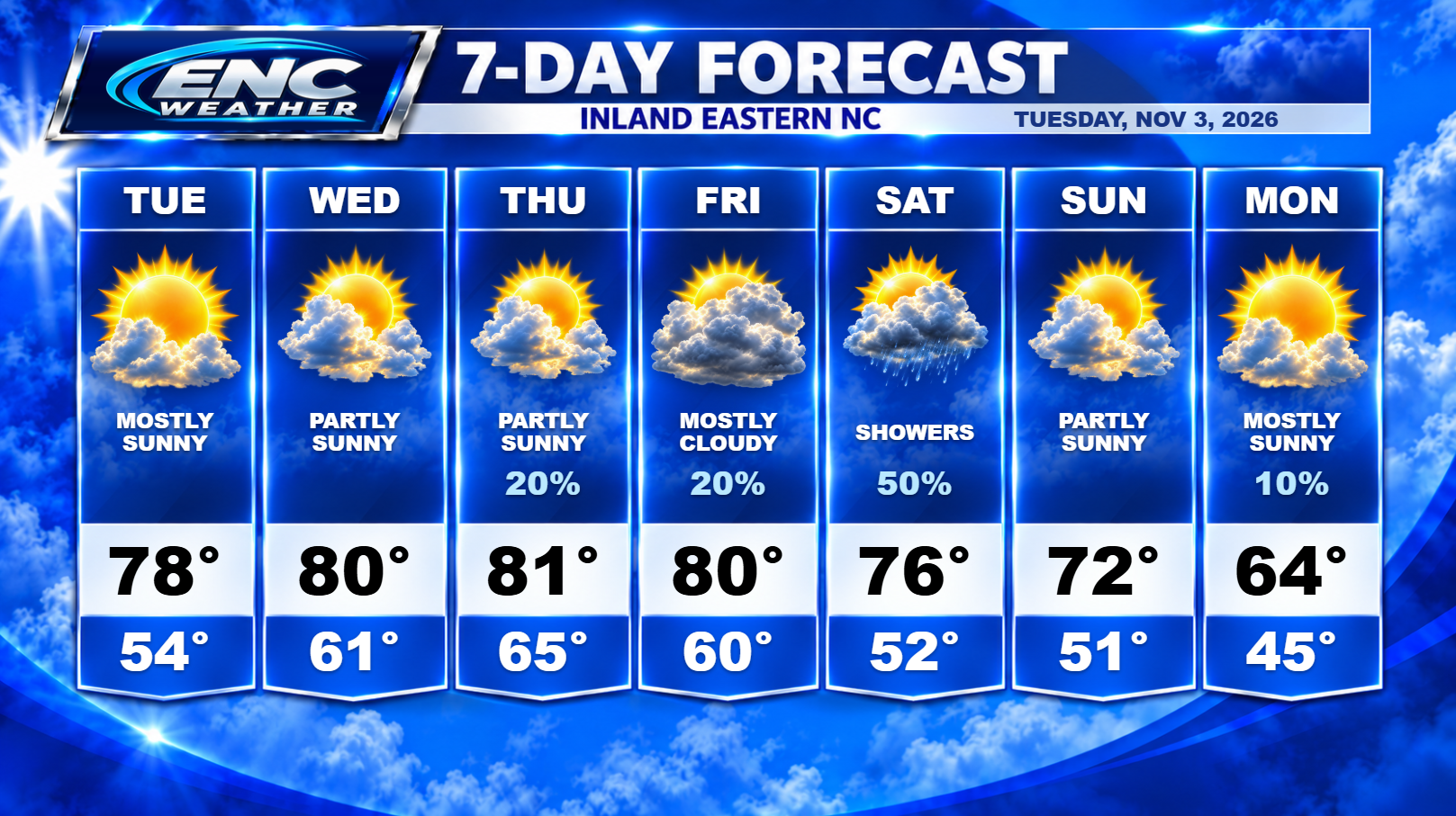
Good morning, ENC! We have a clear start to our Tuesday morning with some patchy fog out there. Most areas did see some light rain yesterday with amounts around a trace to .01″. Not enough to make a dent in the drought conditions. Today will be dry and mostly sunny with highs reaching the upper 70s inland/mid 70s coast.
Temperatures remain above average for November for the rest of the week as we will see mostly sunny conditions persist on Wednesday before we introduce a chance of rain on Thursday ahead of the next cold front. High temperatures will reach near 80 inland and upper 70s along the coast. As for rain, there is a slight chance of some rain for coastal and far eastern sections on Wednesday but rain amounts will be very low. Rain chances increase slightly on Thursday for everyone as some isolated showers and possibly a thunderstorm could impact the area although coverage will be light so I don’t expect everyone to see rain on Thursday.
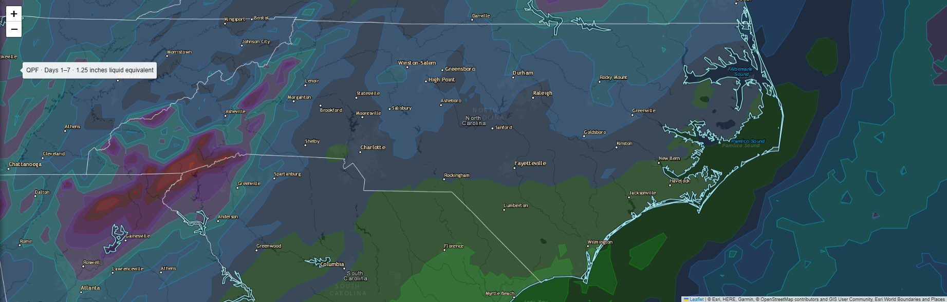
Cold front approaches the area on Friday which will increase the chance of rain for most of the area. It looks like the areas with the best chance of seeing measurable rain will be areas to the north and away from the coast. There is a possibility that there could be some thunderstorms with this front as instability could potentially be enough to spark some convection. I don’t expect any severe storms on Friday but we will continue to monitor the situation. Forecast rainfall totals are in the .25-.50 range towards the south with potentially 1″ over the far northern sections.
The front should pass late Friday with clearing and much more seasonal temperatures behind it for our weekend and early next week. After the frontal passage, it looks like the next chance for rain might come the following weekend so dry conditions should persist through your work-week next week.