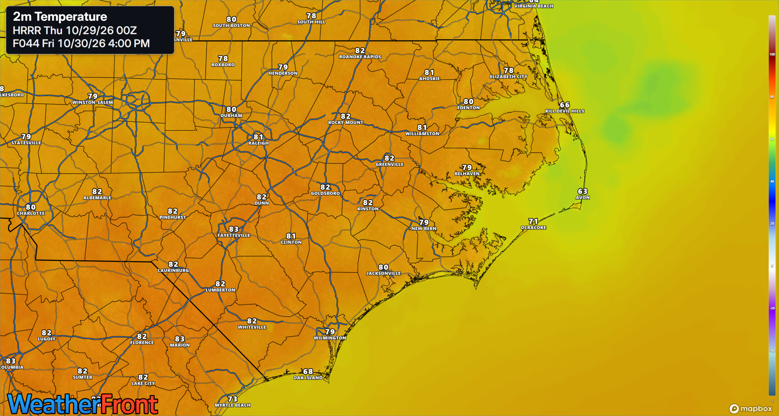
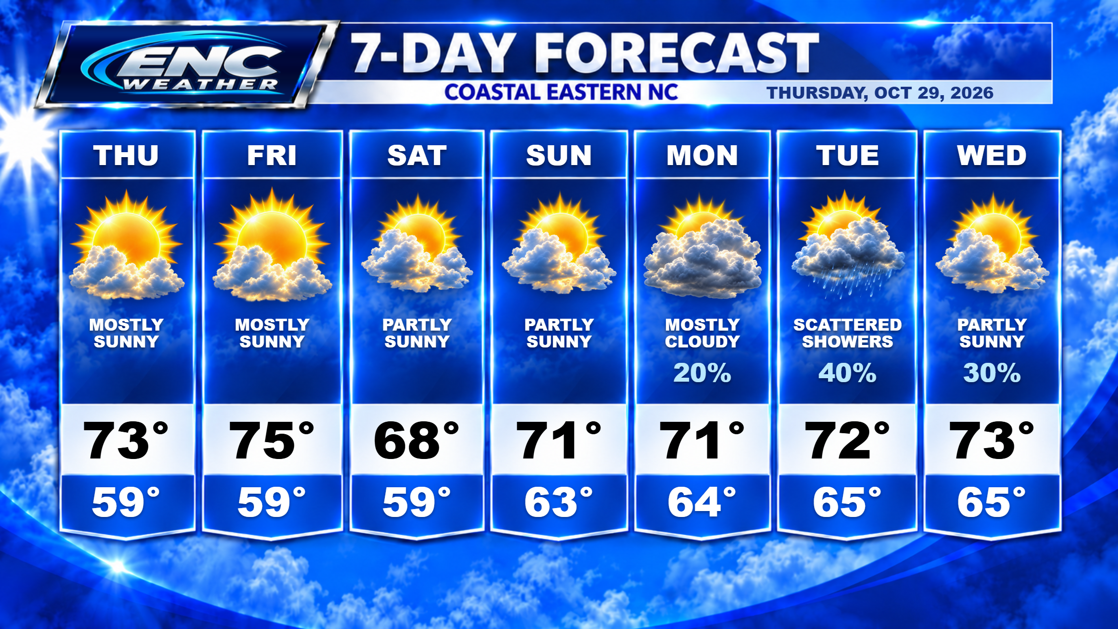
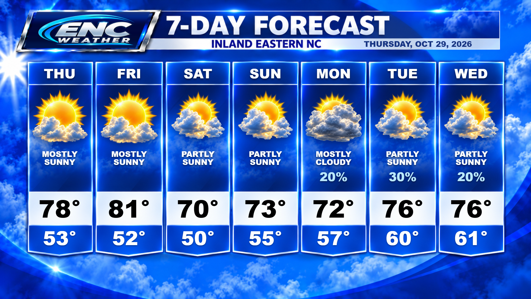
Good morning, ENC! Milder start to your Thursday as current morning temperatures across the area range in the upper 50s to lower 60s. We will see those temperatures rise today into the upper 70s as skies start clearing out today. Coastal sections could see a passing shower or two especially early this morning. Dry, sunny conditions will persist through the end of the week as high temperatures on Friday will reach the low 80s in most areas with coastal sections reaching the low-to-mid 70s.
On Saturday, we will see a backdoor cold front, as a result of high pressure moving eastward just to the north, that will bring in much more seasonable temperatures and lower dewpoints for our weekend. I don’t expect any precipitation with this front as it passes so our weekend is looking dry at this time.
As mentioned in previous forecast discussions, the GFS has been trying to hint at some potential for early week rain for ENC. I was skeptical of this possibility and as a result, kept rain expectations low. The most recent GFS runs have proved that skepticism warranted as rain chances on the most recent runs have diminished considerably. The official forecast still has mention of scattered showers in the early week forecast but I expect that this will change in future updates as rain chances do seem minimal at this time.
What we are keeping an eye on for next week are two features currently over the Pacific Ocean which could impact our weather by the end of next week. Two upper-level troughs are forecast to move onshore on the west coast by early next week, then phase over the central US by mid-week. This setup could potentially bring some severe weather to the Gulf Coast states. By the time it reaches ENC, I expect the severe potential to diminish but the rain potential will increase. The timing of the arrival of this system still needs to be ironed out over the next several days but I do expect a potential arrival around Thursday or Friday of next week. This will be our next best chance of meaningful rainfall across the area. Temperatures next week ahead of this system will slowly increase as the flow shifts more southerly ahead of the next system.
Meanwhile, along the coast, coastal flood advisories are still in effect for west Carteret and coastal Onslow until 2PM this afternoon. There is also a coastal flood advisory in effect for coastal Pender until Noon today.