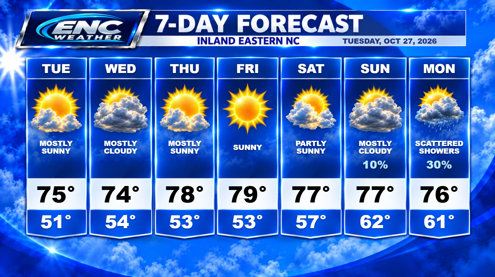
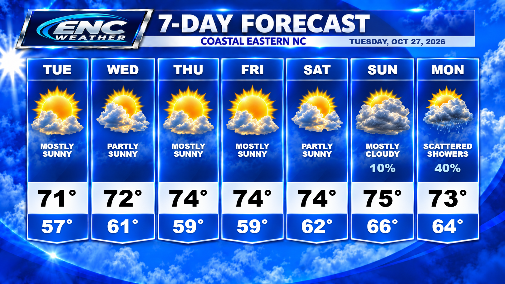
Good morning, ENC! Chilly start to our Tuesday as many of us wake up in the upper-30s to low-40s. Temperatures today will quickly rise after sunrise with highs today approaching the mid-70s inland to low-70s along the coast. Rain chances remain at zero as we head through our Tuesday but chances slightly increase on Wednesday as a few models indicate the possibility of a few isolated showers popping up, however coverage will be very limited so I don’t expect much from this. This will increase our cloud cover for our Wednesday with highs reaching the mid-70s inland and low-70s coast.
Temperatures start to increase somewhat on Thursday through our weekend. Conditions should stay mostly dry through the weekend, including Saturday night. We are watching the possibility of rain late Sunday and into Monday as the GFS still wants to take the energy left over from Vance and bring some moisture over ENC. The Euro has been less enthusiastic about this solution with a much more drier forecast for Monday. Given the disagreement between the two models this far our, we will leave the possibility of rain for Monday in the forecast but that may need to be adjusted as the week progresses.
If we miss out on this next system on Monday, the next real chance of rain has to wait until next Thursday when a cold front looks possible to cross the area. Still a long-range forecast subject to change but that is how far out we are from the possibility of our next rain. So dry conditions look likely over the next several days with the slight possibility of some showers a little less than a week from now.
Along the coast, some coastal flood advisories are still in effect due to the King Tides which should subside towards the end of this week. Some coastal flood advisories have been dropped due to the easing of the northeasterly winds. Conditions should continue to improve throughout the week along the coast.