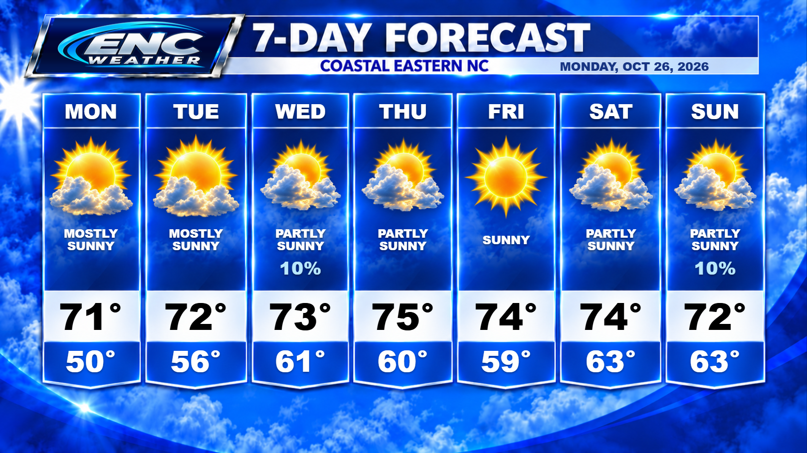
Good morning, ENC! I decided to take a brief break during this copy-and-paste weather pattern to get some work done on the website. As we start this week, the weather pattern still isn’t changing much. The main story this week, similar to last week, is the on-going coastal flooding due to onshore winds and now we add in the King Tides this week. Strong high pressure to the north along with the low pressure off the Florida coast are creating northeasterly winds which continue to push water onshore. There are still several coastal flood advisories in effect as a result of this persistent wind. This has also slowed the recovery efforts of the highway 12 repair from last week’s system.
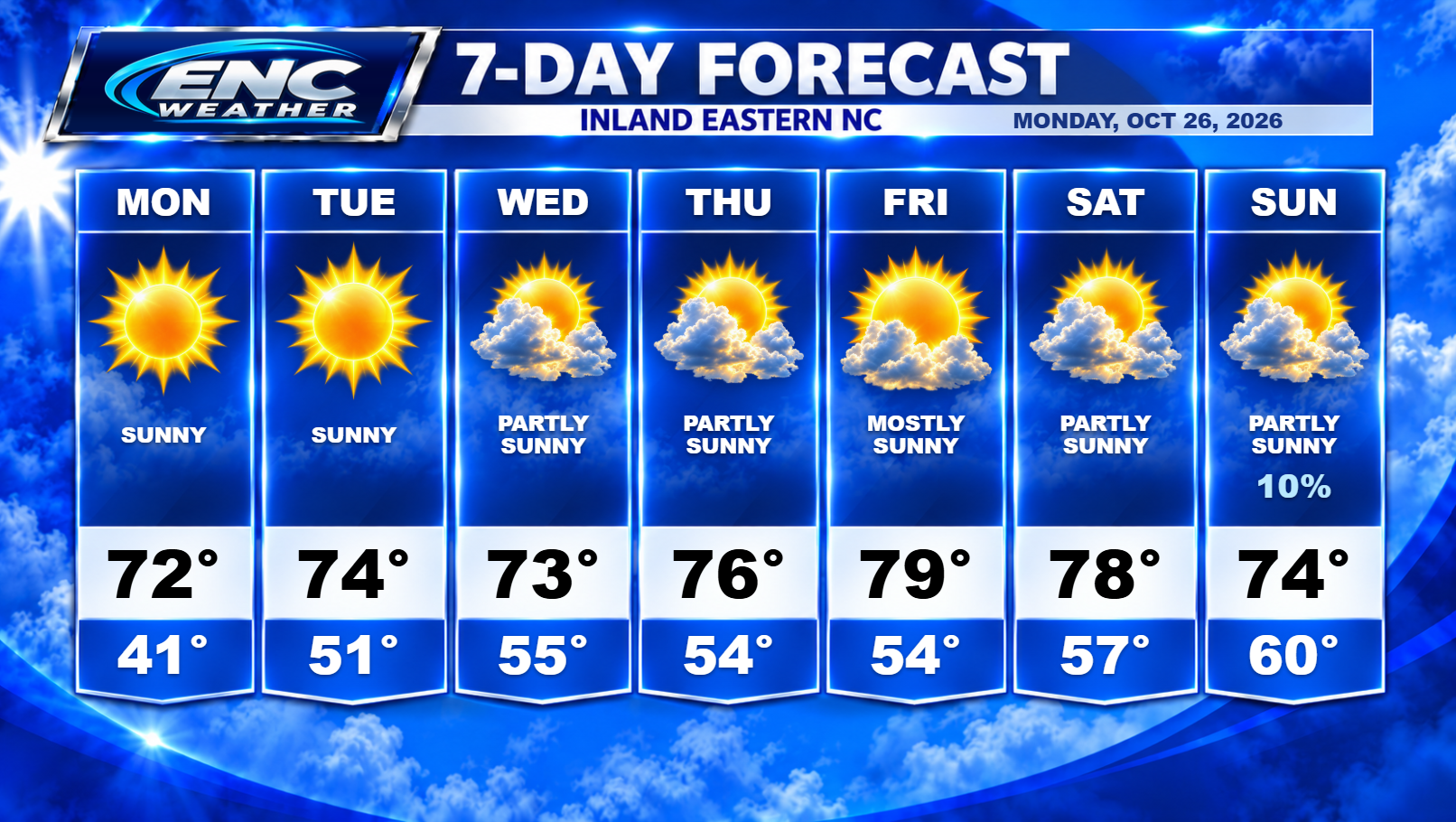
Meanwhile, for inland sections, the forecast is for more of the same this week. Sunny skies, low humidity with highs in the low to mid-70s through mid-week with a slight warm-up as upper-level ridging builds in with highs reaching the upper-70s by Thursday, Friday, and Saturday. Lows tonight will drop down again to the low-40s (possibly upper-30s in some locations) before overnight lows return to the mid-50s by mid to late week.
We are keeping an eye on the next chance of rain. The GFS is hinting at some energy moving over the Gulf Coast States by late weekend potentially bringing some rain to the area late Sunday night into early Monday but given the forecast is still in the long-range time-frame and not supported by the Euro, confidence in this solution is very low at this stage. If that doesn’t materialize, we could be looking at another roughly two week dry stretch for ENC before long-range models indicate the next potential for rain.
There hasn’t been much to report with weather conditions lately other than the coastal flooding. This persistent dry pattern should continue for a little while longer before we see a change.