Good morning, ENC! Another beautiful day in store for inland ENC. Along the coast, it will be another day of strong winds and surf as the effects of the coastal low are still impacting the area. The strong winds are still bringing large surf and coastal flooding where substantial beach erosion is occurring from south Nags Head to Buxton. Also, NC-12 remains closed from Basnight Bridge to Rodanthe as ocean over wash continue to impact the area. It is unknown when the road will be reopened.
The low will start to slowly pull northeast today and begin to accelerate its exit on Thursday so conditions should start to ease up by the latter part of the week. What I’m keeping an eye on now is another set up where low pressure over the Caribbean and strong high pressure building in over the Northeast Coast generate enough pressure gradient to produce a strong onshore flow over the weekend and into early next week. It won’t be as significant as this past system, but it could create hazards to boating interests this weekend.
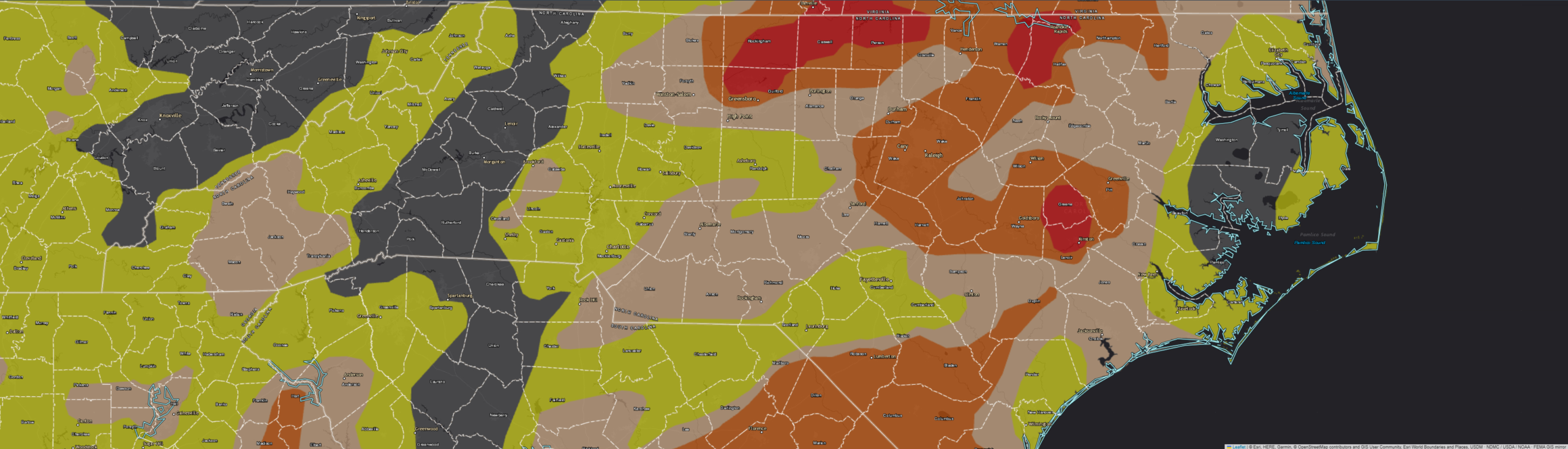
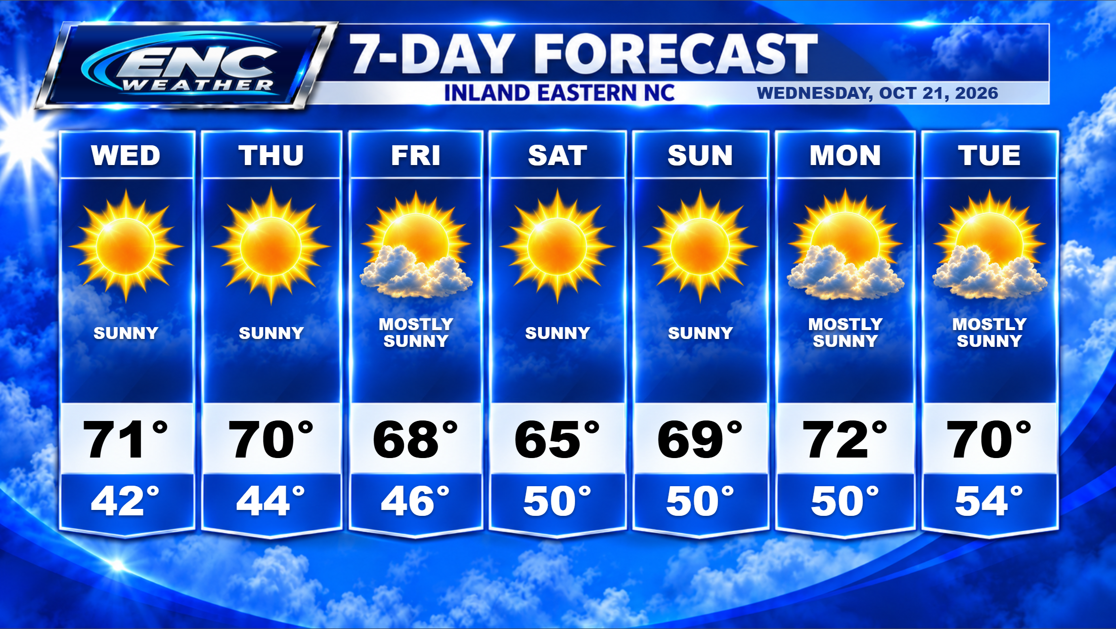
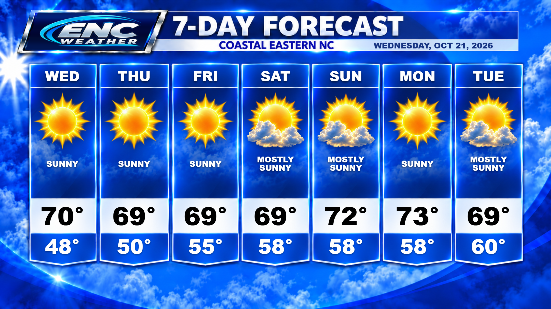
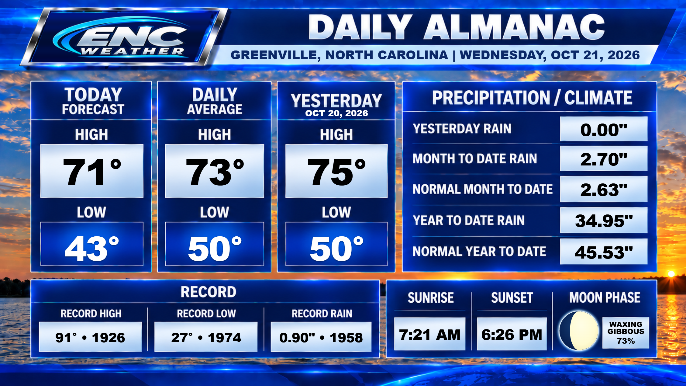
Inland, we will be dealing with ideal conditions for this time of the year. A relatively cool, dry airmass will be situated over the area for most of the next 7 day period with highs mainly in the mid-60s to low-70s. Lows will generally range from the low-40s to low-50s inland/low-50s to near 60 coast. Rain is not expected for the remainder of October. If you have outdoor activities scheduled, that is wonderful news. But if you are impacted by the year-long drought, this is not welcome news. While some progress towards the drought has been made over the past month, most areas are still in a significant deficit. Pitt-Greenville is over 10″ under while my location in southwest Greenville is over 20″ under average for this time of year. Looking at the long-range forecast shows the next chance of rain shows up near the beginning of November, but long-range forecasts are unreliable so we wait.
In the tropical Atlantic, the only area of interest is the coastal low which the NHC still has a 40% of some sort of development over the next 48 hours. The low is still in favorable waters for tropical/subtropical development however that window of opportunity is closing and it doesn’t posses the convective structure that leads me to believe that this will develop within this window. As the system moves northeast over the next few days, it will move into much colder waters and any chance of development will diminish. While the chances are there for development, in my opinion, it will not develop tropical/subtropical characteristics. Whether it ultimately develops or not doesn’t diminish the impacts it will have. It only impacts its classification.
As a side note: there has been talk about whether a system like this, that impacts population areas, should have some sort of classification/designation. While it doesn’t meet the definition of current named or significant systems, it is worth having a discussion about including systems like this if it would improve public communication and preparedness efforts. I do see the potential benefits of including systems like this into the communication process but I also do see some downsides to creating a naming system similar to tropical systems as well. It is worth a debate.
Update: As of 4:15 pm, the NHC will begin issuing advisories on Subtropical Storm Josephine. Whether it deserves that classification will be hotly debated but the impacts don’t change. It is still the same system it was but now, in the eyes of the NHC, meets the definition to be classified. As such, it becomes the next named storm in the Atlantic.