Good morning, ENC! It was a comfortable early fall weekend and this comfortable weather will stick around through the beginning of the work week. The Nor’easter that has been impacting the Northeast Coast for the past several days is continuing to weaken and will begin to move away from the region. Conditions along the coast here in ENC have begun to improve as residence deal with the aftermath of last week’s coastal low. Highway 12 still remains closed but NCDOT are hoping to get a detour in place soon.
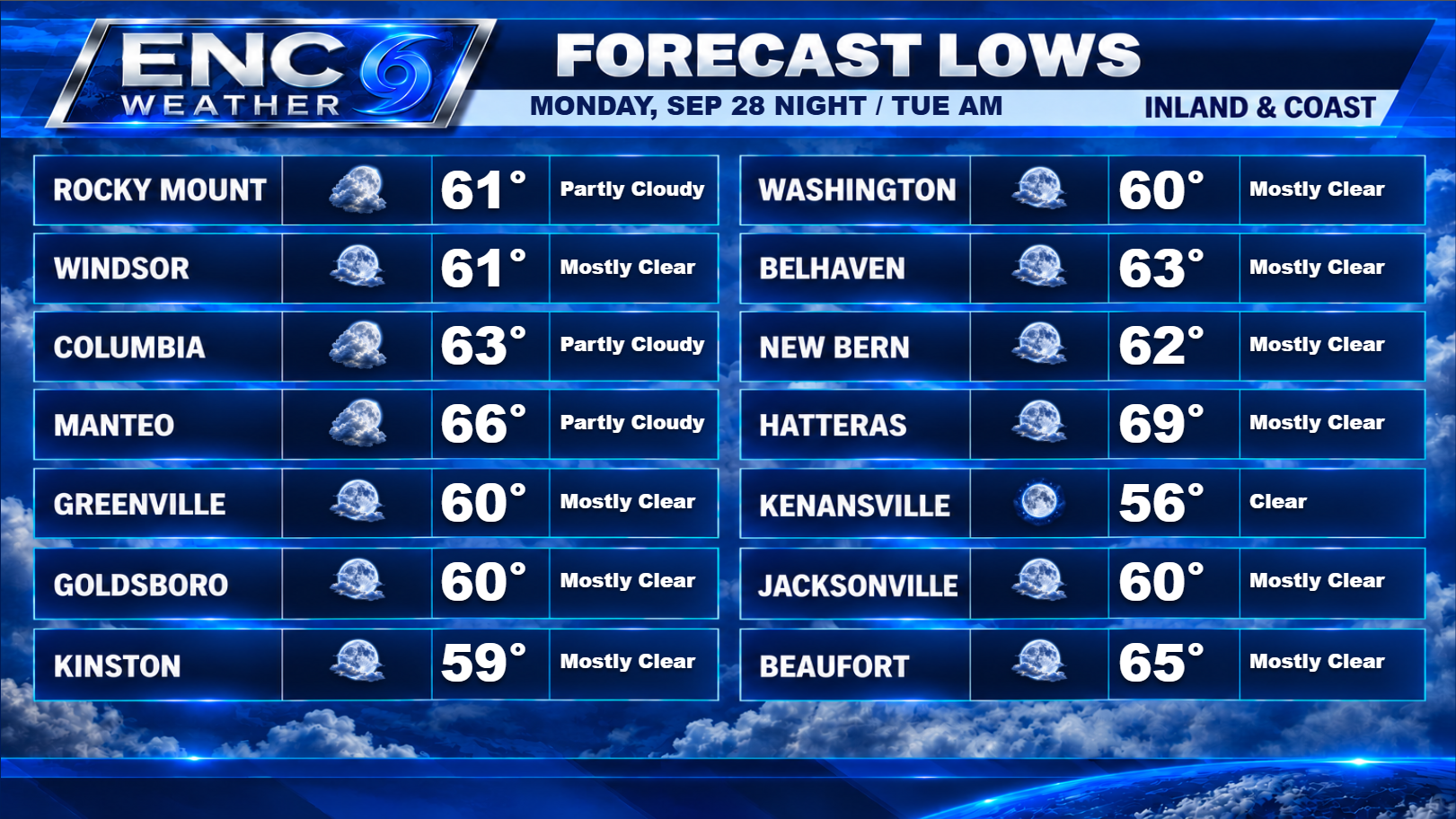
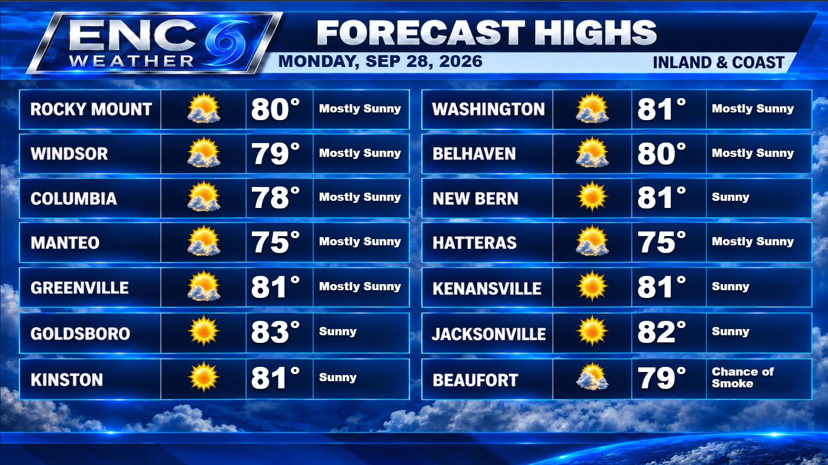
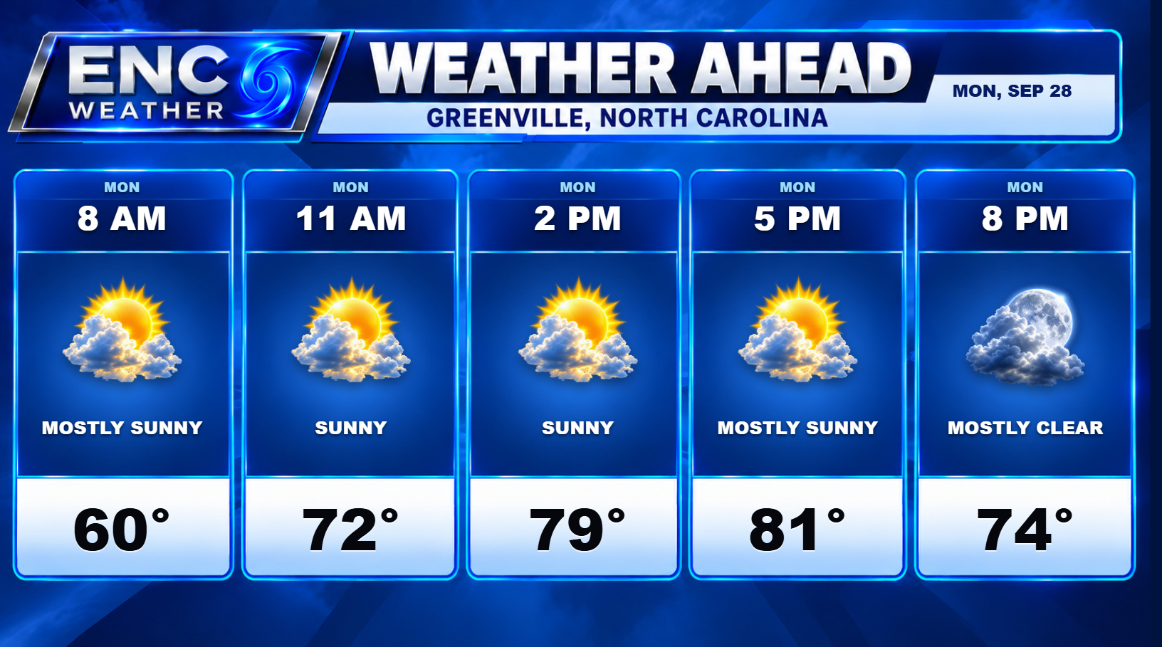
As for Monday’s weather, expect mostly sunny skies with highs in the upper-70s along the coast to low-80s inland. Skies will remain mostly clear tonight with los in the upper-50s to lower-60s.
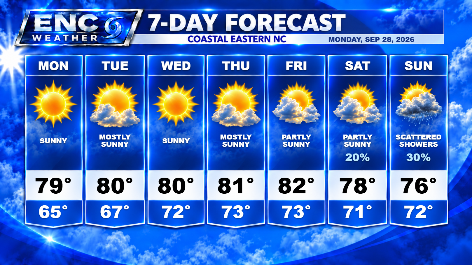
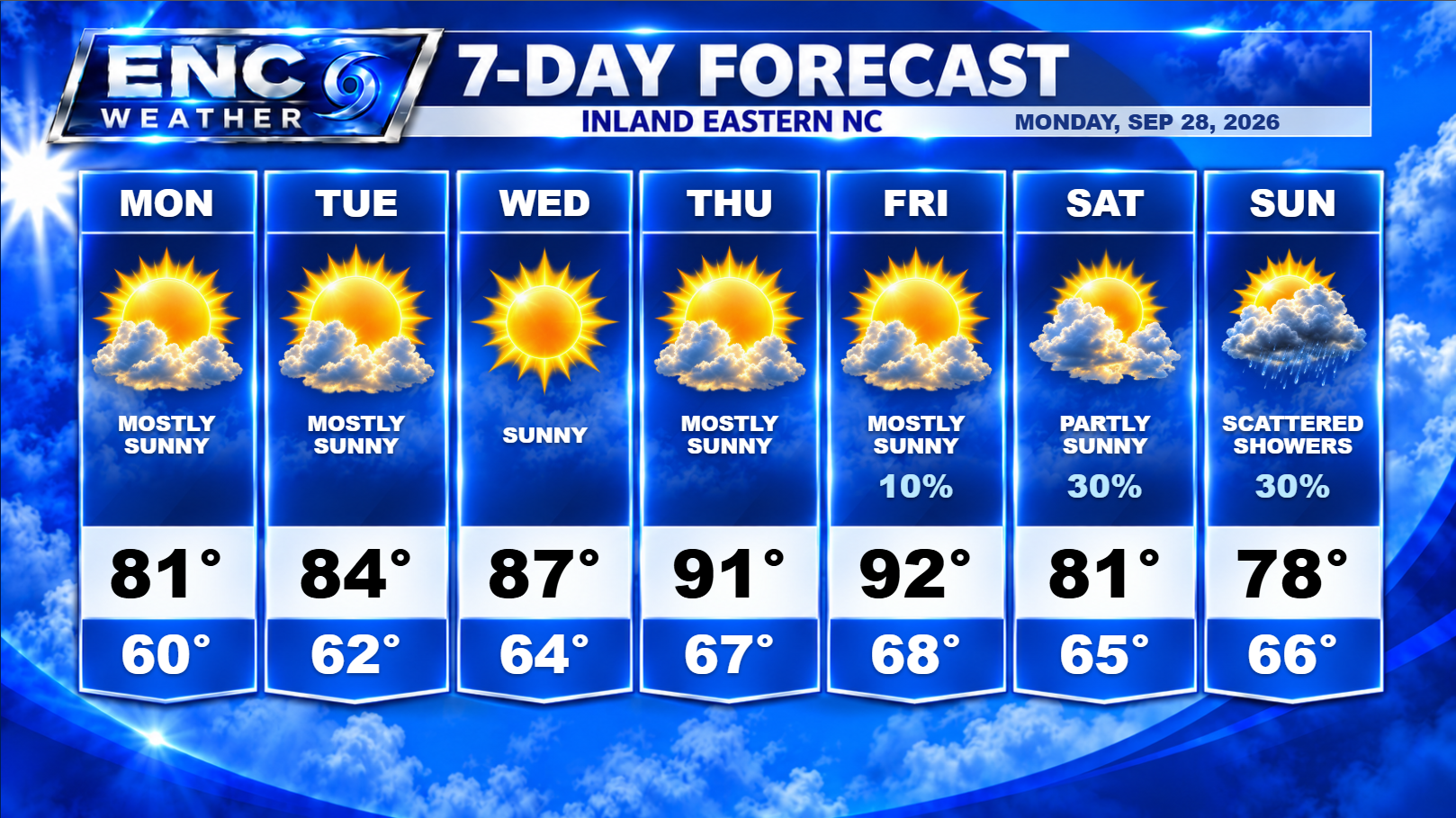
Upper-level ridging builds into the region from the southwest as surface high shifts southeast and moves off the east coast as we head into mid-week keeping skies mostly sunny and highs in the mid-to-upper 80s. As the high shifts off the coast, expect a more southerly flow and a slight increase in temperatures heading into Wednesday, Thursday, and Friday. Inland areas could see temperatures reaching the lower-90s with coastal sections reaching the lower-80s. I don’t expect moisture to return with the higher temperatures (at least not immediately) so it shouldn’t be the uncomfortable summer heat that we typically get.
Moisture does return to the area by Friday as flow off the Gulf and Atlantic will increase dew points across the area making it feel a little more like summer. There could be a slight chance of an isolated shower or storm on Friday but it would be very isolated at this point.
We will need to keep an eye on the weather this weekend as it does appear scattered showers and possibly a thunderstorm do creep back into the forecast. Possible short-wave energy out of the Gulf and the approaching cold front along with the increase in available moisture will give us a good chance at seeing wet conditions this weekend.
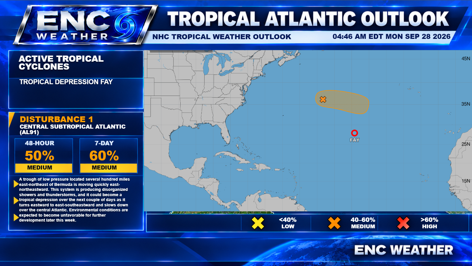
In the Tropical Atlantic, we still have a relatively quiet season for 2026. At the moment, Tropical Depression Fay is barely holding on while another system is being monitored for further development. 91L currently has a 50% chance of development over the next 2 days. The good news is it is far away from land and doesn’t appear to have a lengthy future ahead of it. It will be something to watch but doesn’t appear to be a threat to land. Conditions do not look favorable for continued development after a couple of days.