Hurricane Maria To Potentially Impact ENC
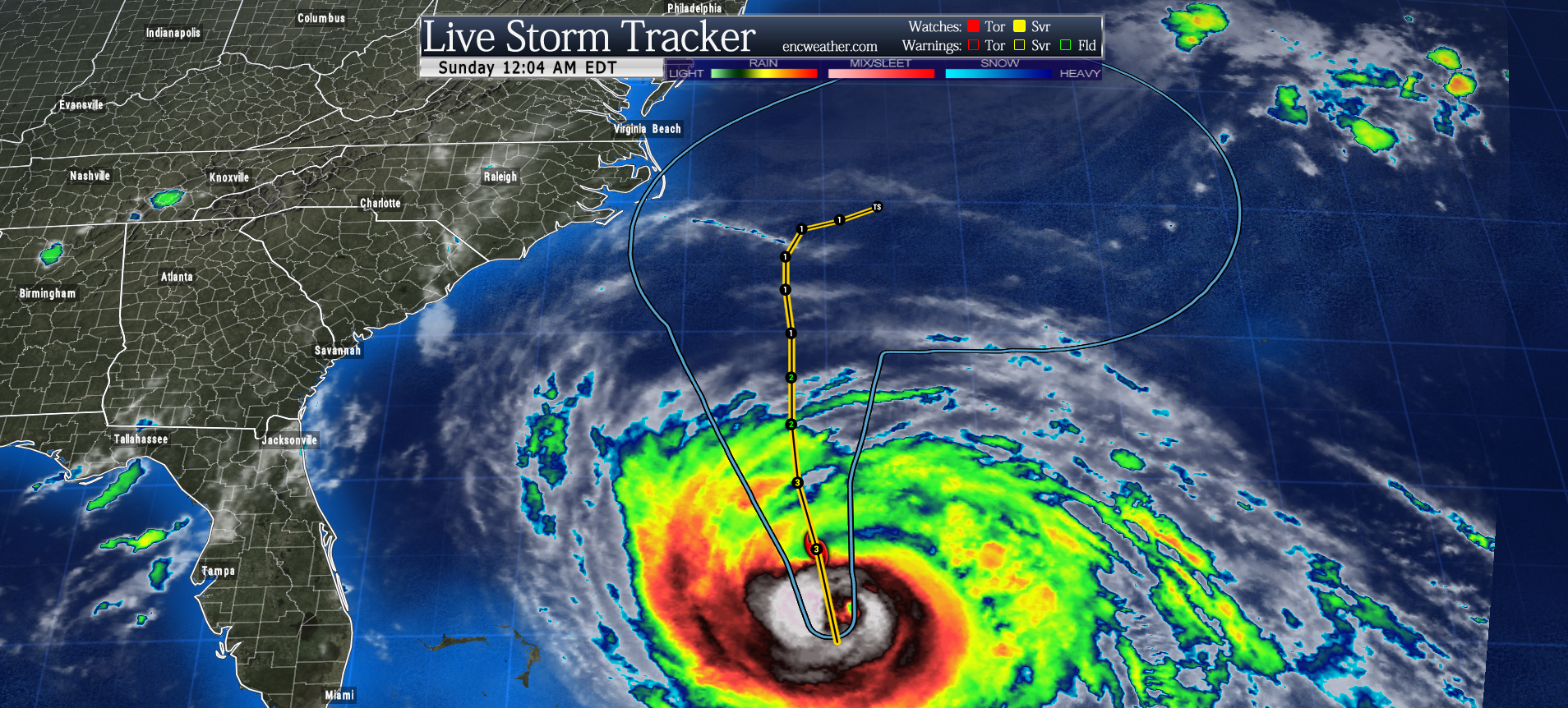
Hurricane Maria is still a category 3 hurricane with winds at 115 mph moving northward at 9 mph. This general motion is expected to continue over the next two to three days between the upper-level trough over the southeastern US and the subtropical ridge over the Atlantic. After that there is some disagreement as to what happens to Maria on day 3 and beyond. The large majority of models keep the center off the Carolina coast but how far off the coast is the main concern now. At the time of this post, the 00Z NAM, 12Z Euro, and 00Z GFS runs completed. The recent trend with the GFS models on Saturday brought the center just off the Outer Banks where it briefly stalls before being picked up by the trough off to the north and pushed out to sea. The Euro and NAM keep Maria further east well off the NC coast. Most hurricane models fall somewhere between the GFS and the NAM/Euro. The NHC has issued its forecast track closer to the NAM/Euro. As tempting as it might be to narrow in on the most recent GFS runs there is still a large amount of uncertainty that complicates this forecast meaning the GFS could be an outlier. It is a little too soon to know for sure.
Maria will most likely remain a category 3 hurricane over the next 24-48 hours before traveling over relatively cooler waters. Maria will likely weaken to a category 1 hurricane during its closest passage to the NC coast. The forecast track will play a role in determining the impacts in terms of forecast wind speeds by middle week. A closer pass could bring tropical storm force winds over the Outer Banks. If you live along the coast, make sure to pay attention if any watches or warnings are issued for your area.
Bottom line: we will need to closely to Maria over the next couple of days. There is a chance that the Outer Banks could experience tropical storm conditions by mid-week if the track is closer to the coast. Swells from Maria are increasing along the coast of the southeastern United States and are expected to reach the Mid-Atlantic coast on Sunday. These swells will likely cause dangerous surf and rip currents at the beach through much of next week.
I will be back online tomorrow with another update.
Update (Sunday morning): This morning’s GFS run has shifted Maria’s track westward closer to this morning’s Euro run which keeps the core of Maria just offshore. Maria could pass close enough for tropical storm force winds possible along the Outer Banks. I will provide a more detailed analysis later today.